Also appeared in Faden's [General atlas. London : William Faden, 1811?]., Includes relief profiles and inset map of "Positions ascertained by courses and distances given; on a scale reduced to the third.", No. 42 of 43 maps bound together in composite atlas., Relief shown pictorially; depths by soundings., and Scale [ca. 1:2,700,000].
Publisher:
Wm. Faden
Subject (Geographic):
Antilles, Lesser --Maps --Early works to 1800
Subject (Topic):
Nautical charts --Antilles, Lesser --Early works to 1800
Delarochette, L. (Louis), 1731-1802 Dicquemare, (Jacques-Francois), M. l'abbe, 1733-1789, creator Faden, William, 1749-1836
Published / Created:
1780 June 17
Call Number:
1982 Folio 10
Image Count:
1
Description:
By Monsr. L Abbe Diquemare ; with several emendations, and many useful additions &c. by L.S. De La Rochette., Depths shown by soundings., No. 8 of 43 maps bound together in composite atlas., and Scale [ca. 1:3,100,000].
Publisher:
Engraved & published by W. Faden
Subject (Geographic):
Biscay, Bay of (France and Spain) --Navigation --Maps --Early works to 1800, English Channel --Navigation --Maps --Early works to 1800, and North Sea --Navigation --Maps --Early works to 1800
Subject (Topic):
Coasts --England --Maps --Early works to 1800, Coasts --France --Maps --Early works to 1800, Nautical charts --English Channel --Early works to 1800, and Nautical charts --North Sea --Early works to 1800
Also appeared in Faden's [General atlas. London : William Faden, 1811?]., Imperfect: torn along fold, with no loss of text., No. 31 of 43 maps bound together in composite atlas., Relief shown pictorially., Scale [ca. 1:480,000]., and Sheets pasted together to form 1 sheet.
Faden, William, 1749-1836 Jefferys, Thomas, d. 1771, creator
Published / Created:
1789 June 1
Call Number:
1982 Folio 10
Image Count:
1
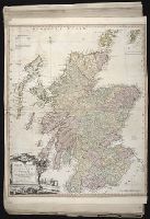
Description:
Also appeared in Faden's [General atlas. London : William Faden, 1811?]., No. 22 of 43 maps bound together in composite atlas., Relief shown pictorially., and Scale [ca. 1:565,000].
Chart of the northwest coast of America and the northeast coast of Asia, explored in the years 1778 and 1779
Description:
Includes notes., No. 34 of 43 maps bound together in composite atlas., Prepared by Lieut. Heny. Roberts, under the immediate inspection of Capt. Cook ; engraved by W. Palmer., Relief shown pictorially. Depths shown by soundings., and Scale [ca. 1:13,500,000].
Publisher:
Wm. Faden, geographer to the King, Charing Cross
Subject (Geographic):
Bering Strait Region --Discovery and exploration --Maps --Early works to 1800, North America --Discovery and exploration --Maps --Early works to 1800, Pacific Coast (North America) --Discovery and exploration --Maps --Early works to 1800, and Russian Far east (Russia) --Discovery and exploration --Maps --Early works to 1800
Subject (Name):
Cook, James, 1728-1779
Subject (Topic):
Discoveries in geography --Maps --Early works to 1800
Delarochette, L. (Louis), 1731-1802, creator Faden, William, 1749-1836 Meta, C. Palmer, W. (William), 1739-1812
Published / Created:
1790 January 1
Call Number:
1982 Folio 10
Image Count:
1
Description:
Also appeared in Faden's [General atlas. London : William Faden, 1811?]., Includes illustrated cartouche C. Meta fec., No. 28 of 43 maps bound together in composite atlas., Relief shown pictorially., and Scale [ca. 1:1,350,000].
Publisher:
Willm. Faden
Subject (Geographic):
Greece --Maps --Early works to 1800 and Turkey --Maps --Early works to 1800
Delarochette, L. (Louis), 1731-1802, creator Faden, William, 1749-1836
Published / Created:
1782 March 20
Call Number:
1982 Folio 10
Image Count:
1
Description:
No. 37 of 43 maps bound together in composite atlas., Place names in Dutch; pictorial relief. "The red line describes the route of the British Army from its landing at Simons Baay to Cape Town.", and Scale [ca. 1:528 000].
Publisher:
W. Faden
Subject (Geographic):
Cape of Good Hope (South Africa) --Maps --Early works to 1800