Twenty four new and accurate maps of the several parts of Europe ... : all (except the last) new
Image Count:
1
Alternative Title:
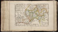
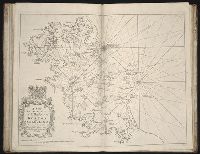
Lombardy, with Dauphine, Provence, the Cevennes, &c
Description:
In pencil on verso: 21. and Table of contents for maps 20-24 misnumbered.
Subject (Geographic):
Cevennes Mountains (France) --Maps, Dauphine Alps (France), France --Maps --Early works to 1800, Graubuenden (Switzerland), Italy --Maps --Early works to 1800, and Switzerland --Maps --Early works to 1800
Subject (Name):
Barker, B. (Benjamin), d. 1764, bookseller, Clements, Henry, d. 1719, bookseller, King, Charles, d. 1735, bookseller, Nicholson, John, d. ca. 1717, bookseller, Parker, Richard, fl. 1692-1725, bookseller, and Tooke, Benjamin, d. 1716, bookseller
Subject (Topic):
Atlases --Early works to 1800
Collection Created:
[London] : Sold by J. Nicholson at the King’s-Arms in Little Britain, Benj. Barker and Charles King ..., Benj. Tooke ..., Hen. Clements ..., R. Parker and Ralph Smith under the Royal-Exchange ..., [1715?]
Compiled from Mr. D'Anville's maps of that continent, with the addition of the Spanish discoveries in 1775 to the north of California & corrected in the several parts belonging to Great Britain from the original materials of Governor Pownall, M.P., From Thomas Kitchin's a general atlas describing the whole universe. [1793]., Includes inset The supplement to North America containing the countries adjoining to Baffins & Hudsons Bays and tables showing European possessions., No. 39 of 43 maps bound together in composite atlas., Prime meridian: Ferro., Relief shown pictorially., and Scale [ca. 1:11,500,000].
Publisher:
Printed for Robt. Sayer, map, chart & printseller
Subject (Geographic):
United States --Maps --Early works to 1800 and Western Hemisphere --Maps --Early works to 1800
Twenty four new and accurate maps of the several parts of Europe ... : all (except the last) new
Image Count:
1
Alternative Title:
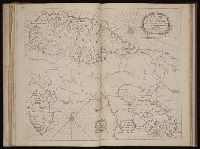
The world in general
Description:
In pencil on verso: 1.
Subject (Name):
Barker, B. (Benjamin), d. 1764, bookseller, Clements, Henry, d. 1719, bookseller, King, Charles, d. 1735, bookseller, Nicholson, John, d. ca. 1717, bookseller, Parker, Richard, fl. 1692-1725, bookseller, and Tooke, Benjamin, d. 1716, bookseller
Subject (Topic):
Atlases --Early works to 1800 and World maps --Early works to 1800
Collection Created:
[London] : Sold by J. Nicholson at the King’s-Arms in Little Britain, Benj. Barker and Charles King ..., Benj. Tooke ..., Hen. Clements ..., R. Parker and Ralph Smith under the Royal-Exchange ..., [1715?]
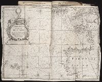
The English pilot: describing the sea-coasts, capes, head-lands, rivers, bays, roads, havens
Image Count:
1
Description:
Most maps numbered in pencil on verso, some on recto.
Subject (Geographic):
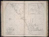
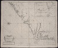
Atlantic Ocean --Maps --Early works to 1800, North Carolina --Maps --Early works to 1800, and South Carolina --Maps --Early works to 1800
Subject (Topic):
Navigation --Early works to 1800, Pilot guides --Atlantic Coast (U.S.) --Early works to 1800, and Pilot guides --Caribbean Area --Early works to 1800
Collection Created:
London : Printed for John Thornton, at the sign of the England, Scotland, and Ireland, in the Minories, and Richard Mount, at the Postern on Tower-Hill, 1698London : Printed for John Thornton, at the sign of the England, Scotland, and Ireland, in the Minories, and Richard Mount, at the Postern on Tower-Hill, 1698