Search
You Searched For
Search Results
- Published / Created:
- 1799
- Call Number:
- 3627 1799
- Image Count:
- 1
- Resource Type:
- Maps, Atlases & Globes
- Publisher:
- J. Cary,
- Subject (Geographic):
- Bavaria (Germany)--Maps--Early works to 1800
- Found in:
- Beinecke Rare Book and Manuscript Library > A new map of the Circle of Bavaria ... By John Cary, Engraver.
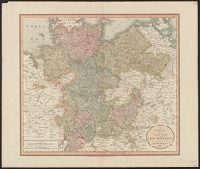
- Published / Created:
- 1811
- Call Number:
- 3635 1811
- Container / Volume:
- BRBL_00143
- Image Count:
- 1
- Resource Type:
- Maps, Atlases & Globes
- Publisher:
- J. Cary,
- Subject (Geographic):
- Lower Saxony (Germany)--Maps
- Found in:
- Beinecke Rare Book and Manuscript Library > A new map of the Circle of Lower Saxony ... By John Cary, Engraver.
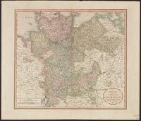
- Published / Created:
- 1801
- Call Number:
- 3635 1801
- Container / Volume:
- BRBL_00143
- Image Count:
- 1
- Resource Type:
- Maps, Atlases & Globes
- Publisher:
- J. Cary,
- Subject (Geographic):
- Lower Saxony (Germany)--Maps
- Found in:
- Beinecke Rare Book and Manuscript Library > A new map of the Circle of Lower Saxony ... By John Cary, Engraver.
- Published / Created:
- 1801
- Call Number:
- 368 1801
- Container / Volume:
- BRBL_00146
- Image Count:
- 1
- Resource Type:
- Maps, Atlases & Globes
- Publisher:
- J. Cary,
- Subject (Geographic):
- Saxony (Germany)--Maps
- Found in:
- Beinecke Rare Book and Manuscript Library > A new map of the Circle of Upper Saxony with the Duchy of Silesia and Lusatia ... By John Cary, Engraver.
- Published / Created:
- 1799
- Call Number:
- 36 R34 1799
- Container / Volume:
- BRBL_00126
- Image Count:
- 1
- Resource Type:
- Maps, Atlases & Globes
- Publisher:
- J. Cary,
- Subject (Geographic):
- Germany--Maps--Early works to 1800
- Found in:
- Beinecke Rare Book and Manuscript Library > A new map of the Circles of the Upper and Lower Rhine ... By John Cary, Engraver.
- Published / Created:
- 1811
- Call Number:
- 36 R34 1811
- Container / Volume:
- BRBL_00126
- Image Count:
- 1
- Resource Type:
- Maps, Atlases & Globes
- Publisher:
- J. Cary,
- Subject (Geographic):
- Germany--Maps
- Found in:
- Beinecke Rare Book and Manuscript Library > A new map of the Circles of the Upper and Lower Rhine ... By John Cary, Engraver.
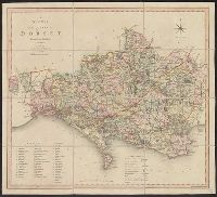
- Published / Created:
- 1804
- Call Number:
- 3246 1808
- Container / Volume:
- BRBL_00066
- Image Count:
- 1
- Resource Type:
- Maps, Atlases & Globes
- Description:
- Corrected to 1808. and Preliminary record.
- Publisher:
- C.S. Smith,
- Subject (Geographic):
- Dorset (England)--Maps
- Found in:
- Beinecke Rare Book and Manuscript Library > A new map of the County of Dorset ...
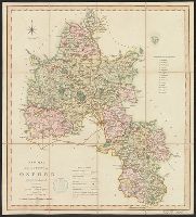
- Published / Created:
- 1818
- Call Number:
- 3218 1818
- Container / Volume:
- BRBL_00058
- Image Count:
- 1
- Resource Type:
- Maps, Atlases & Globes
- Description:
- Preliminary record.
- Publisher:
- C. Smith 3rd Edition,
- Subject (Geographic):
- Oxfordshire (England)--Maps--Early works to 1800
- Found in:
- Beinecke Rare Book and Manuscript Library > A new map of the County of Oxford, Divided into Hundreds.
- Published / Created:
- 1794
- Call Number:
- 3627 1794
- Image Count:
- 1
- Resource Type:
- Maps, Atlases & Globes
- Publisher:
- Laurie & Whittle,
- Subject (Geographic):
- Bavaria (Germany)--Maps--Early works to 1800
- Found in:
- Beinecke Rare Book and Manuscript Library > A new map of the Electorate of Bavaria ...
- Published / Created:
- 1788
- Call Number:
- 36 1788
- Container / Volume:
- BRBL_00118
- Image Count:
- 1
- Resource Type:
- Maps, Atlases & Globes
- Description:
- Four Copies
- Publisher:
- William Faden,
- Subject (Geographic):
- Germany--Maps--Early works to 1800
- Found in:
- Beinecke Rare Book and Manuscript Library > A new map of the German Empire and the neighbouring states and their principal Post roads ... By William Faden ...