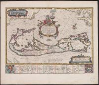
Mappa Aestivarvm insularum, alias Barmvdas dictarum
Description:
Based on Speed's map of 1626 but with new decorations., Below map, list of proprietors in 12 columns with arms of England and Bermuda., From the author's Theatre du monde ou nouvel atlas., Latin and English text on recto and French text on verso., Signature on verso: G., and Title on verso: L'Isle de Barmudas, avec ses voysines.
Publisher:
[Guillaume et Iean Blaeu,
Subject (Geographic):
Bermuda Islands--Maps--Early works to 1800
Subject (Name):
Blaeu, Joan, 1596-1673. Theatrum orbis terrarum. French and Blaeu, Willem Janszoon, 1571-1638. Theatrum orbis terrarum. French
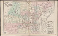
Canada. Mapping and Charting Establishment. MCE ; 317., Carte militaire de la ville. Victoria [map], Series A902 [map], and Victoria [map]
Description:
"Information depicted current as of 1976. Printed 1979.", "Transverse Mercator projection.", and Includes glossary, grid reference diagr., administrative boundary diagr., and diagr. showing "Relationship of the military city map to the national topographic syst
Publisher:
The Establishment : [available from] Canada Map Office, Dept. of Energy, Mines, and Resources,
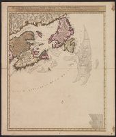
Carte nouvelle contenant la partie d'Amerique la plus septentrionale : ou sont exactement dêcrites les provinces suivantes comme le Canada ou Nouvelle France, la Nouvelle Ecosse, la Nouvelle Angleterre, les Nouveaux Paı̈s Bas, la Pensylvanie, la Virginie
Description:
"Cum privilegio ordinum generalium foederati Belgii.", Appears in some eds. of the author's Atlas minor sive geographia compendiosa., Library copy incomplete, Atlantic Canada sheet only; damaged in upper left., and Relief shown pictorially. Depths shown by sound
Publisher:
Nicolao Visscher,
Subject (Geographic):
Atlantic Provinces--Maps--Early works to 1800 and North America--Maps--Early works to 1800
Subject (Name):
Anse, Luggert van, fl. 1690-1716, engraver and Visscher, Nicolaes, 1649-1702. Atlas minor sive geographia compendiosa
"Brevet n. 458-412.", Includes list of stations and "directions of using = clef" in English and French., Includes pictorial representation of Grands Magasins du Louvre department store., and Shows stations, Métro lines, and piers.
Publisher:
s.n.,
Subject (Geographic):
Paris (France)--Maps
Subject (Name):
Grands Magasins du Louvre and Grands Magasins du Louvre--Maps
Subject (Topic):
Buses--France--Paris--Maps and Street-railroads--France--Paris--Maps
Describes location of steam railroad passenger depots., From Gray's atlas, p. 60-61., Legend in English, French and German., and Shows steam and horse railroads, wards, parks, etc.
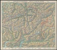
"Nr. 6210 BRB. 3.X.39"., Relief shown by shading, contours, and spot heights., and Text, illus., directory of mountain passes, and location map on verso.
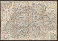
Carta stradale della Svizzera, Carte routière de la Suisse, Reisekarte der Schweiz, and Road map of Switzerland
Description:
In French. Legend and scales in French, English, German, and Italian., Includes insets of northwestern Europe, north-central Europe, northern Italy, and the French-Italian coastal, and Mounted on verso: Luzern -- Bâle -- Genève -- Zuric -- Berne -- Lausanne.
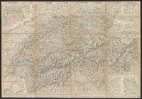
Carta stradale della Svizzera, Carte routière de la Suisse, Reisekarte der Schweiz, and Road map of Switzerland
Description:
In French. Legend and scales in French, English, German, and Italian., Includes insets of northwestern Europe, north-central Europe, northern Italy, and the French-Italian coastal region., Mounted on verso: Luzern, and Relief shown by hachures and spot heights.