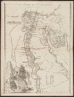
Robert de Vaugondy, Gilles, 1688-1766, cartographer
Call Number:
61 1799A
Container / Volume:
BRBL_00330
Image Count:
1
Resource Type:
Maps, Atlases & Globes
Description:
Appeared in the Gilles and Didier Robert de Vaugondy's Atlas universel., Borders are hand colored., Printed number on verso: 106., Relief shown by hachures., and Watermark.
Subject (Geographic):
Egypt--Historical geography--Maps--Early works to 1800 and Egypt--Maps--Early works to 1800
Subject (Name):
Robert de Vaugondy, Didier, 1723-1786. Atlas universel and Robert de Vaugondy, Gilles, 1688-1766. Atlas universel
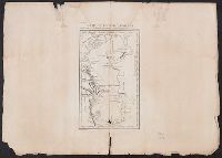
"A. Pl. 17.", From Nicolas-Gabriel Clerc's Histoire physique, morale, civile et politique de la Russie moderne., Relief shown by hachures., Stamp on verso: Douane francaises ... 31 avr 70., and Watermark.
Subject (Geographic):
Caspian Sea--Maps--Early works to 1800
Subject (Name):
Clerc, Nicolas-Gabriel, 1726-1798. Histoire physique, morale, civile et politique de la Russie moderne and Tardieu, P. F. (Pierre François), 1757-1822, engraver
Panorama de l'Afrique françaises and Petit journal. Supplément illustré.
Description:
From Supplément illustré du Le Petit journal (pages 79-80; 1894?)., Includes insert maps "Environs de Tombouctou" and "Plan de Tombouctou.", and Relief shown by hachures.
Subject (Geographic):
Africa, North--Maps, Africa, West--Maps, Africa--Discovery and exploration--French--Maps, France--Colonies--Africa--Maps, and Tombouctou (Mali)--Maps
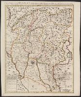
"Avec privilège"., Hand colored, Relief shown pictorially., and Stamp: Karpinski-von Wieser Map Collection. "99"; "Allard"--Manuscript notes.
Subject (Geographic):
Padua (Italy : Province)--Maps--Early works to 1800, Rovigo (Italy : Province)--Maps--Early works to 1800, and Venice (Italy)--Maps--Early works to 1800
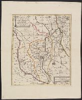
Anville, Jean Baptiste Bourguignon d', 1697-1782, cartographer
Call Number:
655 1751
Container / Volume:
BRBL_00345
Image Count:
1
Resource Type:
Maps, Atlases & Globes
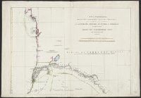
Description:
Bar scales given in "Lieues Françoises de 3000 Pas Géométriques ou de 2500 Toises" and "Lieues Marines de 20au Degré, ou d'environ 2850 Toises.", Prime meridian: Ferro., Relief sho, Shows anchorages, banks, rivers, settlements, kingdoms, etc., and Watermarks.
Subject (Geographic):
Africa, West--Maps--Early works to 1800
Subject (Name):
Anville, Jean Baptiste Bourguignon d', 1697-1782. Atlas général and Haye, G. de la, engraver