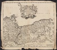
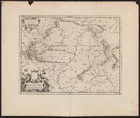
Imperfect: torn along folds and chipped at edges, with no loss of text. Sheet measures 54.0 x 61.9 cm., Prime meridian: Ferro., Relief shown pictorially., and Variant of Koeman, C. Atlantes Neerlandici, III, p. 215, map 99 (without privilege statement
Publisher:
Frederik de Wit?,
Subject (Geographic):
Pomerania (Poland and Germany)--Maps--Early works to 1800
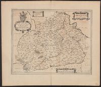
Blankaart, Nikolaas, 1624-1703 Jansson, Jan, 1588-1664. Atlas novus
Published / Created:
1652?]
Call Number:
30 1652
Container / Volume:
BRBL_00029
Image Count:
1
Resource Type:
Maps, Atlases & Globes
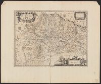
Description:
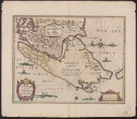
Appears in various ed. of Jansson's Atlas novus., Dedication: Nobilissimo Amplissimoq viro D. Cornelio de Graaf ..., Ms. no. "3" in upper left hand corner. Sheet measures 51 x 62 cm., and Relief shown pictorially.
Publisher:
Jan Jansson,
Subject (Geographic):
Europe--History--392-814--Maps--Early works to 1800
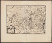
Bar scales in "Miliaria Germanica communia" and "Miliaria Gallica communia.", From Jan Jansson and Henrik Hondius's Atlas novus ... Amstelodami : Apud Ionnem Ianssonium & Henricum Hondium, 1638., In Latin on verso, with caption title "Freti Magellanici et freti le Marii descriptio" and signature 5F., and Relief shown pictorially.
Publisher:
Hendrik Hondius,
Subject (Geographic):
Magellan, Strait of (Chile and Argentina)--Maps--Early works to 1800
Subject (Name):
Hondius, Hendrik, 1597-1651. Atlas novus and Jansson, Jan, 1588-1664. Atlas novus