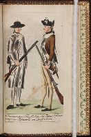
[Atlas nouveau contenant toutes les parties du monde ou sont exactement marques les empires
Image Count:
1
Resource Type:
Maps, Atlases & Globes
Abstract:
Factitious collection of about 549 maps taken from the atlases of the 17th and the beginning of the 18th century, put together with the title "Atlas" and bound in 6 volumes. These volumes originally bore the imprint: Amstelaedamii apvd Reiniervm & Josvam Ottens. Over these words on the title pages of volumes 1-2 and 4-6 is the name of Henrik de Leth who painted them.
Description:
Verso blank.
Subject (Geographic):
British Isles --Maps --Early works to 1800
Subject (Name):
Leth, Hendrik de, 1703-1766, Reiner et Josua Ottens (Firm), Schenck, Peter, 1661-1715, Schenck, Peter, ca. 1698-1752, Valck, G. (Gerard), 1651 or 2-1726, and Wit, Frederik de
Subject (Topic):
Atlases --Early works to 1800
Collection Created:
[A Amsterdam, chez J. Covens & C. Mortier, ca. 1730-ca. 1800]
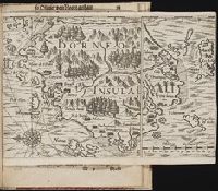
Bound in after p. 92., Map folded irregularly., Map has multiple small brown stains on both the recto and verso., Place names in multiple languages including Italian, Latin, Portuguese, and Spanish., and Scale [ca. 1:6,500,000].
Subject (Geographic):
Borneo --Maps --Early works to 1800
Collection Created:
Gedruckt zu Franckfurt / Durch Matthaeum Becker, 1602
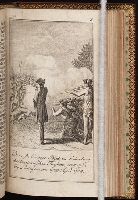
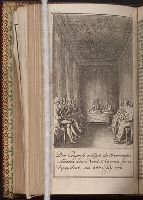
Allgemeines historisches Taschenbuch, oder, Abriss der merkwurdigsten neuen Welt-Begebenheiten
Image Count:
1
Description:
Facing p. 99.
Subject (Geographic):
United States --History --Revolution, 1775-1783, United States --History --Revolution, 1775-1783 --Congresses, and United States. Continental Congress, 1776