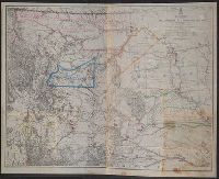
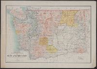
At head of title: War Department., Includes list of authorities., Library's copy annotated in color ink to highlight forts and show Indian lands., Relief shown by hachures., and Shows railroads, trails, and routes.
Publisher:
Office of the Chief of Engineers, U.S. Army,
Subject (Geographic):
Missouri River Watershed--Maps and Yellowstone River Watershed--Maps
Subject (Name):
Maynadier, Henry Eveleth, d. 1868, Raynolds, W. F. (William Franklin), 1820-1894, and United States. Army. Office of the Chief of Engineers
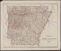
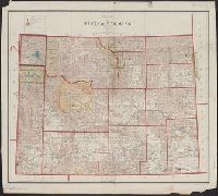
Detached from a report or document in the Congressional series, no. 3., Includes 7-line note on lead, coal and iron resources., and Shows lead and copper regions and 6 and 15 mile limits of land grant railroads.
Publisher:
General Land Office,
Subject (Geographic):
Illinois--Maps
Subject (Name):
Bowen & Co
Subject (Topic):
Natural resources--Illinois and Railroad land grants--Illinois--Maps
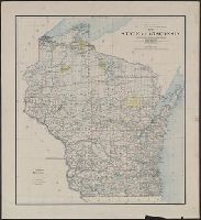
"Department of the Interior General Land Office Hon. S.W. Lamoreux, Commissioner.", "The Friedenwald Co. Photo-Lith, Balto.", and Indicates counties, county seats, cities, Indian reservations, U.S. land offices, railroads, light houses, and life saving stations.
Publisher:
General Land Office,
Subject (Geographic):
Wisconsin--Administrative and political divisions--Maps and Wisconsin--Maps
Subject (Name):
Friedenwald Co, Hendges, M, and King, Harry (Harold G. R.)
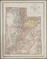
At head of title : Department of the Interior, General Land Office, Hon. Binger Herman, commissioner. and Shows boundaries of water divisions and water districts.
Indian reservations within the limits of the United States
Description:
Insets: Mission Ind. Res. in California. [Scale ca. 1:1,520,640] -- Indian Pueblo grants in New Mexico. [Scale ca. 1:2,534,400] -- Northeastern Oklahoma. [Scale ca. 1:1,520,640].