Search
You Searched For
Search Results
- Creator:
- De Witt, Simeon, 1756-1834
- Published / Created:
- [1793?]
- Call Number:
- 771 1793
- Container / Volume:
- BRBL_00477
- Image Count:
- 1
- Resource Type:
- Maps, Atlases & Globes
- Found in:
- Beinecke Rare Book and Manuscript Library > 1st sheet of De Witt's state-map of New-York / C. Tiebout sculp. NYork.
- Published / Created:
- 1841
- Call Number:
- 32 L84 1841
- Container / Volume:
- BRBL_00050
- Image Count:
- 1
- Resource Type:
- Maps, Atlases & Globes
- Found in:
- Beinecke Rare Book and Manuscript Library > 24 miles round London.
- Creator:
- H.H. Lloyd & Co
- Published / Created:
- 1867, c1866.
- Call Number:
- 771 N49 1867A
- Container / Volume:
- BRBL_00487
- Image Count:
- 2
- Resource Type:
- Maps, Atlases & Globes
- Found in:
- Beinecke Rare Book and Manuscript Library > 40 miles around New York ; H.H. Lloyd's new map of the great metropolis, : including the cities of New York, Brooklyn, Jersey City, Hoboken, &c.
- Published / Created:
- c1922.
- Call Number:
- 846ag G75 1922
- Container / Volume:
- BRBL_00623
- Image Count:
- 2
- Resource Type:
- Maps, Atlases & Globes
- Found in:
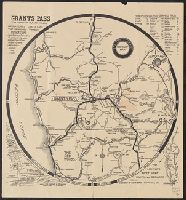
- Beinecke Rare Book and Manuscript Library > 80 mile radius, Grants Pass highway map / approved by Josephine County Court, Grants Pass Chamber of Commerce, Grants Pass City Council.
- Creator:
- American Council on Soviet Relations
- Published / Created:
- 1941]
- Call Number:
- 35 1941B
- Container / Volume:
- BRBL_00101
- Image Count:
- 2
- Resource Type:
- Maps, Atlases & Globes
- Found in:
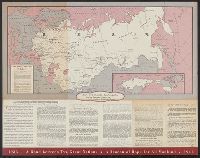
- Beinecke Rare Book and Manuscript Library > 8th anniversary American Soviet diplomatic relations.
- Published / Created:
- 1846
- Call Number:
- 1976 Folio 93
- Collection Title:
- A new universal atlas containing maps of the various empires, kingdoms, states and republics of the
- Image Count:
- 1
- Resource Type:
- Maps, Atlases & Globes
- Found in:
- Beinecke Rare Book and Manuscript Library > 9. Connecticut
- Call Number:
- 8075cea 1848
- Container / Volume:
- BRBL_00551
- Image Count:
- 1
- Resource Type:
- Maps, Atlases & Globes
- Found in:
- Beinecke Rare Book and Manuscript Library > A Chart of Lake Erie ... Buffalo, A. Burke, 1848.
- Published / Created:
- 1870]
- Call Number:
- 8555cea K61 1780
- Container / Volume:
- BRBL_00642
- Image Count:
- 1
- Resource Type:
- Maps, Atlases & Globes
- Found in:
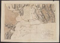
- Beinecke Rare Book and Manuscript Library > A Chart of Port Royal and Kingston Harbours in the Island of Jamaica... / by Jos. Fred. W. des Barres.
- Published / Created:
- 1777
- Call Number:
- 771 1777A
- Container / Volume:
- BRBL_00713
- Image Count:
- 9
- Resource Type:
- Maps, Atlases & Globes
- Found in:
- Beinecke Rare Book and Manuscript Library > A Chart of the Ancient Province of Laconia, Granted to Sir Ferdinando Gorges and Captain John Mason in 1629, shewing the boundaries describ'd in the patent, with its vicinity to the neighbouring provinces in North America. By J. Carver.
- Published / Created:
- 1782
- Call Number:
- 21cea 1782
- Container / Volume:
- BRBL_00016
- Image Count:
- 1
- Resource Type:
- Maps, Atlases & Globes
- Found in:
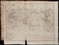
- Beinecke Rare Book and Manuscript Library > A Chart of the Atlantic Ocean.
- Published / Created:
- 1746
- Call Number:
- 307cea 1746
- Container / Volume:
- BRBL_00036
- Image Count:
- 1
- Resource Type:
- Maps, Atlases & Globes
- Found in:
- Beinecke Rare Book and Manuscript Library > A Chart of the English Channel, the Bay of Biscay, with part of the Ocean and Mediterranean ... By T. Kitchin.
- Published / Created:
- 1812
- Call Number:
- 29 1812
- Container / Volume:
- BRBL_00028
- Image Count:
- 1
- Resource Type:
- Maps, Atlases & Globes
- Found in:
- Beinecke Rare Book and Manuscript Library > A Chart of the Great Ethiopian Archipelago in the Indian Seas ... M.D. Apres. For the History of Mauritus by Ch. Grant ... 1801 S.J. Neele Sculp. 1812.
- Creator:
- Pike, Zebulon Montgomery, 1779-1813
- Published / Created:
- 1810
- Call Number:
- GA405 +W44 (LC)
- Collection Title:
- Mapping the transmississippi West, 1540-1861
- Image Count:
- 1
- Found in:
- Beinecke Rare Book and Manuscript Library > A Chart of the Internal Part of Louisiana, Including all the hitherto unexplored Countries, lying between the River La Platte of the Missouri on the N: and the Red River on the S: the Mississippi East and the Mountains of Mexico West; with a Part of New M
- Published / Created:
- [1710]
- Call Number:
- 771cea 1710
- Container / Volume:
- BRBL_00493
- Image Count:
- 1
- Resource Type:
- Maps, Atlases & Globes
- Found in:
- Beinecke Rare Book and Manuscript Library > A Chart of the Sea Coasts of New Neder Land, Virginia, New England and Penn-Silvania with the city of Philadelphia from Boston to Cabo Karrit.
- Published / Created:
- 1825
- Call Number:
- 23cea 1825
- Container / Volume:
- BRBL_00021
- Image Count:
- 2
- Resource Type:
- Maps, Atlases & Globes
- Found in:
- Beinecke Rare Book and Manuscript Library > A Chart of the West Coast of America ... from the latest Spanish surveys. Engraved by J.M. Taylor, NY.
- Published / Created:
- [1795?]
- Call Number:
- 85 1795A
- Container / Volume:
- BRBL_00637
- Image Count:
- 1
- Resource Type:
- Maps, Atlases & Globes
- Found in:
- Beinecke Rare Book and Manuscript Library > A Chart of the West Indies ...
- Published / Created:
- [1797]
- Call Number:
- 85 1797
- Container / Volume:
- BRBL_00637
- Image Count:
- 1
- Resource Type:
- Maps, Atlases & Globes
- Found in:
- Beinecke Rare Book and Manuscript Library > A Chart of the West Indies, From the latest Marine Journals and Surveys.
- Published / Created:
- [1795?]
- Call Number:
- 11 1795A
- Container / Volume:
- BRBL_00006
- Image Count:
- 1
- Resource Type:
- Maps, Atlases & Globes
- Found in:
- Beinecke Rare Book and Manuscript Library > A Chart of the World, According to Mercator's Projection, showing the latest discoveries of Capt. Cook.
- Creator:
- Barker, William
- Published / Created:
- 1796?
- Call Number:
- 1978 Folio 150
- Collection Title:
- Carey's General atlas : containing: 1. Map of the world ... 45. Captain Cook's discoveries
- Image Count:
- 1
- Found in:
- Beinecke Rare Book and Manuscript Library > A Chart of the World, according to Mercators Projection, shewing the latest Discoveries of Capt. Cook