Search
You Searched For
Search Results
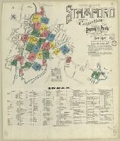
- Creator:
- Sanborn-Perris Map Co., issuing body
- Published / Created:
- 1901
- Call Number:
- 766 St22 1901
- Image Count:
- 26
- Resource Type:
- Maps, Atlases & Globes
- Abstract:
- Sanborn fire insurance maps are a rich
- Description:
- Partial cadastral map.
- Subject (Geographic):
- Stamford (Conn.)--Maps
- Subject (Topic):
- --Stamford--Maps
- Found in:
- Beinecke Rare Book and Manuscript Library > Insurance maps of Stamford, Fairfield Co., Connecticut.
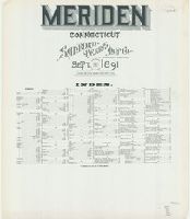
- Creator:
- Sanborn-Perris Map Co., issuing body
- Published / Created:
- 1891
- Call Number:
- 766 M54 1891
- Image Count:
- 28
- Resource Type:
- Maps, Atlases & Globes
- Abstract:
- Sanborn fire insurance maps are a rich
- Description:
- Partial cadastral map.
- Subject (Geographic):
- Meriden (Conn.)--Maps
- Subject (Topic):
- --Meriden--Maps
- Found in:
- Beinecke Rare Book and Manuscript Library > Meriden, Connecticut.
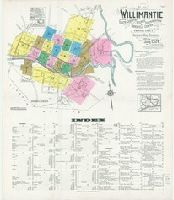
- Creator:
- Sanborn Map Company, issuing body
- Published / Created:
- 1924
- Call Number:
- 766 W677 1924
- Image Count:
- 26
- Resource Type:
- Maps, Atlases & Globes
- Abstract:
- Sanborn fire insurance maps are a rich
- Description:
- Partial cadastral map.
- Subject (Geographic):
- Coventry (Conn.)--Maps
- Subject (Topic):
- --Coventry--Maps
- Found in:
- Beinecke Rare Book and Manuscript Library > Willimantic, including South Coventry, Storrs, South Windham, and Mansfield Center, Windham County, Connecticut.
- Creator:
- Morgan, William, d. 1690
Ogilby, John, 1600-1676
- Published / Created:
- 1689
- Call Number:
- 1973 425
- Image Count:
- 29
- Found in:
- Beinecke Rare Book and Manuscript Library > Mr. Ogilby's and William Morgan's Pocket book of the roads : with their computed and measured distances, and the distinction of market and post-towns / by William Morgan ...
- Creator:
- Sanborn Map Company, issuing body
- Published / Created:
- 1919
- Call Number:
- 766 D19 1919
- Image Count:
- 29
- Resource Type:
- Maps, Atlases & Globes
- Abstract:
- Sanborn fire insurance maps are a rich
- Description:
- Partial cadastral map.
- Subject (Geographic):
- Danbury (Conn.)--Maps
- Subject (Topic):
- --Danbury--Maps
- Found in:
- Beinecke Rare Book and Manuscript Library > Insurance maps of Danbury, Fairfield County, Connecticut.
- Creator:
- Sanborn Map & Publishing Co., issuing body
- Published / Created:
- 1886
- Call Number:
- 766 N46 1886 Copy 2
- Image Count:
- 31
- Resource Type:
- Maps, Atlases & Globes
- Abstract:
- Sanborn fire insurance maps are a rich
- Description:
- Partial cadastral map.
- Subject (Geographic):
- New Haven (Conn.)--Maps
- Subject (Topic):
- Haven--Maps
- Found in:
- Beinecke Rare Book and Manuscript Library > Insurance maps of New Haven, Connecticut. Volume 1.
- Creator:
- Sanborn Map Company, issuing body
- Published / Created:
- 1912
- Call Number:
- 766 So885 1912
- Image Count:
- 28
- Resource Type:
- Maps, Atlases & Globes
- Abstract:
- Sanborn fire insurance maps are a rich
- Description:
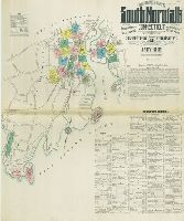
- Partial cadastral map.
- Subject (Geographic):
- Norwalk (Conn.)--Maps
- Subject (Topic):
- --Norwalk--Maps
- Found in:
- Beinecke Rare Book and Manuscript Library > Insurance maps of South Norwalk, including East Norwalk, Rowayton, Bell Island, and Roton Point, Fairfield Co., Connecticut.
- Creator:
- Sanborn Map Company, issuing body
- Published / Created:
- 1909
- Call Number:
- 766 T63 1909
- Image Count:
- 28
- Resource Type:
- Maps, Atlases & Globes
- Abstract:
- Sanborn fire insurance maps are a rich
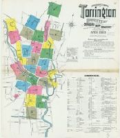
- Description:
- Partial cadastral map.
- Subject (Geographic):
- Torrington (Conn.)--Maps
- Subject (Topic):
- --Torrington--Maps
- Found in:
- Beinecke Rare Book and Manuscript Library > Insurance maps of Torrington, Litchfield Co., Connecticut.
- Creator:
- Hondius, Hendrik, 1597-1651
- Published / Created:
- 1625]
- Call Number:
- 343 1610
- Container / Volume:
- BRBL_00683
- Image Count:
- 2
- Resource Type:
- Maps, Atlases & Globes
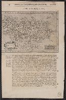
- Alternative Title:
- Chap. 22, Discipline, honour, Island
- Description:
- Paginated 643-644; map on p. 644.
- Subject (Geographic):
- Iceland--Maps--Early works to 1800
- Found in:
- Beinecke Rare Book and Manuscript Library > Island [cartographic material].
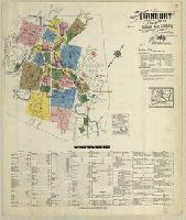
- Creator:
- Sanborn Map Company, issuing body
- Published / Created:
- 1931
- Call Number:
- 766 T63 1931
- Image Count:
- 39
- Resource Type:
- Maps, Atlases & Globes
- Abstract:
- Sanborn fire insurance maps are a rich
- Description:
- Partial cadastral map.
- Subject (Geographic):
- Torrington (Conn.)--Maps
- Subject (Topic):
- --Torrington--Maps
- Found in:
- Beinecke Rare Book and Manuscript Library > Torrington, Litchfield County, Connecticut.