Search
You Searched For
Search Results
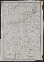
- Creator:
- Bowen, Emanuel, -1767
- Published / Created:
- 2d. July 1772.
- Call Number:
- 71 1763
- Container / Volume:
- BRBL_00364
- Image Count:
- 4
- Resource Type:
- Maps, Atlases & Globes
- Alternative Title:
- Particular map of Baffin and Hudson's
- Description:
- map of Baffin and Hudson's Bay" and "The
- Subject (Geographic):
- North America--Maps--Early works to
- Subject (Topic):
- British--America--Maps--Early works to
- Found in:
- Beinecke Rare Book and Manuscript Library > An accurate map of North America [cartographic material] : Describing and distinguishing the British and Spanish dominions on this great continent; according to the definitive treaty concluded at Paris 10th Feby. 1763. Also all the West India Islands belo
- Creator:
- Merrill, W. E. (William Emery), 1837-1891
- Published / Created:
- 1864]
- Call Number:
- 787hc 1864C
- Container / Volume:
- BRBL_00517A
- Image Count:
- 2
- Resource Type:
- Maps, Atlases & Globes
- Alternative Title:
- [Sherman map collection ; no. 22]
- Subject (Geographic):
- Alabama--Maps
- Found in:
- Beinecke Rare Book and Manuscript Library > Part of northern Georgia : / compiled under the direction of Capt. Wm. E. Merrill, Chief Top'l Eng'r, D.C.
- Call Number:
- 1976 1233
- Collection Title:
- Twenty four new and accurate maps of the several parts of Europe ... : all (except the last) new
- Image Count:
- 1
- Description:
- In pencil on verso: 22.
- Subject (Geographic):
- Switzerland --Maps --Early works to
- Found in:
- Beinecke Rare Book and Manuscript Library > Suisse or Switzerland together with their allies & subjects &c
- Creator:
- Hondius, Jodocus, 1563-1612
- Published / Created:
- [1618]
- Call Number:
- 1983 Folio 19
- Collection Title:
- [Atlas factice of 96 maps by Blaeu, Visscher, Jansson, Hondius and others]
- Image Count:
- 1
- Description:
- . Sheet measures 45.7 x 54.6 cm. No. 22 of 92
- Subject (Geographic):
- America --Maps --Early works to 1800
- Found in:
- Beinecke Rare Book and Manuscript Library > America noviter delineata / auct. Judoco Hondio
- Call Number:
- 1976 1233
- Collection Title:
- Forty-two new maps of Asia, Africa, and America ... : all engrav’d, according to the latest
- Image Count:
- 1
- Description:
- In ink on verso: 22.
- Subject (Geographic):
- Ethiopia --Maps --Early works to 1800
- Found in:
- Beinecke Rare Book and Manuscript Library > Abissina and Anian &c
- Creator:
- Scull, Nicholas, 1686?-1761?
- Published / Created:
- 1759
- Call Number:
- 774 1759
- Container / Volume:
- BRBL_00497
- Image Count:
- 3
- Resource Type:
- Maps, Atlases & Globes
- Alternative Title:
- Map of the improved part of the
- Subject (Geographic):
- political divisions--Maps--Early works to 1800
- Found in:
- Beinecke Rare Book and Manuscript Library > To the honourable Thomas Penn and Richard Penn...this map of the improved part of the province of Pennsylvania is humbly dedicated / by Nicholas Scull ; engraved by Ja. Turner.
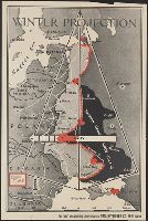
- Creator:
- Chapin, R. M., Jr
- Published / Created:
- 1943
- Call Number:
- 11hd 1939-1
- Image Count:
- 1
- Resource Type:
- Maps, Atlases & Globes
- Description:
- "Enlargement of original map drawn for
- Subject (Geographic):
- Europe, Western--Maps
- Subject (Topic):
- , Western--Maps
- Found in:
- Beinecke Rare Book and Manuscript Library > Winter Projection / TIME map by R. M. Chapin, Jr.
- Creator:
- United States. Office of Strategic Services. Research and Analysis Branch
- Published / Created:
- 1944
- Call Number:
- 28 1944C
- Container / Volume:
- BRBL_00023E
- Image Count:
- 1
- Resource Type:
- Maps, Atlases & Globes
- Description:
- "No. 3764--R & A, OSS; 22 June 1944."
- Subject (Geographic):
- Visayan Islands (Philippines)--Maps
- Subject (Topic):
- --Maps
- Found in:
- Beinecke Rare Book and Manuscript Library > Philippine Islands, transportation facilities of the southern Visayan Islands.
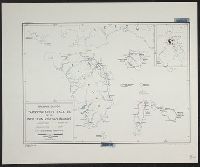
- Creator:
- United States. Office of Strategic Services. Research and Analysis Branch
- Published / Created:
- 1944
- Call Number:
- 28 1944D
- Container / Volume:
- BRBL_00023E
- Image Count:
- 1
- Resource Type:
- Maps, Atlases & Globes
- Description:
- "No. 3417--R & A, OSS; 22 June 1944."
- Subject (Geographic):
- Visayan Islands (Philippines)--Maps
- Subject (Topic):
- --Maps
- Found in:
- Beinecke Rare Book and Manuscript Library > Philippine Islands, transportation facilities of the northern Visayan Islands.
- Published / Created:
- 1918
- Call Number:
- 11hc 1918-Z12
- Container / Volume:
- BRBL_00010G
- Image Count:
- 2
- Resource Type:
- Maps, Atlases & Globes
- Description:
- On verso: Map with "Bl.22.La Malmaison
- Subject (Geographic):
- France--Maps
- Found in:
- Beinecke Rare Book and Manuscript Library > Clermont-Noyon.
- Call Number:
- 402 M59 1630
- Container / Volume:
- BRBL_00233A
- Image Count:
- 2
- Resource Type:
- Maps, Atlases & Globes
- Description:
- Signature R, page number 22 on verso.
- Subject (Geographic):
- Milan (Italy : Province)--Maps--Early
- Found in:
- Beinecke Rare Book and Manuscript Library > Stato di Milano.
- Creator:
- Langren, Arnold Florent van, 1580-1644
- Published / Created:
- 1595
- Call Number:
- Pequot +L65
- Collection Title:
- Nauigatio ac itinerarium Iohannis Hugonis Linscotani in Orientalem siue Lusitanorum Indiam
- Image Count:
- 1
- Description:
- Bound in following page 22.
- Subject (Geographic):
- Borneo --Maps
- Found in:
- Beinecke Rare Book and Manuscript Library > Exacta & accurata delineatio cum orarum maritimarum tum etiam locorum terrestrium quae in regionibus China, Cauchinchina, Camboia sive Champa, Syao, Malacca, Arracamn & Pegu ...
- Call Number:
- WA MSS 443
- Collection Title:
- Isaac Ingalls Stevens papers
- Container / Volume:
- Box 2 | Folder 29
- Image Count:
- 51
- Resource Type:
- Archives or Manuscripts
- Abstract:
- . I. Stevens. 49 p.
Map, "Plan of the
- Found in:
- Beinecke Rare Book and Manuscript Library > [Delacy, Walter Washington]
- Creator:
- Faden, William, 1749-1836
Jefferys, Thomas, d. 1771, creator
- Published / Created:
- 1789 June 1
- Call Number:
- 1982 Folio 10
- Image Count:
- 1
- Description:
- No. 22 of 43 maps bound together in
- Subject (Geographic):
- Germany --Maps --Early works to 1800
- Found in:
- Beinecke Rare Book and Manuscript Library > A new map of the King of Great Britain's dominions in Germany or the electorate of Brunswick-Luneburg and its dependencies
- Creator:
- L'Isle, Guillaume de, 1675-1726
- Published / Created:
- [1730?]
- Call Number:
- 755 1730
- Container / Volume:
- BRBL_00426
- Image Count:
- 1
- Resource Type:
- Maps, Atlases & Globes
- Subject (Geographic):
- Louisiana--Maps--Early works to 1800
- Found in:
- Beinecke Rare Book and Manuscript Library > Carte de la Louisiane et du cours du Mississipi / dressée sur un grand nombre de memoires entr'autres sur ceux de Mr. le Maire, par Guillme. de L'Isle de l'Academie Rle. des Sciences.
- Creator:
- Wit, Frederik de., creator
- Published / Created:
- [1706?]
- Call Number:
- 1973 Folio 10
- Image Count:
- 1
- Resource Type:
- Maps, Atlases & Globes
- Description:
- No. 22 of 69 maps bound together in
- Subject (Geographic):
- Italy, Southern --Maps --Early works to
- Found in:
- Beinecke Rare Book and Manuscript Library > Regnum Neapolis: in quo sunt Aprutium ulterius et citerius, Comitatus Molisius, Terra Laboris, Capitaniata Principatus ulterior et citerior, Terra Bariensis et Hidruntina, Basilicata, Calabria citerior et ulterior
- Creator:
- Clark, William, 1770-1838.
Lewis, Meriwether, 1774-1809
- Published / Created:
- 1804?
- Call Number:
- WA MSS 303
- Collection Title:
- Lewis and Clark Expedition maps and receipt, ca. 1803-1810
- Container / Volume:
- Box 1 | Folder 8
- Image Count:
- 2
- Found in:
- Beinecke Rare Book and Manuscript Library > Evans's Map 5 (the Expedition's route about October 14-22, 1804)
- Published / Created:
- 1595
- Call Number:
- Taylor 219
- Collection Title:
- Navigatio ac itinerarivm Iohannis Hvgonis Linscotani in Orientalem sive Lvsitanorvm Indiam
- Image Count:
- 1
- Description:
- Bound in following page 22.
- Subject (Geographic):
- Borneo --Maps
- Found in:
- Beinecke Rare Book and Manuscript Library > Exacta & accurata delineatio cum orarum maritimarum tum etiam locorum terrestrium quae in regionibus China, Cauchinchina, Camboia sive Champa, Syao, Malacca, Arracamn & Pegu ...