Search
You Searched For
Search Results
- Creator:
- Bowen, Emanuel, -1767
- Published / Created:
- 2d. July 1772.
- Call Number:
- 71 1763
- Container / Volume:
- BRBL_00364
- Image Count:
- 4
- Resource Type:
- Maps, Atlases & Globes
- Alternative Title:
- Particular map of Baffin and Hudson's
- Description:
- map of Baffin and Hudson's Bay" and "The
- Subject (Geographic):
- North America--Maps--Early works to
- Subject (Topic):
- British--America--Maps--Early works to
- Found in:
- Beinecke Rare Book and Manuscript Library > An accurate map of North America [cartographic material] : Describing and distinguishing the British and Spanish dominions on this great continent; according to the definitive treaty concluded at Paris 10th Feby. 1763. Also all the West India Islands belo
- Creator:
- From the Collection: Lmanian, Alexander, 1925-1996
- Published / Created:
- 1968 April 13
- Call Number:
- GEN MSS 590
- Container / Volume:
- Box 1, folder 21-23
- Image Count:
- 8
- Found in:
- Beinecke Rare Book and Manuscript Library > Photographs of Washington, D.C., and New Haven, Connecticut (GEN MSS 590) > Series I: Negatives > Negatives from Negative Sleeve Book > Copy photograph of a map of and a tally of costs
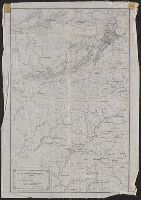
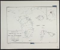
- Creator:
- Merrill, W. E. (William Emery), 1837-1891
- Published / Created:
- 1864]
- Call Number:
- 787hc 1864C
- Container / Volume:
- BRBL_00517A
- Image Count:
- 2
- Resource Type:
- Maps, Atlases & Globes
- Alternative Title:
- [Sherman map collection ; no. 22]
- Subject (Geographic):
- Alabama--Maps
- Found in:
- Beinecke Rare Book and Manuscript Library > Part of northern Georgia : / compiled under the direction of Capt. Wm. E. Merrill, Chief Top'l Eng'r, D.C.
- Call Number:
- 1976 1233
- Collection Title:
- Twenty four new and accurate maps of the several parts of Europe ... : all (except the last) new
- Image Count:
- 1
- Description:
- In pencil on verso: 22.
- Subject (Geographic):
- Switzerland --Maps --Early works to
- Found in:
- Beinecke Rare Book and Manuscript Library > Suisse or Switzerland together with their allies & subjects &c
- Call Number:
- 1976 1233
- Collection Title:
- Forty-two new maps of Asia, Africa, and America ... : all engrav’d, according to the latest
- Image Count:
- 1
- Description:
- In ink on verso: 22.
- Subject (Geographic):
- Ethiopia --Maps --Early works to 1800
- Found in:
- Beinecke Rare Book and Manuscript Library > Abissina and Anian &c
- Creator:
- Scull, Nicholas, 1686?-1761?
- Published / Created:
- 1759
- Call Number:
- 774 1759
- Container / Volume:
- BRBL_00497
- Image Count:
- 3
- Resource Type:
- Maps, Atlases & Globes
- Alternative Title:
- Map of the improved part of the
- Subject (Geographic):
- political divisions--Maps--Early works to 1800
- Found in:
- Beinecke Rare Book and Manuscript Library > To the honourable Thomas Penn and Richard Penn...this map of the improved part of the province of Pennsylvania is humbly dedicated / by Nicholas Scull ; engraved by Ja. Turner.
- Creator:
- From the Collection: Kissinger, Henry, 1923-2023
- Published / Created:
- 1967-1973
- Call Number:
- MS 2004
- Container / Volume:
- Box 206, folder 4
- Image Count:
- 58
- Found in:
- Manuscripts and Archives > Henry A. Kissinger papers, part III (MS 2004) > Series V: Writing and Research Materials > Research files for books > White House Years > Maps of Middle East
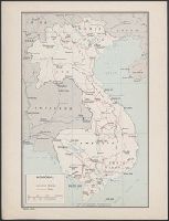
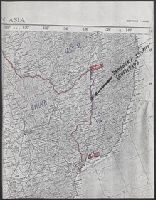
- Creator:
- From the Collection: Kissinger, Henry, 1923-2023
- Published / Created:
- 1970, undated
- Call Number:
- MS 2004
- Container / Volume:
- Box 206, folder 3
- Image Count:
- 76
- Found in:
- Manuscripts and Archives > Henry A. Kissinger papers, part III (MS 2004) > Series V: Writing and Research Materials > Research files for books > White House Years > Maps of Indochina
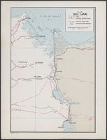
- Creator:
- United States. Office of Strategic Services. Research and Analysis Branch
- Published / Created:
- [1943]
- Call Number:
- 382 1943
- Container / Volume:
- BRBL_00175
- Image Count:
- 1
- Resource Type:
- Maps, Atlases & Globes
- Description:
- "22 November 1943."
- Subject (Geographic):
- Normandy (France)--Maps
- Subject (Topic):
- Beaches--France--Normandy--Maps
- Found in:
- Beinecke Rare Book and Manuscript Library > Beaches of Normandy - Vierville to Houlgate [cartographic material] / compiled and drawn in the Branch of Research and Analysis, OSS.
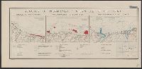
- Creator:
- United States. Office of Strategic Services. Research and Analysis Branch
- Published / Created:
- 1944
- Call Number:
- 28 1944C
- Container / Volume:
- BRBL_00023E
- Image Count:
- 1
- Resource Type:
- Maps, Atlases & Globes
- Description:
- "No. 3764--R & A, OSS; 22 June 1944."
- Subject (Geographic):
- Visayan Islands (Philippines)--Maps
- Subject (Topic):
- --Maps
- Found in:
- Beinecke Rare Book and Manuscript Library > Philippine Islands, transportation facilities of the southern Visayan Islands.
- Creator:
- United States. Office of Strategic Services. Research and Analysis Branch
- Published / Created:
- 1944
- Call Number:
- 28 1944D
- Container / Volume:
- BRBL_00023E
- Image Count:
- 1
- Resource Type:
- Maps, Atlases & Globes
- Description:
- "No. 3417--R & A, OSS; 22 June 1944."
- Subject (Geographic):
- Visayan Islands (Philippines)--Maps
- Subject (Topic):
- --Maps
- Found in:
- Beinecke Rare Book and Manuscript Library > Philippine Islands, transportation facilities of the northern Visayan Islands.
- Creator:
- From the Collection: Kissinger, Henry, 1923-2023
- Published / Created:
- 1970-1979, undated
- Call Number:
- MS 2004
- Container / Volume:
- Box 206, folder 2
- Image Count:
- 130
- Found in:
- Manuscripts and Archives > Henry A. Kissinger papers, part III (MS 2004) > Series V: Writing and Research Materials > Research files for books > White House Years > Maps and photographs for White House Years
- Published / Created:
- 1965-1966
- Call Number:
- GEN MSS 1319
- Container / Volume:
- Box 4
- Image Count:
- 1640
- Found in:
- Beinecke Rare Book and Manuscript Library > The Vinland Map and the Tartar Relation: proofs and subject files (GEN MSS 1319) > Series II: Subject files > Newspaper and magazine clippings
- Creator:
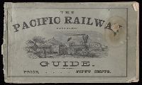
- Hart, Alfred A., 1816-1908.
- Published / Created:
- c1870.
- Call Number:
- Zc10 870hac
- Image Count:
- 67
- Description:
- Maps have 6 panels and are bound in at
- Subject (Topic):
- Railroads--Maps
- Found in:
- Beinecke Rare Book and Manuscript Library > The traveler's own book, a panorama of overland travel, from Chicago to San Francisco via the great and attractive route, Chicago Burlington & Quincy R.R. ... Burlington & Missouri River R.R. ... Union Pacific Railroad ... Utah Central Railroad ... Central Pacific Railroad ... Western Pacific Railroad ... containing complete traveler's maps ... By Alfred A. Hart.
- Creator:
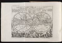
- Moll, Herman, d. 1732
Salmon, Thomas, 1679-1767
- Published / Created:
- 1739
- Call Number:
- 1996 +91
- Image Count:
- 3
- Resource Type:
- Books, Journals & Pamphlets
- Description:
- Frontispiece map, 25 x 41 cm.
- Subject (Geographic):
- Madras (India)--Maps--Early works to
- Found in:
- Beinecke Rare Book and Manuscript Library > Modern history: or, The present state of all nations. Describing their respective situations, persons, habits, ... animals and minerals. ... By Mr. Salmon. Illustrated with cuts and maps ... by Herman Moll ...
- Creator:
- From the Collection: Kissinger, Henry, 1923-2023
- Published / Created:
- 2004
- Call Number:
- MS 1981
- Container / Volume:
- Box 745, folder 9
- Image Count:
- 176
- Found in:
- Manuscripts and Archives > Henry A. Kissinger papers, part II (MS 1981) > Series III: Post-Government Career > Speeches and writings > General > Testimony before Senate Foreign Relations Committee on "Middle East: Re-thinking the Road Map," Feb 24, 2004 [2 of 2]
- Creator:
- From the Collection: Kissinger, Henry, 1923-2023
- Published / Created:
- 2004
- Call Number:
- MS 1981
- Container / Volume:
- Box 745, folder 8
- Image Count:
- 318
- Found in:
- Manuscripts and Archives > Henry A. Kissinger papers, part II (MS 1981) > Series III: Post-Government Career > Speeches and writings > General > Testimony before Senate Foreign Relations Committee on "Middle East: Re-thinking the Road Map," Feb 24, 2004 [1 of 2]
- Creator:
- Faden, William, 1749-1836
Jefferys, Thomas, d. 1771, creator
- Published / Created:
- 1789 June 1
- Call Number:
- 1982 Folio 10
- Image Count:
- 1
- Description:
- No. 22 of 43 maps bound together in
- Subject (Geographic):
- Germany --Maps --Early works to 1800
- Found in:
- Beinecke Rare Book and Manuscript Library > A new map of the King of Great Britain's dominions in Germany or the electorate of Brunswick-Luneburg and its dependencies
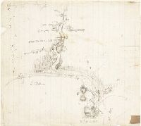
- Creator:
- From the Collection: Stenzel, Franz
- Published / Created:
- n.d.
- Call Number:
- WA MSS S-2368
- Container / Volume:
- Box 7, folder 134
- Image Count:
- 1
- Found in:
- Beinecke Rare Book and Manuscript Library > Franz R. and Kathryn M. Stenzel collection of western American art (WA MSS S-2368) > Series II: James G. Swan Artwork and Associated Material > > ARTWORK > Works by Swan > Views of Native American Life > [Map of coastal village Alekistet?] Pencil drawing, 19.1 x 22 cm.
- Creator:
- Sanborn Map Company
- Published / Created:
- August, 1923.
- Call Number:
- 776 B764 1923
- Container / Volume:
- BRBL_00502
- Image Count:
- 4
- Resource Type:
- Maps, Atlases & Globes
- Abstract:
- Fire insurance map, colored to show
- Description:
- Coordinates not present on map and are
- Publisher:
- Sanborn Map Company,
- Subject (Geographic):
- Bridgeville (Del.)--Maps.
- Subject (Topic):
- --Bridgeville--Maps.
- Found in:
- Beinecke Rare Book and Manuscript Library > Bridgeville, Sussex County, Delaware.