Kitchin, Thomas, d. 1784, creator Sayer, Robert, 1725-1794
Published / Created:
1787 January 1
Call Number:
1982 Folio 10
Image Count:
1
Description:
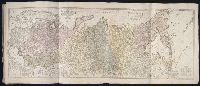
Also appeared in Kitchin's General atlas describing the whole universe. London : Printed for Robert Sayer, [1780]., Ms. notes in contemporary hand., No. 23 of 43 maps bound together in composite atlas., Relief shown pictorially., Scale [ca. 1:2,450,000]., and Shows vegetation, marshes, etc.
Publisher:
Robert Sayer
Subject (Geographic):
Europe, Eastern --Maps --Early works to 1800, Lithuania --Boundaries --Maps --Early works to 1800, Lithuania --Maps --Early works to 1800, Poland --Boundaries --Maps --Early works to 1800, and Poland --Maps --Early works to 1800
Also appeared in Kitchin's General atlas describing the whole universe. London : Printed for Robert Sayer, [1780]., By S. Boulton ; and also a summary description relative to the trade and natural produce, manners and customs of the African continent and islands., Insets: A particular chart of the Gold Cost. -- Azores or Western Islands., No. 35 of 43 maps bound together in composite atlas., Scale [ca. 1:8,500,000]., Sheets pasted together to create 1 map on 2 sheets., and With descriptive text.
Publisher:
Printed for Robert Sayer
Subject (Geographic):
Africa --Maps --Early works to 1800 and Ghana --Maps --Early works to 1800
Anville, Jean Baptiste Bourguignon d', 1697-1782 Cook, James, 1728-1779 Kitchin, Thomas, d. 1784, creator Sayer, Robert, 1725-1794
Published / Created:
1787 January 6
Call Number:
1982 Folio 10
Image Count:
2
Description:
Also appeared in Kitchin's General atlas describing the whole universe. London : Printed for Robert Sayer, [1780]., No. 29 of 43 maps bound together in composite atlas., Relief shown pictorially., Scale [ca. 1:11,100,000]., Sheets mounted together to form 2 sheets., Shows boundaries, rivers, settlements, islands; includes descriptive notes., and Title cartouche depicts local produce, a palm tree and a camel.
Kitchin, Thomas, d. 1784, creator Sayer, Robert, 1725-1794
Published / Created:
1787 January 1
Call Number:
1982 Folio 10
Image Count:
2
Description:
Also appeared in Kitchin's General atlas, describing the whole universe. London : Printed and sold for R. Sayer and J. Bennet, 1780., By Thos. Kitchin, hydrographer to the king ; with many additions and improvements from the latest surveys and observations., No. 4 of 43 maps bound together in composite atlas., Pictorial relief., Scale [ca. 1:4,800,000]., and Western part of the northern states including the British Islands, Norway, Denmark and part of Sweden -- Eastern part of the northern states, including the eastern part of Sweden; European Russia, &c. -- Western part of the Mediterranean Sea with the coasts of Spain, France, Italy, Barbary -- Eastern part of the Mediterranean Sea with the coasts of Turky [sic], Anatolia, Syria, Egypt and Barbary.
Publisher:
Robert Sayer
Subject (Geographic):
Africa, North --Maps --Early works to 1800, Europe --Maps --Early works to 1800, and Middle east --Maps --Early works to 1800
Imperatorskaia akademia nauk (Russia) Kitchin, Thomas, d. 1784, creator Sayer, Robert, 1725-1794
Published / Created:
1788 May 1
Call Number:
1982 Folio 10
Image Count:
2
Alternative Title:
Asiatic part of the Russian empire : from the maps published by the Imperial Academy of St. Petersburg with the new discoveries of Captn. Cook &c
Description:
Also appeared in Kitchin's General atlas describing the whole universe. London : Printed R. Sayer and J. Bennet, 1780., No. 25 of 43 maps bound together in composite atlas., Prime meridian: Ferro., Relief shown pictorially., Scale [ca. 1:8,000,000]., Sheets mounted together to form 1 sheet., and Shows vegetation, sailing and explorers tracks, etc.
Anville, Jean Baptiste Bourguignon d', 1697-1782 Compagnie des Indes Jefferys, Thomas, d. 1771, creator Kitchin, Thomas, d. 1784 Robert Laurie and James Whittle Sayer, Robert, 1725-1794
Published / Created:
1789 January 1
Call Number:
1982 Folio 10
Image Count:
1
Description:
Also appeared in Kitchin's General atlas describing the whole universe. London : Printed for Robert Sayer, [1780]., Has illustrated cartouche and includes text., No. 36 of 43 maps bound together in composite atlas., Norwich, O.I. Norwich's maps of Africa., Prime meridians: Ferro and London., Relief shown pictorially; depths by soundings., Scale [ca. 1:1,850,000]., and This map is copied from an original drawn by Monsr. D'Anville at the expense of the French East India Company, & published at Paris. The country thorough [sic] which the R. Senegal runs has been improved & corrected from a large & curious survey of that river found in the Fort of Senegal.
Publisher:
Printed for by Robert Sayer
Subject (Geographic):
Africa, West --Maps --Early works to 1800
Subject (Topic):
Coasts --Africa, West --Maps --Early works to 1800
Chernyshov, Ivan Georgievich Dury, Andrew., creator Sayer, Robert, 1725-1794
Published / Created:
1787 October 24
Call Number:
1982 Folio 10
Image Count:
1
Alternative Title:
Map of the present seat of war, between the Russians, Poles, and Turk
Description:
Also shows parts of Hungary and Poland., Includes paste-on addition to northwestern sheet depicting Bosnia, Herzegovina, and the Dalmatian Coast., No. 26 of 43 maps bound together in composite atlas., Prime meridian: Ferro., Relief shown pictorially., Scale [ca. 1:2,500,000]., and Sheets mounted together to form 2 sheets.
Publisher:
Wm. Faden
Subject (Geographic):
Black Sea --Maps --Early works to 1800 and Russia --Maps --Early works to 1800
Subject (Topic):
Russo-Turkish War, 1787-1792 --Maps --Early works to 1800