Search
You Searched For
Search Results
- Creator:
- Kip, Johannes, 1653-1722
- Published / Created:
- 1903
- Call Number:
- 32 L84 1720/1903
- Container / Volume:
- BRBL_00736
- Image Count:
- 12
- Resource Type:
- Maps, Atlases & Globes
- Found in:
- Beinecke Rare Book and Manuscript Library > A prospect of the city of London, Westminster and St. James Park = veue et perspective de la ville de Londre, Westminster et Parc St. Jacques / John Kip delineavit et sculpsit.
- Published / Created:
- 1959
- Call Number:
- 32fb L84 1907
- Container / Volume:
- BRBL_00075
- Image Count:
- 1
- Resource Type:
- Maps, Atlases & Globes
- Found in:
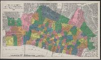
- Beinecke Rare Book and Manuscript Library > City of London showing parish boundaries prior to the Union of Parishes Act, 1907 [cartographic material].
- Creator:
- Agas, Ralph, 1545-1621
- Published / Created:
- 1905
- Call Number:
- 32 L84 1570/1905
- Container / Volume:
- BRBL_00737
- Image Count:
- 8
- Resource Type:
- Maps, Atlases & Globes
- Found in:
- Beinecke Rare Book and Manuscript Library > Civitas Londinum.
- Creator:
- Salway, Joseph.
- Published / Created:
- 1899-1903.
- Call Number:
- LTS 32 L84 1811/1903
- Image Count:
- 30
- Resource Type:
- Maps, Atlases & Globes
- Found in:
- Beinecke Rare Book and Manuscript Library > Plan of the road from Hyde Park Corner to Counter's Bridge / made for the Kensington Turnpike Trustees by their surveyor Joseph Salway in the year 1811.
- Published / Created:
- 1983
- Call Number:
- 32 L84 1682/1983
- Container / Volume:
- BRBL_00739
- Image Count:
- 2
- Resource Type:
- Maps, Atlases & Globes
- Found in:
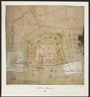
- Beinecke Rare Book and Manuscript Library > The Tower of London 1682.