Skip to search
Skip to main content
Skip to first result
Search
You Searched For
Extent of Digitization
Unspecified
Format
cartographic
Publication Place
London :
New Search
Search Results
Creator:
Published / Created:
Jany. 1st, 1795.
Call Number:
1977 Folio 177
Image Count:
2
Resource Type:
Maps, Atlases & Globes
Found in:
Beinecke Rare Book and Manuscript Library > A map of China : with the surrounding states, correctly copied from Monsr. d'Anville : engraved for Monsr. de Paun's Philosophical dissertations on the Egyptians & Chinese.
Creator:
Published / Created:
[1759]
Call Number:
1977 Folio 177
Image Count:
2
Resource Type:
Maps, Atlases & Globes
Found in:
Beinecke Rare Book and Manuscript Library > A map of the King of Great Britain's Dominions in Germany, or, The Electorate of Brunswick-Lunenburg with its dependencies [cartographic material] : containing the Dutchies of Lunenburg, Calenberg, Grunbenhagen, Lauenburg, Bremen & Verden, and the countie
Creator:
Published / Created:
1787
Call Number:
1977 Folio 177
Image Count:
2
Resource Type:
Maps, Atlases & Globes
Found in:
Beinecke Rare Book and Manuscript Library > A map of the country between Albemarle Sound, and Lake Erie [cartographic material] : comprehending the whole of Virginia, Maryland, Delaware and Pensylvania, with parts of several other of the United States of America / engraved by S.J. Neele.
Creator:
Published / Created:
Jany. 1st , 1793.
Call Number:
1977 Folio 177
Image Count:
2
Resource Type:
Maps, Atlases & Globes
Found in:
Beinecke Rare Book and Manuscript Library > A new map of France divided into eighty three departments according to the decree of the National Assembly in 1790.
Creator:
Published / Created:
[1783?]
Call Number:
1977 Folio 177
Image Count:
4
Resource Type:
Maps, Atlases & Globes
Found in:
Beinecke Rare Book and Manuscript Library > England and Ireland : containing all the cities, boroughs, markettowns & principal villages : with the coast of France from Calais to Brest delineated and engraved from actual surveys / by Richard William Seale.
Creator:
Published / Created:
[1768]
Call Number:
1977 Folio 177
Image Count:
2
Resource Type:
Maps, Atlases & Globes
Found in:
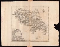
Beinecke Rare Book and Manuscript Library > Martinico, one of the Caribbee Islands in the West Indies subject to the French / [cartographic material] / according to the observations of Mr. Houel engineer ; by Thos. Jefferys, geographer to His Royal Highness the Prince.
Branch:v1.60.98 ,Deployed:2024-06-05T10:04:40-04:00