Search
You Searched For
Search Results
- Creator:
- Schenk, Peter, 1660-1718 or 1719.
- Published / Created:
- ca. 1700?]
- Call Number:
- 1973 Folio 18
- Image Count:
- 1
- Resource Type:
- Maps, Atlases & Globes
- Found in:
- Beinecke Rare Book and Manuscript Library > Anglia in septem Anglo-Saxonum regna omnesque hodiernas regiones ordine distincta [cartographic material] / ededit Petrus Schenk.
- Creator:
- Valck, G. (Gerard), 1651 or 1652-1726.
- Published / Created:
- ca. 1702?]
- Call Number:
- 1973 Folio 18
- Image Count:
- 1
- Resource Type:
- Maps, Atlases & Globes
- Found in:
- Beinecke Rare Book and Manuscript Library > Archiepiscopatus Coloniensis, ducatibus Iuliacensi et Montensi intermedius [cartographic material] : queis in septentrionem adjacent Geldria Hispanica, ac comitatus Mursanus / prostant penes Gerardum Valk.
- Creator:
- Keulen, Gerard van.
- Published / Created:
- [1717]
- Call Number:
- 1973 Folio 18
- Image Count:
- 1
- Resource Type:
- Maps, Atlases & Globes
- Found in:
- Beinecke Rare Book and Manuscript Library > Attaque der Turkse galeyen en saiken, op de 2 keyserlyke oorlog scheepen op den 9 July voor gevallen op den Donau [cartographic material].
- Creator:
- Valck, G. (Gerard), 1651 or 1652-1726.
- Published / Created:
- [ca. 1702?]
- Call Number:
- 1973 Folio 18
- Image Count:
- 1
- Resource Type:
- Maps, Atlases & Globes
- Found in:
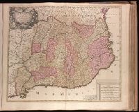
- Beinecke Rare Book and Manuscript Library > Aurelianensis Praefectura Generalis, in qua partiliter discriminati superiores Ducatus Cenomanensis ... [cartographic material] / Ger. et Leo. Valk.
- Creator:
- Valck, G. (Gerard), 1651 or 1652-1726.
- Published / Created:
- ca. 1702?]
- Call Number:
- 1973 Folio 18
- Image Count:
- 1
- Resource Type:
- Maps, Atlases & Globes
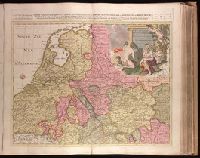
- Found in:
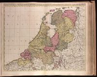
- Beinecke Rare Book and Manuscript Library > Belgica Foederata complectens septem Provincias, Ducatum Geldriae, Comitatus Hollandiae et Zelandiae, Dioeceses Trajectum, Transisulaniam, Groningam, et Frisiam, et circumjacentes Provincias [cartographic material] / venalis habent Gerardus et Leonardus Valk.
- Creator:
- Valck, G. (Gerard), 1651 or 1652-1726.
- Published / Created:
- ca. 1702]
- Call Number:
- 1973 Folio 18
- Image Count:
- 1
- Resource Type:
- Maps, Atlases & Globes
- Found in:
- Beinecke Rare Book and Manuscript Library > Bulgaria et Romania [cartographic material] : divisa in singulares sangiacatus Silistriam, Nicopolin, Bodinum, Sardiam, Bysantium, Kirkeliam et Gallipolin, una cum finitimis regionibus Valachia, Servia etc. / per Ger. et Leon. Valk.
- Creator:
- Verseyl, Elizabeth, d. 1726.
- Published / Created:
- 1710?]
- Call Number:
- 1973 Folio 18
- Image Count:
- 1
- Resource Type:
- Maps, Atlases & Globes
- Found in:
- Beinecke Rare Book and Manuscript Library > Carte du Paraguay, du Chili, Détroit de Magellan, & Terre de Feu, dans l'Amérique Méridionale / par la veuve de Nicolas Visscher.
- Creator:
- Danckerts, Justus, 1635-1701.
- Published / Created:
- after 1696]
- Call Number:
- 1973 Folio 18
- Image Count:
- 1
- Resource Type:
- Maps, Atlases & Globes
- Found in:
- Beinecke Rare Book and Manuscript Library > Circuli Austriaci in quo sunt archiducatus Austriae ducatus Stiriae Carintiae Carniolae Comitatus Tirolis et episcopatus Tridentini novissima deschriptio [cartographic material] / per Iustinum Danckerts.
- Creator:
- Valck, G. (Gerard), 1651 or 1652-1726.
- Published / Created:
- ca. 1702?]
- Call Number:
- 1973 Folio 18
- Image Count:
- 1
- Resource Type:
- Maps, Atlases & Globes
- Found in:
- Beinecke Rare Book and Manuscript Library > Circulus Franconicus [cartographic material] : divisa in Ducatus Coburgi, Franconiae, et Episcopatus Wurtzburgi, Bambergae, et Stadii., Marchionatus Culmbachii, et Onspachii, Comitatus Hennenbergae, Rheineci, Werthemii, Erpachia, Limburgi, Hollae, Suartenburgi, et Castellae / per Ger. et Leon Valk.
- Creator:
- Valck, G. (Gerard), 1651 or 1652-1726.
- Published / Created:
- ca. 1702?]
- Call Number:
- 1973 Folio 18
- Image Count:
- 1
- Resource Type:
- Maps, Atlases & Globes
- Found in:
- Beinecke Rare Book and Manuscript Library > Circulus Saxoniae Inferioris, divisa in ducatus Brunsuici, Zellae, Holsatiae, Meklenburgi et Bremae, archiepiscopatum Magdeburgi, et episcopatus Hildesii et Halberstadii [cartographic material] / per Gerardi et Leonardi Valk, cum privilegio.
- Creator:
- Valck, G. (Gerard), 1651 or 1652-1726.
- Published / Created:
- ca. 1702?]
- Call Number:
- 1973 Folio 18
- Image Count:
- 1
- Resource Type:
- Maps, Atlases & Globes
- Found in:
- Beinecke Rare Book and Manuscript Library > Circulus Saxoniae superioris, divisa in ducatus Saxoniae, Altenburgi, Vinariae, Gothae, et Isenaci, principatum Anhaltinum, comitatus Suartenburgi, Barbiae, et Bichlingii, episcoptatius Ceitzii et Halae, cum reliquis ditionibus [cartographic material] / per Gerard et Leonard Valk.
- Creator:
- Valck, G. (Gerard), 1651 or 1652-1726.
- Published / Created:
- [ca. 1702?]
- Call Number:
- 1973 Folio 18
- Image Count:
- 1
- Resource Type:
- Maps, Atlases & Globes
- Found in:
- Beinecke Rare Book and Manuscript Library > Circulus Suevicus complectens omnes status subdivisos ex quibus constat [cartographic material].
- Creator:
- Blaeu, Willem Janszoon, 1571-1638.
- Published / Created:
- [after 1644]
- Call Number:
- 1973 Folio 18
- Image Count:
- 1
- Resource Type:
- Maps, Atlases & Globes
- Found in:
- Beinecke Rare Book and Manuscript Library > Comitatus Bellovacum vernaculè Beauvais [cartographic material].
- Creator:
- Caroli, Francesco di.
- Published / Created:
- ca. 1700?]
- Call Number:
- 1973 Folio 18
- Image Count:
- 1
- Resource Type:
- Maps, Atlases & Globes
- Found in:
- Beinecke Rare Book and Manuscript Library > Comitatus Hollandiae tabula [cartographic material] / pluribus locis recens emendata a Francisco Caroli.
- Creator:
- Valck, G. (Gerard), 1651 or 1652-1726.
- Published / Created:
- [1710?]
- Call Number:
- 1973 Folio 18
- Image Count:
- 1
- Resource Type:
- Maps, Atlases & Globes
- Found in:
- Beinecke Rare Book and Manuscript Library > Dalmatia, Sclavonia, Croatia, Bosnia, Servia, et Istria [cartographic material] : distributa in singulares ditiones et diœceses, una cum Republica Ragusana, et circumjacentibus regionibus, Hungaria, Venetiis, statu ecclesiastico, Napoli et Macedonia / Venundantur per Gerardum et Leonardum Valk, cum Priv.
- Creator:
- Schenk, Peter, 1660-1718 or 1719.
- Published / Created:
- 1706
- Call Number:
- 1973 Folio 18
- Image Count:
- 1
- Resource Type:
- Maps, Atlases & Globes
- Found in:
- Beinecke Rare Book and Manuscript Library > Dania regnum [cartographic material] : ducatus Holsatia et Slesvicum insulae Danicae et provinciae Iutia Scania etc. / auctore Petrus Schenk.
- Creator:
- Keulen, Gerard van.
- Published / Created:
- [ca. 1734]
- Call Number:
- 1973 Folio 18
- Image Count:
- 1
- Resource Type:
- Maps, Atlases & Globes
- Found in:
- Beinecke Rare Book and Manuscript Library > De Haven en Stad Wismar desselfs Districkt Belegering en Werken daer voor [cartographic material].
- Creator:
- Keulen, Gerard van.
- Published / Created:
- [ca. 1734?]
- Call Number:
- 1973 Folio 18
- Image Count:
- 1
- Resource Type:
- Maps, Atlases & Globes
- Found in:
- Beinecke Rare Book and Manuscript Library > De Haven van Cette in de Middelandse Zee in Langedoc [cartographic material].
- Creator:
- Keulen, Gerard van.
- Published / Created:
- [1734]
- Call Number:
- 1973 Folio 18
- Image Count:
- 1
- Resource Type:
- Maps, Atlases & Globes
- Found in:
- Beinecke Rare Book and Manuscript Library > De kust van Pomeren, hey eyland Rugen [cartographic material].
- Creator:
- Blaeu, Joan, 1596-1673.
- Published / Created:
- 1647?]
- Call Number:
- 1973 Folio 18
- Image Count:
- 1
- Resource Type:
- Maps, Atlases & Globes
- Found in:
- Beinecke Rare Book and Manuscript Library > Ducato di Parma et di Piacenza [cartographic material].
- Creator:
- Blaeu, Joan, 1596-1673.
- Published / Created:
- 1647?]
- Call Number:
- 1973 Folio 18
- Image Count:
- 1
- Resource Type:
- Maps, Atlases & Globes
- Found in:
- Beinecke Rare Book and Manuscript Library > Ducato ouero Territorio di Milano [cartographic material].
- Creator:
- Doppelmayr, Johann Gabriel, 1677-1750.
- Published / Created:
- [1706?]
- Call Number:
- 1973 Folio 18
- Image Count:
- 1
- Resource Type:
- Maps, Atlases & Globes
- Found in:
- Beinecke Rare Book and Manuscript Library > Eclipseos solis totalis cum mora d[ie] 12 Maii 1706, horis antem: in Europa celebratae, geographica repraesentatio [cartographic material] : in qua centralis umbrae tractus ac reliquae magnitudines suis locis competentes, ex illustrium virorum observationibus deductae, per arcus parallelos, ceu digitorum singulorum indices / ope. Dni. J. Gabr. Doppelmayr, Math. P. P. et Simon Moolen, Mathematici, curiose ostenduntur.
- Creator:
- Allard, Carel, 1648-ca. 1709.
- Published / Created:
- 1702]
- Call Number:
- 1973 Folio 18
- Image Count:
- 1
- Resource Type:
- Maps, Atlases & Globes
- Found in:
- Beinecke Rare Book and Manuscript Library > Exactissima Asiae delineatio, in praecipuas regiones, ceterasq [cartographic material] : partes divisa, et denuo in lucem / edita per Carolum Allard, cum privilegio potentissimorum D.D. Ordinum Hollandiae & Westfriae ; extracta ex authenticis tabulis D. Nicolai Witsen, cos. Amst., et praecipuorum auctorum, cum consensu viri amplissimi ; Ph. Tiedeman, delin. ; G. v. Gouwen, sculp.
- Creator:
- Blaeu, Willem Janszoon, 1571-1638.
- Published / Created:
- [163-?]
- Call Number:
- 1973 Folio 18
- Image Count:
- 1
- Resource Type:
- Maps, Atlases & Globes
- Found in:
- Beinecke Rare Book and Manuscript Library > Gastinois et Hurepois [cartographic material].
- Creator:
- Valck, G. (Gerard), 1651 or 1652-1726.
- Published / Created:
- ca. 1702]
- Call Number:
- 1973 Folio 18
- Image Count:
- 1
- Resource Type:
- Maps, Atlases & Globes
- Found in:
- Beinecke Rare Book and Manuscript Library > Helvetiorum Reipublicae Cantones XIII : ut et Faederata Rhaetia quique I is socii ac subditi. adjunctis unà comitatibus Vallesiae et Neocomi / per G. Valk.
- Creator:
- Blaeu, Joan, 1596-1673.
- Published / Created:
- 1647?]
- Call Number:
- 1973 Folio 18
- Image Count:
- 1
- Resource Type:
- Maps, Atlases & Globes
- Found in:
- Beinecke Rare Book and Manuscript Library > Il Bellunese con il Feltrino [cartographic material].
- Creator:
- Blaeu, Joan, 1596-1673.
- Published / Created:
- 1647?]
- Call Number:
- 1973 Folio 18
- Image Count:
- 1
- Resource Type:
- Maps, Atlases & Globes
- Found in:
- Beinecke Rare Book and Manuscript Library > Il Cadorino [cartographic material].
- Creator:
- Reelant, Adriaan, 1676-1718.
- Published / Created:
- MDCCV [1705]
- Call Number:
- 1973 Folio 18
- Image Count:
- 1
- Resource Type:
- Maps, Atlases & Globes
- Found in:
- Beinecke Rare Book and Manuscript Library > Imperii Persici delineatio [cartographic material] / ex scriptis potissimum geographicis arabum et persarum tentata ab Adriano Relando.
- Creator:
- Schenk, Peter, 1660-1718 or 1719.
- Published / Created:
- ca. 1700?]
- Call Number:
- 1973 Folio 18
- Image Count:
- 1
- Resource Type:
- Maps, Atlases & Globes
- Found in:
- Beinecke Rare Book and Manuscript Library > Imperii circulus Bavaria titulô Electoratus insignis [cartographic material] : ea pro ut in ducatum, ac palatinatum, aliosque eorundem status hîc politicè divisa / denuò nunc exhibetur â Petro Schenk, cum privilegio.
- Creator:
- Visscher, Nicolaes, 1649-1702.
- Published / Created:
- 1698?]
- Call Number:
- 1973 Folio 18
- Image Count:
- 1
- Resource Type:
- Maps, Atlases & Globes
- Found in:
- Beinecke Rare Book and Manuscript Library > Insula Matanino, vulgo Martanico [cartographic material] / in lucem edita per Nicolaum Visscher.
- Creator:
- Allard, Carel, 1648-ca. 1709.
- Published / Created:
- [169-?]
- Call Number:
- 1973 Folio 18
- Image Count:
- 1
- Resource Type:
- Maps, Atlases & Globes
- Found in:
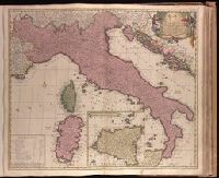
- Beinecke Rare Book and Manuscript Library > Italia [cartographic material] : in suos quoscunq[ue] status divisa, iiq[ue] iterum in particulares ditiones distributi, huic accedunt insulae Sicilia, Sardinia, Corsica & c. quae suos ad principes nominatim referuntur / auctore Carolo Allard, Amstelod. ; J. Deur delin. et sculp.
- Creator:
- Visscher, Nicolaes, 1649-1702.
- Published / Created:
- 169-?]
- Call Number:
- 1973 Folio 18
- Image Count:
- 1
- Resource Type:
- Maps, Atlases & Globes
- Found in:
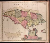
- Beinecke Rare Book and Manuscript Library > Jamaica, Americae Septentrionalis Ampla Insula a Christophoro Columbo detecta, in suas Gubernationes per accuratè distincta [cartographic material] / per Nicolaum Visser ; L. v Anse, schulp.
- Creator:
- Sanson, Nicolas, 1600-1667, cartographer.
- Published / Created:
- [ca. 1700?]
- Call Number:
- 1973 Folio 18
- Image Count:
- 1
- Resource Type:
- Maps, Atlases & Globes
- Found in:
- Beinecke Rare Book and Manuscript Library > La Russie blanche ou Moscovie [cartographic material] : divisée suivant l'estendue des royaumes, duchés, principautés, provinces et peuples qui sont presentement soubs la domination du czar de la Russie ... / par le Sr. Sanson geographe ordre. du roy.
- Creator:
- Blaeu, Willem Janszoon, 1571-1638.
- Published / Created:
- [163-?]
- Call Number:
- 1973 Folio 18
- Image Count:
- 1
- Resource Type:
- Maps, Atlases & Globes
- Found in:
- Beinecke Rare Book and Manuscript Library > Languedoc [cartographic material].
- Creator:
- Sanson, Nicolas, 1600-1667, cartographer.
- Published / Created:
- [173-?]
- Call Number:
- 1973 Folio 18
- Image Count:
- 2
- Resource Type:
- Maps, Atlases & Globes
- Found in:
- Beinecke Rare Book and Manuscript Library > Le Royaume de France : distingué suivant l'estendue de toutes ses provinces et ses acquisitions, dans l'Espagne, dans l'Italie, dans l'Allemagne et dans les Pays Bas / par le Sr Sanson, géographe ordinaire du Roy, présenté au Roy par son très humble serviteur J. de Ram.
- Creator:
- Sanson, Nicolas, 1600-1667.
- Published / Created:
- [ca. 1700]
- Call Number:
- 1973 Folio 18
- Image Count:
- 2
- Resource Type:
- Maps, Atlases & Globes
- Found in:
- Beinecke Rare Book and Manuscript Library > Le cours de la riviere du Rhein [cartographic material] : depuis sa source jusques a son emboucheure, ou sont distingués toutes les estats et souverainetés qui sont dessus et aux environs / tiré de tous les Memoires les plus nouveaux par le Sr. Sanson ...
- Creator:
- Sanson, Nicolas, 1600-1667, cartographer.
- Published / Created:
- [ca. 1700]
- Call Number:
- 1973 Folio 18
- Image Count:
- 1
- Resource Type:
- Maps, Atlases & Globes
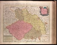
- Found in:
- Beinecke Rare Book and Manuscript Library > Le royaume de Boheme, duché de Silésie, les marquisat de Moravie et de Lusace [cartographic material] / dressé sur les memoires les plus nouueaux par le Sr. Sanson geographe ordinaire du Roy.
- Creator:
- Sanson, Nicolas, 1600-1667.
- Published / Created:
- [ca. 1700?]
- Call Number:
- 1973 Folio 18
- Image Count:
- 1
- Resource Type:
- Maps, Atlases & Globes
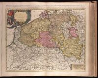
- Found in:
- Beinecke Rare Book and Manuscript Library > Les Provinces des Pays-Bas catholiques [cartographic material] : distinguées suivant qelles sont presentement partagées entre le Roy de France, le Roy d'Espagne et les Estats Generaux des Provinces-Unies / par le Sr. Sanson.
- Creator:
- Danckerts, Theodore.
- Published / Created:
- ca. 1680]
- Call Number:
- 1973 Folio 18
- Image Count:
- 1
- Resource Type:
- Maps, Atlases & Globes
- Found in:
- Beinecke Rare Book and Manuscript Library > Lotharingiae et Utriusque Alsatiae in ditiones minores divisarum tractibusque insertis et finitimis circumscriptarum novissima, nitidissima et accuratissima delineatio [cartographic material] / per Theodorum Danckerts, cum privilegio.
- Creator:
- Blaeu, Joan, 1596-1673.
- Published / Created:
- ca. 1670]
- Call Number:
- 1973 Folio 18
- Image Count:
- 1
- Resource Type:
- Maps, Atlases & Globes
- Found in:
- Beinecke Rare Book and Manuscript Library > March. Brandenburgici pars, quae marchia media vulgo Mittelmarck audit [cartographic material].
- Creator:
- Blaeu, Joan, 1596-1673.
- Published / Created:
- ca. 1670]
- Call Number:
- 1973 Folio 18
- Image Count:
- 1
- Resource Type:
- Maps, Atlases & Globes
- Found in:
- Beinecke Rare Book and Manuscript Library > Marchionatus Brandenburgici pars, quae marchia vetus, vulgo Altemarck dicitur [cartographic material].
- Creator:
- Gothus, Olaus Joannis, 1600-1644.
- Published / Created:
- ca. 1670]
- Call Number:
- 1973 Folio 18
- Image Count:
- 1
- Resource Type:
- Maps, Atlases & Globes
- Found in:
- Beinecke Rare Book and Manuscript Library > Marchionatus Brandenburgici partes duae, Ruppin Comitatus & Prignits regiuncula [cartographic material] / auth. Olao Iohannis Gotho ...
- Creator:
- Gothus, Olaus Joannis, 1600-1644.
- Published / Created:
- ca. 1670]
- Call Number:
- 1973 Folio 18
- Image Count:
- 1
- Resource Type:
- Maps, Atlases & Globes
- Found in:
- Beinecke Rare Book and Manuscript Library > Marchionatus Brandenburgici partes duae, nova Marchia et Uckerana [cartographic material] / auctore Olao Johannis Gotho ...
- Creator:
- Valck, G. (Gerard), 1651 or 1652-1726.
- Published / Created:
- ca. 1702]
- Call Number:
- 1973 Folio 18
- Image Count:
- 1
- Resource Type:
- Maps, Atlases & Globes
- Found in:
- Beinecke Rare Book and Manuscript Library > Marchionatus Brandenburgicus et Ducatus Pomeraniae, quorum prior sub divisus in singulares Marchias, nempe Veterem, Mediam, Novam et Ucermarchiam, cum regione Prignitia, posterior in Ducatus Pomeraniae, Stettinii, et Wandaliae, comitatum Gutzcoviae, et Dioeceses Bardi, et Butoviae / venundantur per Gerardm. et Leonarm. Valk.
- Creator:
- Keulen, Gerard van.
- Published / Created:
- [1716]
- Call Number:
- 1973 Folio 18
- Image Count:
- 1
- Resource Type:
- Maps, Atlases & Globes
- Found in:
- Beinecke Rare Book and Manuscript Library > Nieuwe accurate kaert van een gedeelte van Hongarie en Donau Stroom vertonende Belgrado en Peter Wardein, alwaer de Batalje is Voor gevallen tussen de Kyser en Groote Turk, den 5 Augustus 1716, als ook de Stad Temeswar nu door den Kyser ingenomen [cartographic material] : nevens de Daar omtrent geleegenen Provintien en Steeden / J. Keyser sculp.
- Creator:
- Keulen, Gerard van.
- Published / Created:
- [ca. 1734]
- Call Number:
- 1973 Folio 18
- Image Count:
- 1
- Resource Type:
- Maps, Atlases & Globes
- Found in:
- Beinecke Rare Book and Manuscript Library > Nieuwe afteekening van de Haven en Stad Wismar [cartographic material] : met desselfs inkoomende Zee Gaatten soo beoosten als bewesten Poel Eyland en beleegering van dito Stad.
- Creator:
- Keulen, Gerard van.
- Published / Created:
- [1717]
- Call Number:
- 1973 Folio 18
- Image Count:
- 1
- Resource Type:
- Maps, Atlases & Globes
- Found in:
- Beinecke Rare Book and Manuscript Library > Nieuwe afteekening van de sterke stad Belgrado met desselfs Kasteel en alle de Buyten Werken in syn platte Grond ... berent den 24 Juny 1717 [cartographic material].
- Creator:
- Keulen, Gerard van.
- Published / Created:
- [1734]
- Call Number:
- 1973 Folio 18
- Image Count:
- 1
- Resource Type:
- Maps, Atlases & Globes
- Found in:
- Beinecke Rare Book and Manuscript Library > Nieuwe afteekening van het eyland Rugen en de Straalsond [cartographic material] : als mede de stad Straalsond en t Nieuwe diep met alle desselfs gelegentheden int groot.
- Creator:
- Keulen, Gerard van.
- Published / Created:
- [ca. 1720?]
- Call Number:
- 1973 Folio 18
- Image Count:
- 1
- Resource Type:
- Maps, Atlases & Globes
- Found in:
- Beinecke Rare Book and Manuscript Library > Nieuwe en nette afteekening van het eyland of Koninkryk Sardinia vertoonende alle desselfs zee havenen anker plaetsen rivieren dieptens klippen steeden en vastigheeen als mede de Straet van Bonifacio aent eyland Corsica [cartographic material] / J. Keyser sculp.
- Creator:
- Keulen, Johannes van, fl. 1726-1753.
- Published / Created:
- [ca. 1734]
- Call Number:
- 1973 Folio 18
- Image Count:
- 1
- Resource Type:
- Maps, Atlases & Globes
- Found in:
- Beinecke Rare Book and Manuscript Library > Nieuwe pascaert waar in te sien is de gaten van Texel en 't Vlie [cartographic material] : met alle syn mercken, diepte en droogte / alles op 't nieuws oversien en van veel fouten verbetert ...
- Creator:
- Keulen, Johannes van, fl. 1726-1753.
- Published / Created:
- [ca. 1734]
- Call Number:
- 1973 Folio 18
- Image Count:
- 1
- Resource Type:
- Maps, Atlases & Globes
- Found in:
- Beinecke Rare Book and Manuscript Library > Nieuwe paskaart van de Noord-Bodem [cartographic material] : beginnende aen de Oost Zÿde van Abo tot Torne en aen de West-kant van Torne tot Gafle / door C I Vooght.
- Creator:
- Keulen, Johannes van, fl. 1726-1753.
- Published / Created:
- [ca. 1734]
- Call Number:
- 1973 Folio 18
- Image Count:
- 1
- Resource Type:
- Maps, Atlases & Globes
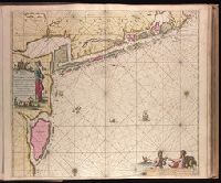
- Found in:
- Beinecke Rare Book and Manuscript Library > Nieuwe paskaart van de kust van Noorwegen [cartographic material] : beginnende van Bommelsondt tot aan de Wtweer Klippen Naauwkeurig opgestelt en van veel fouten verbeetert met Privilegie voor 15 Iaaren.
- Creator:
- Schenk, Peter, 1660-1718 or 1719.
- Published / Created:
- 1708
- Call Number:
- 1973 Folio 18
- Image Count:
- 1
- Resource Type:
- Maps, Atlases & Globes
- Found in:
- Beinecke Rare Book and Manuscript Library > Novissima Regni Scotiae septentrionalis et meridionalis tabula [cartographic material] : divisae in ducatus, comitat., vice-comitat., prov., praefecturas, dominia et insulas / auctore Petro Schenk.
- Creator:
- Schenk, Peter, 1660-1718 or 1719.
- Published / Created:
- ca. 1700?]
- Call Number:
- 1973 Folio 18
- Image Count:
- 1
- Resource Type:
- Maps, Atlases & Globes
- Found in:
- Beinecke Rare Book and Manuscript Library > Novissima et accuratissima regni et insulae Hiberniae delineatio, in qua sunt Lagenia, Ultonia, Connachia, et Momonia Provinciae, divisae in triginta duos comitatus qui et sunt divisi in omnes subiacentes baronnatus [cartographic material] / per Petrus Schenk.
- Creator:
- Schenk, Peter, 1660-1718 or 1719.
- Published / Created:
- anno 1706.
- Call Number:
- 1973 Folio 18
- Image Count:
- 1
- Resource Type:
- Maps, Atlases & Globes
- Found in:
- Beinecke Rare Book and Manuscript Library > Novissima et accuratissima regnorum Hispaniae et Portugalliae tabula [cartographic material] / auctore P. Schenk.
- Creator:
- Schenk, Peter, 1660-1718 or 1719.
- Published / Created:
- 1706
- Call Number:
- 1973 Folio 18
- Image Count:
- 1
- Resource Type:
- Maps, Atlases & Globes
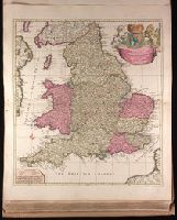
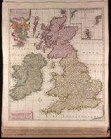
- Found in:
- Beinecke Rare Book and Manuscript Library > Novissima prae caeteris aliis accuratissima regnorum Angliae, Scotiae, Hiberniae [cartographic material] / tabula auctore Petri Schenk.
- Creator:
- Valck, G. (Gerard), 1651 or 1652-1726.
- Published / Created:
- [ca. 1702?]
- Call Number:
- 1973 Folio 18
- Image Count:
- 1
- Resource Type:
- Maps, Atlases & Globes
- Found in:
- Beinecke Rare Book and Manuscript Library > Novissimam hanc tabulam Aquitaniae et Vasconiae, Guascogne et Guienne dictae provincias curosissimae representantem ... [cartographic material] / Gerardus Valk.
- Creator:
- Schenk, Peter, 1660-1718 or 1719.
- Published / Created:
- ca. 1700?]
- Call Number:
- 1973 Folio 18
- Image Count:
- 1
- Resource Type:
- Maps, Atlases & Globes
- Found in:
- Beinecke Rare Book and Manuscript Library > Palatinatus Rheni tabula exquisitissima : cui quoque subjacentes ac finitimae Dominatus, Ditiones atque Satrapias / fideliter inferi curavit Petrus Schenk.
- Creator:
- Keulen, Gerard van.
- Published / Created:
- [ca. 1702?]
- Call Number:
- 1973 Folio 18
- Image Count:
- 2
- Resource Type:
- Maps, Atlases & Globes
- Found in:
- Beinecke Rare Book and Manuscript Library > Pas-kaart vande rivieren Commewini, Suriname, Suramaca, Cupanama en Courantin [cartographic material] : vertoonende alle desselfs plantagie en wie deselve bezitten, alles opt naukeurigste opgestelt.
- Creator:
- Keulen, Johannes van, fl. 1726-1753.
- Published / Created:
- [ca. 1734]
- Call Number:
- 1973 Folio 18
- Image Count:
- 1
- Resource Type:
- Maps, Atlases & Globes
- Found in:
- Beinecke Rare Book and Manuscript Library > Paskaart van de kust van Noorwegen : beginnende van Swarten Os tot aan Heyligelander Leen, Naaukeurigh opgestelt waar in vervaat werd 't Liet van Dronten : met Privilegie voor 15 Iaaren.
- Creator:
- Keulen, Johannes van, 1654-1715.
- Published / Created:
- [ca. 1734]
- Call Number:
- 1973 Folio 18
- Image Count:
- 1
- Resource Type:
- Maps, Atlases & Globes
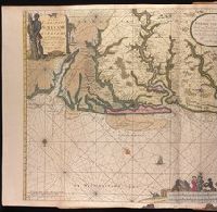
- Found in:
- Beinecke Rare Book and Manuscript Library > Paskaarte vande kuste van Holland en Vriesland, Groeninger, Emder en Keydingerland, Holstyn, Ditmarsche en 't Eydersted [cartographic material] : met de Riviere Eylande Droogte en Diepten die geleege zijn tussen Olant en Egmont op Zee / gelegt en verbeeterd naar Mathurin Guitet ....
- Creator:
- Blaeu, Joan, 1596-1673.
- Published / Created:
- 166-?]
- Call Number:
- 1973 Folio 18
- Image Count:
- 1
- Resource Type:
- Maps, Atlases & Globes
- Found in:
- Beinecke Rare Book and Manuscript Library > Petrocorium comitatus vulgo la comtée de Périgort [cartographic material].
- Creator:
- Beeck, Anna, b. 1678.
- Published / Created:
- [1715]
- Call Number:
- 1973 Folio 18
- Image Count:
- 1
- Resource Type:
- Maps, Atlases & Globes
- Found in:
- Beinecke Rare Book and Manuscript Library > Plan de la Decente dans l'Isle de Rügen par les Hauts Alliez du Nord le 15 de Novembre 1715 [cartographic material] : sous les ordres de Son Altesse Serenisme Monseigneur le Prince d'Anhalt General-Feld-Marechal des Armées de Sa Majestez le Roy de Prüsse, et du retranchement fait à grossen Stresow, la nuit du 15 au 16, et attaquez par le Roy de Suede le 16 à 4 heure du Matin / d'Hautcharmogi.
- Creator:
- Husson, Pieter, 1678-1733.
- Published / Created:
- [1716]
- Call Number:
- 1973 Folio 18
- Image Count:
- 1
- Resource Type:
- Maps, Atlases & Globes
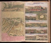
- Found in:
- Beinecke Rare Book and Manuscript Library > Plan de la ville et chateau de Temeswar [cartographic material] : ville capitale dans la haute Hongarie, assiegez l'Armée Imperiale, sous le commandement de S.A.S. Monseigr. le Prince Ugene de Savoye, la tranchée a èté ouverte le 1 Septembe. et la ville est rendue le 13. Octobe. ae. 1716 ... / par Rietquesler, ingenieur et capitaine.
- Creator:
- Allard, Carel, 1648-ca. 1709.
- Published / Created:
- 1696]
- Call Number:
- 1973 Folio 18
- Image Count:
- 1
- Resource Type:
- Maps, Atlases & Globes
- Found in:
- Beinecke Rare Book and Manuscript Library > Planisphaerium terrestre, sive terrarum orbis, planisphaericè constructi repraesentatio quintuplex [cartographic material] : adjunctis aliquibus astronomicae geographiae tyrociniis / auctore Carolo Allard, Amstelo-Batavo = Vlakke aard-kloot, gemeenlyk genaamd de geheele waereld, vysvoudiglyk in vlakke ronden verbeeld : mitsgaders eenige noodige ontwerpen des sterrekundigen aard-beschryvings / door Carel Allard, tot Amsterdam.
- Creator:
- Valck, G. (Gerard), 1651 or 1652-1726.
- Published / Created:
- ca. 1702?]
- Call Number:
- 1973 Folio 18
- Image Count:
- 1
- Resource Type:
- Maps, Atlases & Globes
- Found in:
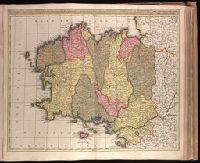
- Beinecke Rare Book and Manuscript Library > Praefectura ducatus Britanniae : quae superior et inferior, subdivisae suos in episcopatus Nannetensem nempe, Redonensem, Sti. Macloviensem, St. Briocensem, Dolanensem, ut et Venetiensem, Trecoriensem, Corisopiensem, Sti. Pauli Leoniensem, omnes subiecti, archiepiscopatui Turonensi aureliorum, queis adjacent porrò in freto Gallo Britannico septem insulae, et ad occidentem in oceano Calonesus, et Uxantus / aliae[que] ex editione Geo. et Leo. Valk, cum privileg.
- Creator:
- Valck, G. (Gerard), 1651 or 1652-1726.
- Published / Created:
- ca. 1702?]
- Call Number:
- 1973 Folio 18
- Image Count:
- 1
- Resource Type:
- Maps, Atlases & Globes
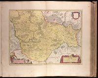
- Found in:
- Beinecke Rare Book and Manuscript Library > Principatus Valachiae, Moldaviae et Transylvaniae [cartographic material] : divisus in singulares populos cum finitimis regionibus, distincte ostenduntur : cum privilegio / per Gerardum et Leonardum Valk , cum privilegio.
- Creator:
- Valck, G. (Gerard), 1651 or 1652-1726.
- Published / Created:
- ca. 1702?]
- Call Number:
- 1973 Folio 18
- Image Count:
- 1
- Resource Type:
- Maps, Atlases & Globes
- Found in:
- Beinecke Rare Book and Manuscript Library > Principauté de Catalogne ou sont compris les comtés de Roussillon et de Cerdagne diviseés en leurs vigueries [cartographic material] / dressé sur les memoires les pl.s nouveaux par G. Valck.
- Creator:
- Schenk, Peter, 1660-1718 or 1719.
- Published / Created:
- ca. 1700?]
- Call Number:
- 1973 Folio 18
- Image Count:
- 1
- Resource Type:
- Maps, Atlases & Globes
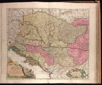
- Found in:
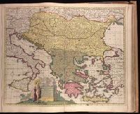
- Beinecke Rare Book and Manuscript Library > Regni Hungariae, Graeciae, Moreae, totius Danubii, adiacentiumque regnorum, nec non totius Graeciae et Archipelagi delineatio nova [cartographic material] / expressa a Petro Schenk.
- Creator:
- Keulen, Gerard van.
- Published / Created:
- 171-?]
- Call Number:
- 1973 Folio 18
- Image Count:
- 1
- Resource Type:
- Maps, Atlases & Globes
- Found in:
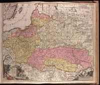
- Beinecke Rare Book and Manuscript Library > Regni Poloniae magnique Ducatus Lithuaniae, Volhyniae, Podoliae, Ucraniae, Prussiae, Livoniae exactissima descriptio [cartographic material] / auctore Ger. van Keulen.
- Creator:
- Schenk, Peter, 1660-1718 or 1719.
- Published / Created:
- 1705
- Call Number:
- 1973 Folio 18
- Image Count:
- 1
- Resource Type:
- Maps, Atlases & Globes
- Found in:
- Beinecke Rare Book and Manuscript Library > Regnorum Hungariae, Dalmatiae, Croatiae, Sclavoniae, Bosniae, Serviae, et Principatus Transylvaniae typus accuratior et plane novus [cartographic material] / editore Petro Schenck caelatur.
- Creator:
- Valck, G. (Gerard), 1651 or 1652-1726.
- Published / Created:
- [ca. 1702?]
- Call Number:
- 1973 Folio 18
- Image Count:
- 1
- Resource Type:
- Maps, Atlases & Globes
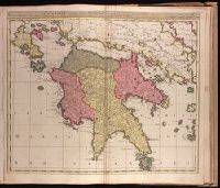
- Found in:
- Beinecke Rare Book and Manuscript Library > Regnum Moreae accuratissime divisum in Provincias Saccaniam, Tzaconiam, Caliscopium et Ducatum Clarensae, una cum Insulis Cephalonia, Zacyntho, Cythera, Aegina et Sidra [cartographic material].
- Creator:
- Schenk, Peter, 1660-1718 or 1719.
- Published / Created:
- 1706?]
- Call Number:
- 1973 Folio 18
- Image Count:
- 1
- Resource Type:
- Maps, Atlases & Globes
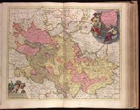
- Found in:
- Beinecke Rare Book and Manuscript Library > S. Imperium Romano-Germanicum oder Teutschland mit seinen angrantzenden Konigreichen und Provincien [cartographic material] / aussgegeben durch Petrus Schenk ; mit Privilegie derer H. H. Staten General des Vereinigten Niederland.
- Creator:
- Schenk, Peter, 1660-1718 or 1719.
- Published / Created:
- 1704
- Call Number:
- 1973 Folio 18
- Image Count:
- 1
- Resource Type:
- Maps, Atlases & Globes
- Found in:
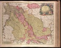
- Beinecke Rare Book and Manuscript Library > Septendecim provinciae Germaniae inferioris [cartographic material] : uti sunt sub potestate regum Franciae, et Hispaniae, ordinumque generalium provinciarum unitarum , una cum episcopatibus Monasteriensi, Coloniensi, Leodiensi, et Cameracensi : XVII provinciae latae sunt 88 et longae 60 miliaria Gallica, atque una complent 4928 miliaria quadrata, in iis inveniuntur 216 urbes et 6000 pagi / P. Schenk exc.
- Creator:
- Valck, G. (Gerard), 1651 or 1652-1726.
- Published / Created:
- after 1705]
- Call Number:
- 1973 Folio 18
- Image Count:
- 1
- Resource Type:
- Maps, Atlases & Globes
- Found in:
- Beinecke Rare Book and Manuscript Library > Status Ecclesiasticus, magnus ducatus Florentiae, et resp. Lucae [cartographic material] : complectens ducatus Urbini, Spoleti, Braciani et Castri. marchion. Anconae, urbis ditiones Romam, patrimonium S. Petri, Orvietum, Florentiam, Pisam et Senam : cum supra et subjacentibus regionibus / fecerunt et ediderunt Gerardus et Leonardus Valk.
- Creator:
- Husson, Pieter, 1678-1733.
- Published / Created:
- [1715]
- Call Number:
- 1973 Folio 18
- Image Count:
- 1
- Resource Type:
- Maps, Atlases & Globes
- Found in:
- Beinecke Rare Book and Manuscript Library > Strahlsundt investi le 15 juillet 1715 [cartographic material] / P.V. Cab, fect.
- Creator:
- Valck, G. (Gerard), 1651 or 1652-1726.
- Published / Created:
- ca. 1702?]
- Call Number:
- 1973 Folio 18
- Image Count:
- 1
- Resource Type:
- Maps, Atlases & Globes
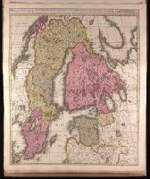
- Found in:
- Beinecke Rare Book and Manuscript Library > Sueciae magnae, totius orbis regni antiquissimi, hodierna in sex principales suas partes : Gothiam nempe, Sueciam propriam sive stricté sumptam, Nordlandiam, Finniam, Ingriam, Livoniam earundemq[ue] subdivisionum, ac adjacentium insularum geographica distinctio / ex optimis auctorum descriptionibus collecta, per Geo. et Leo. Valk.
- Creator:
- Schenk, Peter, 1660-1718 or 1719.
- Published / Created:
- ca. 1700?]
- Call Number:
- 1973 Folio 18
- Image Count:
- 1
- Resource Type:
- Maps, Atlases & Globes
- Found in:
- Beinecke Rare Book and Manuscript Library > Superioris atque inferioris Alsatiae tabula perquam accurata et exacta [cartographic material] : proximis regionibus Iucunde huic insertis, annexisque / ex conatibus P. Schenk.
- Creator:
- Schenk, Peter, 1660-1718 or 1719.
- Published / Created:
- ca. 1700?]
- Call Number:
- 1973 Folio 18
- Image Count:
- 1
- Resource Type:
- Maps, Atlases & Globes
- Found in:
- Beinecke Rare Book and Manuscript Library > Tabula nova atque exacta Westphaliae finitimas quoque ditiones prafecturas et satrapias [cartographic material] / eleganter comprehendens, conante Petro Schenck.
- Creator:
- Blaeu, Joan, 1596-1673, cartographer.
- Published / Created:
- 164-?]
- Call Number:
- 1973 Folio 18
- Image Count:
- 1
- Resource Type:
- Maps, Atlases & Globes
- Found in:
- Beinecke Rare Book and Manuscript Library > Territorio di Cremona [cartographic material].
- Creator:
- Blaeu, Willem Janszoon, 1571-1638.
- Published / Created:
- [ca. 1631]
- Call Number:
- 1973 Folio 18
- Image Count:
- 1
- Resource Type:
- Maps, Atlases & Globes
- Found in:
- Beinecke Rare Book and Manuscript Library > Territorio di Trento [cartographic material].
- Creator:
- Blaeu, Joan, 1596-1673.
- Published / Created:
- 1647?]
- Call Number:
- 1973 Folio 18
- Image Count:
- 1
- Resource Type:
- Maps, Atlases & Globes
- Found in:
- Beinecke Rare Book and Manuscript Library > Territorio di Vicenza [cartographic material].
- Creator:
- Blaeu, Joan, 1596-1673.
- Published / Created:
- ca. 1670]
- Call Number:
- 1973 Folio 18
- Image Count:
- 1
- Resource Type:
- Maps, Atlases & Globes
- Found in:
- Beinecke Rare Book and Manuscript Library > Territorium Basileense, cum adjacentibus [cartographic material].
- Creator:
- Fabert, Abraham de, 1599-1662.
- Published / Created:
- [163-]
- Call Number:
- 1973 Folio 18
- Image Count:
- 1
- Resource Type:
- Maps, Atlases & Globes
- Found in:
- Beinecke Rare Book and Manuscript Library > Territorium Metense [cartographic material] : le Pais Messin / Auctore Ab. Fabert. Consule urbis Metensis.
- Creator:
- Valck, G. (Gerard), 1651 or 1652-1726.
- Published / Created:
- ca. 1702]
- Call Number:
- 1973 Folio 18
- Image Count:
- 1
- Resource Type:
- Maps, Atlases & Globes
- Found in:
- Beinecke Rare Book and Manuscript Library > Treverensis regio archiepiscopatus electoratusque titulo insignus : quae per suas divisa praefecturas comitatum Manderscheit complectitur / pro ut edidit Gerardus Valk.
- Creator:
- Beauplan, Guillaume Le Vasseur, sieur de, approximately 1600- cartographer.
- Published / Created:
- 166-?]
- Call Number:
- 1973 Folio 18
- Image Count:
- 1
- Resource Type:
- Maps, Atlases & Globes
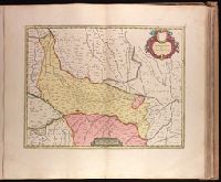
- Found in:
- Beinecke Rare Book and Manuscript Library > Ukrainae pars, quae Podolia Palatinatus vulgo dicitur / per Guil. le Vasseur de Beauplan.
- Published / Created:
- ca. 163--1734]
- Call Number:
- 1973 Folio 18
- Image Count:
- 10
- Resource Type:
- Maps, Atlases & Globes
- Found in:
- Beinecke Rare Book and Manuscript Library > [Composite atlas of the world].
- Creator:
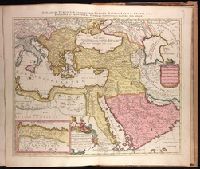
- Sanson, Nicolas, 1600-1667, cartographer.
- Published / Created:
- ca. 1702?]
- Call Number:
- 1973 Folio 18
- Image Count:
- 1
- Resource Type:
- Maps, Atlases & Globes
- Found in:
- Beinecke Rare Book and Manuscript Library > [Est]ats de L'Empire du Grand Seigneur des Turcs Europe, en Asie, et en Afrique [cartographic material] : divise en tous ses Beglerbeglicz ou Gouvernements ou sont aussi remarques les Estats qui luy sont Tributaires dresse sur les plus nouvelles relations / par le Sr. Sanson ...