Skip to search
Skip to main content
Skip to first result
Search
You Searched For
Language
Latin
Publication Place
Norimbergae
Call Number
1973 Folio 30
Search Results
Creator:
Published / Created:
1715?
Call Number:
1973 Folio 30
Collection Title:
[Atlas factice of 32 maps and 1 distance table, produced by the Homann Erben firm]
Image Count:
2
Publisher:
[Johann Baptist Homann]
Subject (Geographic):
Saxony (Germany) --Maps --Early works to 1800
Subject (Topic):
Atlases, German --Early works to 1800
Collection Created:
[Nuremberg : s.n., 1701-1760]
Found in:
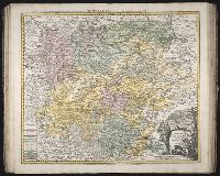
Beinecke Rare Book and Manuscript Library > Circulus Saxoniae inferioris in omnes suos status et principatus / [cartographic material] / accurate divisus ex conatibus Io. Bapt. Homanni
Creator:
Published / Created:
a. 1760
Call Number:
1973 Folio 30
Collection Title:
[Atlas factice of 32 maps and 1 distance table, produced by the Homann Erben firm]
Image Count:
2
Alternative Title:
Comitatus Schoenburgensis
Publisher:
Edentibus Homannianis Heredibus
Subject (Geographic):
Zwickau (Germany : Landkreis) --Maps --Early works to 1800
Subject (Topic):
Atlases, German --Early works to 1800
Collection Created:
[Nuremberg : s.n.,
Found in:
Beinecke Rare Book and Manuscript Library > Comitatvs Schoenburgensis [cartographic material] : in quo celsissimorum comitum de Schoenburg regiones ad circulum Saxoniae superiorem Imperii Romano-Germanici pertinentes et in Marchionatu Misniae sitae, subfeuda porro Bohemico-Imperialia, nempe Dynasti
Creator:
Published / Created:
1720?
Call Number:
1973 Folio 30
Collection Title:
[Atlas factice of 32 maps and 1 distance table, produced by the Homann Erben firm]
Image Count:
2
Publisher:
Johann Baptist Homann
Subject (Geographic):
Balkan Peninsula --Maps --Early works to 1800
Subject (Topic):
Atlases, German --Early works to 1800
Collection Created:
[Nuremberg : s.n., 1701-1760]
Found in:
Beinecke Rare Book and Manuscript Library > Fluviorum in Europa principis Danubii [cartographic material] : cum adiacentibus regnis nec non totius Graeciae et archipelagi novissima tabula / authore Joh. Baptista Homanno
Creator:
Published / Created:
a. 1751
Call Number:
1973 Folio 30
Collection Title:
[Atlas factice of 32 maps and 1 distance table, produced by the Homann Erben firm]
Image Count:
2
Alternative Title:
Helvetia tredecim statibus liberis, quos cantones vocant composita and Suisse, divisee en ses treze cantons, ses alliez et ses sujets
Publisher:
Luci publicae tradita ab Homannianis Heredibus
Subject (Geographic):
Switzerland --Maps --Early works to 1800
Subject (Topic):
Atlases, German --Early works to 1800
Collection Created:
[Nuremberg : s.n., 1701-1760]
Found in:
Beinecke Rare Book and Manuscript Library > Helvetia tredecim statibvs liberis, qvos cantones vocant composita [cartographic material] : una cum foederatis & subjectis provinciis, ex probatissimis subsidiis / geographice delineata per Dm. Tobiam Mayerum, Professorem Matth., Goettingensem
Creator:
Published / Created:
[1746?]
Call Number:
1973 Folio 30
Collection Title:
[Atlas factice of 32 maps and 1 distance table, produced by the Homann Erben firm]
Image Count:
2
Alternative Title:
Allemagne distinguee en ses cercles & subdivisee en ses etats, contenant son etendue presente rectifiee & methodiquement enluminee suivant les elements de geographie de Mr. Schatz and Imperii Romano Germanici in suos status et circulos divisi tabula generalis
Publisher:
[Homann Erben?]
Subject (Geographic):
Austria --Maps --Early works to 1800, Czechoslovakia --Maps --Early works to 1800, Germany --Maps --Early works to 1800, Hungary --Maps --Early works to 1800, and Poland --Maps --Early works to 1800
Subject (Topic):
Atlases, German --Early works to 1800
Collection Created:
[Nuremberg : s.n.,
Found in:
Beinecke Rare Book and Manuscript Library > Imperii Romano Germanici in svos statvs et circvlos divisi tabvla generalis in ufus iuventutis erundiendae accommodata / [cartographic material] / a Ioh Bapt Homanno, S.C.M. Geographo, Reg. Boruss. Societ. Scient. Sodali
Creator:
Published / Created:
[1738]
Call Number:
1973 Folio 30
Collection Title:
[Atlas factice of 32 maps and 1 distance table, produced by the Homann Erben firm]
Image Count:
2
Alternative Title:
Multis in locis augmentata longeque priori editione correctior facta haec Thuringiae tabula A.D. 1729 per Ioh. Christ. Homannum, M.D
Publisher:
Curantibus Homannianis Herdeibus ...
Subject (Geographic):
Thuringia (Germany) --Maps --Early works to 1800
Subject (Topic):
Atlases, German --Early works to 1800
Collection Created:
[Nuremberg : s.n., 1701-1760]
Found in:
Beinecke Rare Book and Manuscript Library > Landgraviat Thuringiae tabula generalis in suos principatus et status accurate divi / [cartographic material] / per Ioh. Bapt. Homa[nn]
Creator:
Published / Created:
1750
Call Number:
1973 Folio 30
Collection Title:
[Atlas factice of 32 maps and 1 distance table, produced by the Homann Erben firm]
Image Count:
2
Alternative Title:
Carte des etats de la Covronne de Pologne
Publisher:
Luci publicae tradita per Homannianos Heredes
Subject (Geographic):
Belarus --Maps --Early works to 1800, Lithuania --Maps --Early works to 1800, Poland --Maps --Early works to 1800, and Ukraine --Maps --Early works to 1800
Subject (Topic):
Atlases, German --Early works to 1800
Collection Created:
[Nuremberg : s.n.,
Found in:
Beinecke Rare Book and Manuscript Library > Mappa geographica Regni Poloniae [cartographic material] : ex novissimis quotquot sunt mappis specialibus composita et ad L.L. stereographicae projectionis / revocata a Tob. Mayero, S.C.S.
Creator:
Published / Created:
1749
Call Number:
1973 Folio 30
Collection Title:
[Atlas factice of 32 maps and 1 distance table, produced by the Homann Erben firm]
Image Count:
1
Alternative Title:
General map of Great Britain and Ireland with part of Holland Flandres France &c. agreable to modern history by the heirs of late Mr. Homann at Nueremburg 1749, priviledged by Emperours Majesty
Publisher:
Edentibg. Homan[n]ianis heredibus
Subject (Geographic):
Great Britain --Maps --Early works to 1800 and Ireland --Maps --Early works to 1800
Subject (Topic):
Atlases, German --Early works to 1800
Collection Created:
[Nuremberg : s.n., 1701-1760]
Found in:
Beinecke Rare Book and Manuscript Library > Regnorum Magnae Britanniae et Hiberniae mappa geographica : iuxta observationes astronomicas recentiores denuo correcta et ad formam legitimae projectionis reducta a Tobia Majero
Creator:
Published / Created:
between 1701 and 1709?
Call Number:
1973 Folio 30
Collection Title:
[Atlas factice of 32 maps and 1 distance table, produced by the Homann Erben firm]
Image Count:
2
Publisher:
[Johann Baptist Homann]
Subject (Geographic):
Prussia (Germany) --Maps --Early works to 1800 and Prussia, east (Poland and Russia) --Maps --Early works to 1800
Subject (Topic):
Atlases, German --Early works to 1800
Collection Created:
[Nuremberg : s.n., 1701-1760]
Found in:
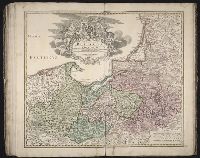
Beinecke Rare Book and Manuscript Library > Regnum Borussiae [cartographic material] : gloriosis auspicys serenissimi et potentissimi Prin. Friderici III. Primi Borussiae Regis, March. et Elect. Bran. inauguratum die 18. Ian. a. 1701 / geographice cum vicinis regionibus adumbratum a Ioh. Baptista H
Branch:v1.68.7 ,Deployed:2025-07-09T09:08:05-04:00