Search
You Searched For
Search Results
- Creator:
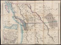
- Wyld, James, 1812-1887
- Published / Created:
- July 16th, 1858.
- Call Number:
- 739 1858
- Container / Volume:
- BRBL_00388
- Image Count:
- 2
- Resource Type:
- Maps, Atlases & Globes
- Description:
- Cut and mounted on linen; "Wyld's new maps" advertisement on verso.
- Publisher:
- James Wyld,
- Subject (Geographic):
- British Columbia--Maps and Canada--Boundaries--United States--Maps
- Subject (Topic):
- Coal mines and mining--North America, Western--Maps, Gold mines and mining--British Columbia--Maps, and Indians--North America, Western--Maps
- Found in:
- Beinecke Rare Book and Manuscript Library > Map of the colony of New Caledonia and the British & American territory west of the Rocky mountains including Vancouvers Island and the gold fields [cartographic material] / by James Wyld, geographer to the Queen & the Prince Consort, Charing Cross East,