Skip to search
Skip to main content
Skip to first result
Search
You Searched For
Extent of Digitization
Completely digitized
Resource Type
Maps, Atlases & Globes
Language
English
Subject (Name)
Eldridge, George W
Call Number
754cea B98 1880
New Search
Search Results
Published / Created:
1880
Call Number:
754cea B98 1880
Container / Volume:
BRBL_00418
Image Count:
2
Resource Type:
Maps, Atlases & Globes
Alternative Title:
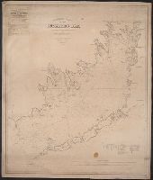
Buzzards Bay and Chart no. 10 Buzzard's Bay
Description:
Depths shown by soundings. Distance shown, Includes abbreviations of types of bottoms, references, and tides., Mounted on linen. Includes adv. for "American Ship Windlass Company, Providence, R.I.", and Shows lighthouses, bouys, ferries, and some coastal towns.
Publisher:
S. Thaxter & Son,
Subject (Geographic):
Buzzards Bay (Mass.)--Maps
Subject (Name):
Eldridge, George W
Subject (Topic):
Nautical charts--Massachusetts--Buzzards Bay
Found in:
Beinecke Rare Book and Manuscript Library > Eldridge's chart no. 10 : Buzzard's Bay, from the United States Coast and George Eldridge's surveys / published by Thaxter & Son. 125 State St. Boston, 1880.
Branch:v1.61.8 ,Deployed:2024-06-20T11:14:46-04:00