Skip to search
Skip to main content
Skip to first result
Search
You Searched For
Genre
Maps
Language
Latin
Publication Place
[Amsterdam] :
New Search
Search Results
Creator:
Published / Created:
[1688?]
Call Number:
BrSides Double Folio 2018 10
Image Count:
1
Resource Type:
Maps, Atlases & Globes
Found in:
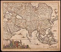
Beinecke Rare Book and Manuscript Library > Accuratissima totius Asiae tabula [cartographic material] : in omnes partes divisa, de nova correcta, ac in lucem edita / per Fredericum de Witt Amstelodami cum privilegio D.D. ordinum Hollandiae Westristacq[ue] ; F. de Wit excudit.
Creator:
Published / Created:
[approximately 1700?]
Call Number:
BrSides Double Folio 2019 68
Image Count:
1
Resource Type:
Maps, Atlases & Globes
Found in:
Beinecke Rare Book and Manuscript Library > Achaiae nova & accurata descriptio / autore I. Laurenbergio.
Creator:
Published / Created:
[170-?]
Call Number:
70 170X
Container / Volume:
BRBL_00686
Image Count:
1
Resource Type:
Maps, Atlases & Globes
Found in:
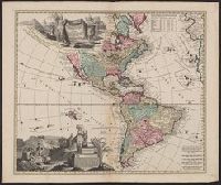
Beinecke Rare Book and Manuscript Library > Americae tam septentrionalis quam meridionalis in mappa geographica delineatio ... / opera A.F. Zürneri ...
Creator:
Published / Created:
[approximately 1700]
Call Number:
BrSides Double Folio 2019 63
Image Count:
1
Resource Type:
Maps, Atlases & Globes
Found in:
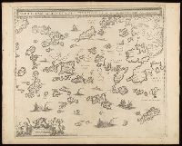
Beinecke Rare Book and Manuscript Library > Archipelagi meridionalis, seu Cycladum Insularum accurata delineatio / autore I. Laurenbergio.
Creator:
Published / Created:
[between 1652 and 1684]
Call Number:
BrSides Double Folio 2019 56
Image Count:
1
Resource Type:
Maps, Atlases & Globes
Found in:
Beinecke Rare Book and Manuscript Library > Argonavtica / Petrus Kaerius caelavit aetatis suae 74.
Creator:
Published / Created:
[1662?]
Call Number:
3945 1662
Container / Volume:
BRBL_00193
Image Count:
2
Resource Type:
Maps, Atlases & Globes
Found in:
Beinecke Rare Book and Manuscript Library > Arragonia regnum / auctore Joanne Baptista Labanna.
Creator:
Published / Created:
[1640?]
Call Number:
3945 1640
Container / Volume:
BRBL_00193
Image Count:
2
Resource Type:
Maps, Atlases & Globes
Found in:
Beinecke Rare Book and Manuscript Library > Arragonia regnum / auctore Joanne Baptista Labanna.
Creator:
Published / Created:
[1638]
Call Number:
90 1638
Container / Volume:
BRBL_00661
Image Count:
1
Resource Type:
Maps, Atlases & Globes
Found in:
Beinecke Rare Book and Manuscript Library > Delineatio omnium orarum totius Australis partis Americae ... / Arnoldus Florentius à Langren, author & sculptor.
Creator:
Published / Created:
[between 1680 and 1700]
Call Number:
BrSides Double Folio 2019 54
Image Count:
1
Resource Type:
Maps, Atlases & Globes
Found in:
Beinecke Rare Book and Manuscript Library > Epirus, hodie vulgò Albania / autore I. Laurenbergio.
Creator:
Published / Created:
[1629]
Call Number:
966 1730
Container / Volume:
BRBL_00699
Image Count:
1
Resource Type:
Maps, Atlases & Globes
Found in:
Beinecke Rare Book and Manuscript Library > Freti Magellanici ac novi freti vulgo le Maire exactissima delineatio / [cartographic material] / D Grÿp, sculp.
Creator:
Published / Created:
[1635]
Call Number:
966 1625
Container / Volume:
BRBL_00699
Image Count:
2
Resource Type:
Maps, Atlases & Globes
Found in:
Beinecke Rare Book and Manuscript Library > Freti Magellanici ac novi freti vulgo le Maire exactissima delineatio : = Afbeelding der Straet Magellanes : so als de selve van Mr. Barent Iansz : potgeieter van Munster door en weder door bevaren en met syn Capiteyn Sebald de Waerd met groot pericul syn
Creator:
Published / Created:
[between 1652 and 1684]
Call Number:
BrSides Double Folio 2019 55
Image Count:
1
Resource Type:
Maps, Atlases & Globes
Found in:
Beinecke Rare Book and Manuscript Library > Hellas, seu Graecia sophiani.
Creator:
Published / Created:
[1680?]
Call Number:
BrSides Double Folio 2019 53
Image Count:
1
Resource Type:
Maps, Atlases & Globes
Found in:
Beinecke Rare Book and Manuscript Library > Hellas, seu Graecia universa / auctore I. Laurenbergio ; F. de Wit excudit.
Creator:
Published / Created:
[1680?]
Call Number:
4894 1680
Container / Volume:
BRBL_00267
Image Count:
1
Resource Type:
Maps, Atlases & Globes
Found in:
Beinecke Rare Book and Manuscript Library > Insula Candia [cartographic material] : eiusque fortificatio / edita per F. de wit.
Creator:
Published / Created:
[1680?]
Call Number:
408 1680
Container / Volume:
BRBL_00238
Image Count:
1
Resource Type:
Maps, Atlases & Globes
Found in:
Beinecke Rare Book and Manuscript Library > Insula sive regnum Siciliae / urbibus praecipuis exornatum et novissime editum per F. de Wit.
Creator:
Published / Created:
[ca. 1720]
Call Number:
85 1710
Container / Volume:
BRBL_00692
Image Count:
1
Resource Type:
Maps, Atlases & Globes
Found in:
Beinecke Rare Book and Manuscript Library > Insulae Americanae in Oceano Septentrionali ac regiones adiacentes : a C. de May usque ad Lineam Aequinoctialem / per Nicolaum Visscher.
Creator:
Published / Created:
[approximately 1700?]
Call Number:
BrSides Double Folio 2019 72
Image Count:
1
Resource Type:
Maps, Atlases & Globes
Found in:
Beinecke Rare Book and Manuscript Library > Insularum archipelagi septentrionalis seu Maris Aegaei accurata delineatio / autore I. Laurenbergio.
Creator:
Published / Created:
[between 1652 and 1684]
Call Number:
BrSides Double Folio 2019 62
Image Count:
1
Resource Type:
Maps, Atlases & Globes
Found in:
Beinecke Rare Book and Manuscript Library > Italia Gallica, sive, Gallia Cisalpina / ex conatibus geographicis Abrah. Ortelij.
Creator:
Published / Created:
[1635]
Call Number:
46 1630
Container / Volume:
BRBL_00259
Image Count:
2
Resource Type:
Maps, Atlases & Globes
Found in:
Beinecke Rare Book and Manuscript Library > Karstia, Carniola, Histria et Windorum marchia / Ger. Mercatore auctore.
Creator:
Published / Created:
[approximately 1700]
Call Number:
BrSides Double Folio 2019 52
Image Count:
1
Resource Type:
Maps, Atlases & Globes
Found in:
Beinecke Rare Book and Manuscript Library > Macedonia Alexandri M. patria illustris / autore I. Laurenbergio.
Creator:
Published / Created:
[1700?]
Call Number:
35 1700
Container / Volume:
BRBL_00100
Image Count:
1
Resource Type:
Maps, Atlases & Globes
Found in:
Beinecke Rare Book and Manuscript Library > Magnae Tartariae: magni Mogolis imperii, Japoniae et Chinae, nova descriptio.
Published / Created:
[1635?]
Call Number:
335 N15 1635
Container / Volume:
BRBL_00087
Image Count:
2
Resource Type:
Maps, Atlases & Globes
Found in:
Beinecke Rare Book and Manuscript Library > Namurcum comitatus / auctore Iohann Surhonio.
Creator:
Published / Created:
[between 1652 and 1684]
Call Number:
BrSides Double Folio 2019 60
Image Count:
1
Resource Type:
Maps, Atlases & Globes
Found in:
Beinecke Rare Book and Manuscript Library > Nova & accurata Tvsciae antiqvae descriptio / auctore Ab. Ortelio ; Petrus Kaerius caelavit.
Creator:
Published / Created:
[1630]
Call Number:
783 1630
Container / Volume:
BRBL_00507
Image Count:
1
Resource Type:
Maps, Atlases & Globes
Found in:
Beinecke Rare Book and Manuscript Library > Nova Virginiae tabula / DGrijp sculpt.
Creator:
Published / Created:
[1635]
Call Number:
783 1630
Container / Volume:
BRBL_00691
Image Count:
2
Resource Type:
Maps, Atlases & Globes
Found in:
Beinecke Rare Book and Manuscript Library > Nova Virginiae tabula / DGrijp sculpt.
Creator:
Published / Created:
[1635]
Call Number:
783 1630A
Container / Volume:
BRBL_00691
Image Count:
2
Resource Type:
Maps, Atlases & Globes
Found in:
Beinecke Rare Book and Manuscript Library > Nova Virginiae tabula / DGrijp sculpt.
Published / Created:
[1658?]
Call Number:
57 1658
Container / Volume:
BRBL_00301
Image Count:
2
Resource Type:
Maps, Atlases & Globes
Found in:
Beinecke Rare Book and Manuscript Library > Nova et Accurata Japoniae, Terrae Esonis, ac Insularem Adjacentium ex Novissimâ detectione descriptio.
Creator:
Published / Created:
[ca. 1720]
Call Number:
911 1708
Container / Volume:
BRBL_00699
Image Count:
1
Resource Type:
Maps, Atlases & Globes
Found in:
Beinecke Rare Book and Manuscript Library > Nova et accurata Brasiliae totius tabula / auctore Ioanne Blaeu I.F.
Creator:
Published / Created:
[approximately 1700?]
Call Number:
BrSides Double Folio 2019 71
Image Count:
1
Resource Type:
Maps, Atlases & Globes
Found in:
Beinecke Rare Book and Manuscript Library > Peloponnesus sive Morea / auth. J. Laurenbergio.
Published / Created:
[1639]
Call Number:
19 1639
Container / Volume:
BRBL_00013
Image Count:
2
Resource Type:
Maps, Atlases & Globes
Found in:
Beinecke Rare Book and Manuscript Library > Polus Antarcticus.
Creator:
Published / Created:
[1652?]
Call Number:
BrSides Double Folio 2019 66
Image Count:
1
Resource Type:
Maps, Atlases & Globes
Found in:
Beinecke Rare Book and Manuscript Library > Pontos Euxeinos = Pontus Euxinus : æquor Iasonio pulsatum remige primum / ex conatibus Abrahami Ortelii ; Petrus Kaerius caelavit.
Published / Created:
[1635?]
Call Number:
3334 1635
Container / Volume:
BRBL_00084
Image Count:
2
Resource Type:
Maps, Atlases & Globes
Found in:
Beinecke Rare Book and Manuscript Library > Quarta pars Brabantiæ cujus caput Sylvaducis ...
Published / Created:
[1650?]
Call Number:
408 1650
Container / Volume:
BRBL_00238
Image Count:
2
Resource Type:
Maps, Atlases & Globes
Found in:
Beinecke Rare Book and Manuscript Library > Sicilia regnum.
Published / Created:
[1650?]
Call Number:
408 1650
Container / Volume:
BRBL_00238
Image Count:
1
Resource Type:
Maps, Atlases & Globes
Found in:
Beinecke Rare Book and Manuscript Library > Sicilia regnum.
Published / Created:
[1635?]
Call Number:
3334 B453 1635
Container / Volume:
BRBL_00084
Image Count:
2
Resource Type:
Maps, Atlases & Globes
Found in:
Beinecke Rare Book and Manuscript Library > Tabula Bergarum ad Zomam Slenbergæ et novorum ibi operum.
Published / Created:
[1635]
Call Number:
966 1635
Container / Volume:
BRBL_00676
Image Count:
1
Resource Type:
Maps, Atlases & Globes
Found in:
Beinecke Rare Book and Manuscript Library > Tabula Magellanico, qua Tierrae del fuego, cum celerrimis fretis a F. Magellano et L. Le Maire detectis novissima et accuratissimo descriptio exhibetur.
Creator:
Published / Created:
[ca. 1680?]
Call Number:
51 1680
Container / Volume:
BRBL_00278
Image Count:
1
Resource Type:
Maps, Atlases & Globes
Found in:
Beinecke Rare Book and Manuscript Library > Terra Sancta, sive Promissionis, olim Palestina / recens delineata, et in lucem edita per Fredericum de Wit.
Creator:
Published / Created:
[approximately 1700?]
Call Number:
BrSides Double Folio 2019 67
Image Count:
1
Resource Type:
Maps, Atlases & Globes
Found in:
Beinecke Rare Book and Manuscript Library > Thessaliae accurata descriptio / autore I. Laurenbergio.
Creator:
Published / Created:
[between 1652 and 1684]
Call Number:
BrSides Double Folio 2019 57
Image Count:
1
Resource Type:
Maps, Atlases & Globes
Found in:
Beinecke Rare Book and Manuscript Library > Thrakē = Thraciae veteris typus / ex conatibus geographicis Abrah. Ortelij. ; Petrus Kaerius caelavit.
Published / Created:
[ca. 1652]
Call Number:
380 1652
Container / Volume:
BRBL_00173
Image Count:
1
Resource Type:
Maps, Atlases & Globes
Found in:
Beinecke Rare Book and Manuscript Library > Typus Galliae veteris [cartographic material] : ex conatib[us] geograph[icis] Abrah[ami] Ortelii.
Creator:
Published / Created:
[1635]
Call Number:
3326 1635
Container / Volume:
BRBL_00082
Image Count:
2
Resource Type:
Maps, Atlases & Globes
Found in:
Beinecke Rare Book and Manuscript Library > Ultraiectum dominium.
Creator:
Published / Created:
[ca. 1645]
Call Number:
331 1700
Container / Volume:
BRBL_00078
Image Count:
2
Resource Type:
Maps, Atlases & Globes
Found in:
Beinecke Rare Book and Manuscript Library > Ultraiectum dominium.
Creator:
Published / Created:
[between 1652 and 1684]
Call Number:
BrSides Double Folio 2019 59
Image Count:
1
Resource Type:
Maps, Atlases & Globes
Found in:
Beinecke Rare Book and Manuscript Library > Veteris Pannoniae utriusque, nec non Illyrici descriptio geographica.
Creator:
Published / Created:
[between 1652 and 1684]
Call Number:
BrSides Double Folio 2019 58
Image Count:
1
Resource Type:
Maps, Atlases & Globes
Found in:
Beinecke Rare Book and Manuscript Library > Vetvs descriptio Daciarum nec non Moesiarvm : vrbes incognitae positionis huc referendae sunt / Petrus Kaerius caelavit.
Published / Created:
[1635?]
Call Number:
3333 1635A
Container / Volume:
BRBL_00084
Image Count:
2
Resource Type:
Maps, Atlases & Globes
Found in:
Beinecke Rare Book and Manuscript Library > Zelandiae pars transscaldina vulgo Beooster-Scheld.
Branch:v1.60.98 ,Deployed:2024-05-01T09:16:02-04:00