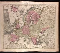
"Cum privilegio Amsteld. et Regis Poloniae .", Backed with paper. Ms. no. "3" in upper right-hand corner. Sheet measures 53.4 x 62.0 cm. No. 2 of 87 maps bound together., Includes two insets showing the path of the solar eclipse of May 12, 1706., Prime meridian: Ferro., and Relief shown pictorially.
Publisher:
Á Petro Schenk,
Subject (Geographic):
Europe--Maps--Early works to 1800.
Subject (Name):
Moolen, Simon van de. and Schenk, Peter, 1660-1718 or 1719.