Search
You Searched For
Search Results
- Published / Created:
- [1635?]
- Call Number:
- 3334 B453 1635
- Container / Volume:
- BRBL_00084
- Image Count:
- 2
- Resource Type:
- Maps, Atlases & Globes
- Found in:
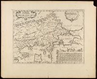
- Beinecke Rare Book and Manuscript Library > Tabula Bergarum ad Zomam Slenbergæ et novorum ibi operum.
- Published / Created:
- [1635]
- Call Number:
- 966 1635
- Container / Volume:
- BRBL_00676
- Image Count:
- 1
- Resource Type:
- Maps, Atlases & Globes
- Found in:
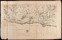
- Beinecke Rare Book and Manuscript Library > Tabula Magellanico, qua Tierrae del fuego, cum celerrimis fretis a F. Magellano et L. Le Maire detectis novissima et accuratissimo descriptio exhibetur.
- Creator:
- Duval, P. (Pierre), 1619-1682, cartographer.
- Published / Created:
- [between 1652 and 1684]
- Call Number:
- BrSides Double Folio 2019 98
- Image Count:
- 1
- Resource Type:
- Maps, Atlases & Globes
- Found in:
- Beinecke Rare Book and Manuscript Library > Tabula itineris decies mille Graecorum sub Cyro contra fratrem suum Artaxerxem Regem Persarum : eorumque reditus sub Xenophonte secundum ipsium Xenophontis commentaria / per P. du Val, Abbevillensem Geographum Regium.
- Creator:
- Blaeu, Willem Janszoon, 1571-1638, cartographer.
- Published / Created:
- [between 1643 and 1650]
- Call Number:
- BrSides Folio 2017 7
- Image Count:
- 2
- Resource Type:
- Maps, Atlases & Globes
- Found in:
- Beinecke Rare Book and Manuscript Library > Tartaria sive Magni Chami imperium.
- Creator:
- Wit, Frederik de
- Published / Created:
- [ca. 1680?]
- Call Number:
- 51 1680
- Container / Volume:
- BRBL_00278
- Image Count:
- 1
- Resource Type:
- Maps, Atlases & Globes
- Found in:
- Beinecke Rare Book and Manuscript Library > Terra Sancta, sive Promissionis, olim Palestina / recens delineata, et in lucem edita per Fredericum de Wit.
- Creator:
- Lauremberg, Johann, 1590-1658
- Published / Created:
- [approximately 1700?]
- Call Number:
- BrSides Double Folio 2019 67
- Image Count:
- 1
- Resource Type:
- Maps, Atlases & Globes
- Found in:
- Beinecke Rare Book and Manuscript Library > Thessaliae accurata descriptio / autore I. Laurenbergio.
- Creator:
- Keere, Pieter van den, 1571-approximately 1646
- Published / Created:
- [between 1652 and 1684]
- Call Number:
- BrSides Double Folio 2019 57
- Image Count:
- 1
- Resource Type:
- Maps, Atlases & Globes
- Found in:
- Beinecke Rare Book and Manuscript Library > Thrakē = Thraciae veteris typus / ex conatibus geographicis Abrah. Ortelij. ; Petrus Kaerius caelavit.
- Creator:
- Wit, Frederik de
- Published / Created:
- [1688?]
- Call Number:
- BrSides Double Folio 2019 114
- Image Count:
- 1
- Resource Type:
- Maps, Atlases & Globes
- Found in:
- Beinecke Rare Book and Manuscript Library > Totius Africae accuratissima tabula [cartographic material] : denuo correcte revisa multis locis aucta, in partes tam maiores quam minores divisa / per F. de Witt.
- Creator:
- Jansson, Jan, 1588-1664, cartographer, publisher.
- Published / Created:
- [between 1652 and 1684]
- Call Number:
- BrSides Double Folio 2019 100
- Image Count:
- 1
- Resource Type:
- Maps, Atlases & Globes
- Found in:
- Beinecke Rare Book and Manuscript Library > Tribus Aser, et partes occidentales tribuum Zabulon et Isachar.
- Creator:
- Jansson, Jan, 1588-1664, cartographer, publisher.
- Published / Created:
- [between 1652 and 1684]
- Call Number:
- BrSides Double Folio 2019 100
- Image Count:
- 1
- Resource Type:
- Maps, Atlases & Globes
- Found in:
- Beinecke Rare Book and Manuscript Library > Tribuum Ephraim, Beniamin, et Dimidiae, Manasse intra Iordanem partes occidentales, et partes septentrionales Dan et Juda.