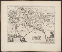
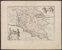
From: Nieuwen atlas ... Amstelodami : Apud Ioannem Ianssonium, [1662?]., Relief shown pictorially., Sheet measures 50 x 60 cm., and Verso: Text in Latin, with signature 3Q.
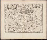
Atlas novus. and Gallia vetus ad Julij Caesaris commentaria
Description:
Latin text on recto; Dutch text on verso., Lower left corner: "Amstelodami apud Ioannem Ianβonium.", Published in Dutch editions of Jansson's Atlas novus (Dutch title: Nieuwen atlas, ofte vveerelts-beschrijvinge), vol. 6, ca. 1662, and Relief shown pictorially.
Publisher:
Jan Jansson,
Subject (Geographic):
France--History--To 987--Maps--Early works to 1800 and Gaul--Maps--Early works to 1800
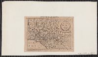
Based on John Smith's map of Virginia., From Gerardus Mercator's Altas minor (French ed.) ... A Amsterdam : Chez Iean Iansson, 1630., Map in Latin, with pagination "631." Text on verso in French., Mounted on paper. Sheet measures 14.5 x 20.3 cm. Cross Collection no. 209., Oriented with north towards the right., and Relief shown pictorially.
Publisher:
Jan Jansson,
Subject (Geographic):
Virginia--Maps--Early works to 1800
Subject (Name):
Keere, Pieter van den, 1571-ca. 1646, Mercator, Gerhard, 1512-1594. Atlas minor. French, and Smith, John, 1580-1631
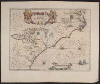
Appears in various, Hand col. Sheet measures 50 x 60.9 cm., Latin text on recto; Dutch text on verso., Prime meridian Ferro., Relief shown pictorially., and Verso in Dutch, with running and caption title "Florida," signature 2E and catchword "rivieren".
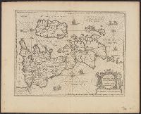
Cross Collection no. 60., From Janssonius's Niewen atlas ... Amstelodami : Apud Ioannem Ianssonium, 1652., Hand col. Mounted on linen., Includes marginal ill., Relief shown pictorially., Title supplied by cataloger., and Variant of Hondius' Polus Antarcticus, 1638.
Publisher:
J. Jansson,
Subject (Geographic):
Antarctica--Maps--Early works to 1800 and Southern Hemisphere--Maps--Early works to 1800