Skip to search
Skip to main content
Skip to first result
Search
You Searched For
Date
-
"Austria--Maps"
Genre
Maps.
Publication Place
[Amsterdam :
New Search
Search Results
Creator:
Published / Created:
ca. 1700?]
Call Number:
1973 Folio 18
Image Count:
1
Resource Type:
Maps, Atlases & Globes
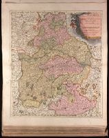
Description:
Backed with paper. Ms. no. "27" in upper right-hand corner. Sheet measures 52.7 x 53.7 cm. No. 27 of 87 maps bound together., Bar scales given in "milliaria Germanica" and "mill. Gallica"., Prime meridian: Ferro., and Relief shown pictorially.
Publisher:
Peter Schenk,
Subject (Geographic):
Austria --Maps --Early works to 1800.
Found in:
Beinecke Rare Book and Manuscript Library > Imperii circulus Bavaria titulô Electoratus insignis [cartographic material] : ea pro ut in ducatum, ac palatinatum, aliosque eorundem status hîc politicè divisa / denuò nunc exhibetur â Petro Schenk, cum privilegio.
Branch:v1.61.8 ,Deployed:2024-06-20T11:14:48-04:00