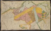
2nd copy positive photostat., Inset: Map of part of Ste. Marie river, from actual survey, scale 8 mi. to an inch, ca. 1:500,000., and Maj. Long's route, Schoolcraft's route, Lewis and Clark's route. Relief by modified hachures. North shown by fleur-de-lis, slig
2nd copy positive photostat., Inset: Map of part of Ste. Marie river, from actual survey, scale 8 mi. to an inch, ca. 1:500,000., and Maj. Long's route, Schoolcraft's route, Lewis and Clark's route. Relief by modified hachures. North shown by fleur-de-lis, slig