Search
You Searched For
Search Results
- Published / Created:
- 1882]
- Call Number:
- 61AM SU27 1882
- Container / Volume:
- BRBL_00331
- Image Count:
- 1
- Resource Type:
- Maps, Atlases & Globes
- Found in:
- Beinecke Rare Book and Manuscript Library > A birds eye view of the Suez Canal / Maclure & MacDonald, Lithrs. to the Queen, London.
- Published / Created:
- 1810?]
- Call Number:
- 75 1810A
- Container / Volume:
- BRBL_00396
- Image Count:
- 1
- Resource Type:
- Maps, Atlases & Globes
- Found in:
- Beinecke Rare Book and Manuscript Library > A correct map of the United States of North America. Including the British and Spanish territories carefully laid down agreeable to the treaty of 1784. By T. Bowen, Geogr.
- Published / Created:
- 1720?]
- Call Number:
- 21 1720
- Image Count:
- 1
- Resource Type:
- Maps, Atlases & Globes
- Found in:
- Beinecke Rare Book and Manuscript Library > A map of the King of Great Britain's dominions in Europe, Africa, and America ... Eman: Bowen Sculpt.
- Creator:
- Bowen, Emanuel, d. 1767
- Published / Created:
- 1752?]
- Call Number:
- 71 1752B
- Container / Volume:
- BRBL_00725
- Image Count:
- 1
- Resource Type:
- Maps, Atlases & Globes
- Found in:
- Beinecke Rare Book and Manuscript Library > A new & accurate map of Louisiana, with part of Florida and Canada, and the adjacent countries / drawn from surveys, assisted by the most approved English & French maps & charts, the whole being regulated by astronl. observations. By Eman. Bowen.
- Creator:
- Bowen, Emanuel, d. 1767
- Published / Created:
- 1752?]
- Call Number:
- 71 1752
- Container / Volume:
- BRBL_00362
- Image Count:
- 1
- Resource Type:
- Maps, Atlases & Globes
- Found in:
- Beinecke Rare Book and Manuscript Library > A new & accurate map of Louisiana, with part of Florida and Canada, and the adjacent countries / drawn from surveys, assisted by the most approved English & French maps & charts, the whole being regulated by astronl. observations. By Eman. Bowen.
- Published / Created:
- 1750?]
- Call Number:
- 217 1750
- Container / Volume:
- BRBL_00015
- Image Count:
- 1
- Resource Type:
- Maps, Atlases & Globes
- Found in:
- Beinecke Rare Book and Manuscript Library > A new and accurate map of Bermudas or Sommer's Islands, taken from an actual survey ... by Eman Bowen.
- Creator:
- Bankes, Thomas, b. 1744. New, royal, and authentic system of universal geography
Bowen, Thomas
- Published / Created:
- 1790?]
- Call Number:
- 30 1790
- Container / Volume:
- BRBL_00030
- Image Count:
- 1
- Resource Type:
- Maps, Atlases & Globes
- Found in:
- Beinecke Rare Book and Manuscript Library > A new and accurate map of Europe : drawn from the best authorities / by Thos. Bowen.
- Published / Created:
- 1684?]
- Call Number:
- 7855 1684
- Container / Volume:
- BRBL_00515
- Image Count:
- 2
- Resource Type:
- Maps, Atlases & Globes
- Found in:
- Beinecke Rare Book and Manuscript Library > A new map of Carolina. By Philip Lea at the Atlas and hercules in Cheap Side.
- Creator:
- Spofforth, Robert
- Published / Created:
- 1700?]
- Call Number:
- 390 1700
- Container / Volume:
- BRBL_00192
- Image Count:
- 1
- Resource Type:
- Maps, Atlases & Globes
- Found in:
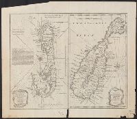
- Beinecke Rare Book and Manuscript Library > A new map of Iberia Europaea alias Celtiberia or ancient Spain : shewing its principal divisions, cheif cities, townes, rivers, mountains &c / R. Spofforth sculp.
- Published / Created:
- 1680?]
- Call Number:
- 39 1680
- Image Count:
- 1
- Resource Type:
- Maps, Atlases & Globes
- Found in:
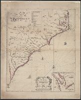
- Beinecke Rare Book and Manuscript Library > A new map of present Spain and Portugal : shewing their principal divisions, chief cities, townes, ports, rivers, mountains, &c. / R. Spofforth, sculp.