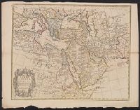
Map of Turkey, Arabia & Persia and Map of Turkey, Arabia and Persia
Description:
Appears in Senex's A new general atlas ... London: Printed for Daniel Browne ... [etc.], 1721., Relief shown pictorially., and Sheet measures 53 x 69 cm. Cross Collection no. 104.
Publisher:
Sold by John Senex at the Globe against St. Dunstans Church Fleetstreet,
Subject (Geographic):
Africa--Maps--Early works to 1800, Arabian Peninsula--Maps--Early works to 1800, Iran--Maps--Early works to 1800, and Middle East--Maps--Early works to 1800
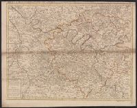
Appears in Senex's A new general atlas ... London: Printed for Daniel Browne ... [etc.], 1721., Dated fom other maps in the atlas., Decorative title carouche., London meridian., Ms. no. on verso: 12. Hand col. Sheet measures 54 x 69 cm. Cross Collection no. 91., Relief shown pictorially and by hachures., and Shows boundaries, rivers, roads, canals, forests and settlements.
Appears in John Senex's A new general atlas., Imperfect: mutilated along folds, with some loss of text. Hand col. Mounted in linen. Sheet measures 53 x 68 cm. Cross Collection no. 89., London meridian., Relief shown pictorially and by hachures., and Shows boundaries, rivers, roads, forests and settlements.