Search
You Searched For
Search Results
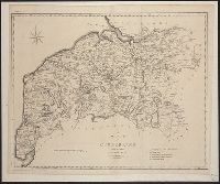
- Published / Created:
- 1805
- Call Number:
- 3238 1805
- Container / Volume:
- BRBL_00065
- Image Count:
- 1
- Resource Type:
- Maps, Atlases & Globes
- Found in:
- Beinecke Rare Book and Manuscript Library > A map of Cumberland ... Engraved by J. Cary.
- Published / Created:
- 1805
- Call Number:
- 3235 1805
- Container / Volume:
- BRBL_00064
- Image Count:
- 1
- Resource Type:
- Maps, Atlases & Globes
- Found in:
- Beinecke Rare Book and Manuscript Library > A map of Lancashire ... Engraved by J. Cary.
- Published / Created:
- 1805
- Call Number:
- 3253 1805
- Container / Volume:
- BRBL_00067
- Image Count:
- 1
- Resource Type:
- Maps, Atlases & Globes
- Found in:
- Beinecke Rare Book and Manuscript Library > A map of Westmoreland ... Engraved by J. Cary.
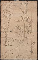
- Published / Created:
- 1826
- Call Number:
- 344cea 1826
- Container / Volume:
- BRBL_00095
- Image Count:
- 1
- Resource Type:
- Maps, Atlases & Globes
- Found in:
- Beinecke Rare Book and Manuscript Library > A new chart of the coast of Norway Christiansund to Stadtland ... Engraved by W.R. Pearcey.
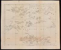
- Published / Created:
- 1802
- Call Number:
- 34 1802
- Container / Volume:
- BRBL_00091
- Image Count:
- 1
- Resource Type:
- Maps, Atlases & Globes
- Found in:
- Beinecke Rare Book and Manuscript Library > A sketch of the North of Sweden, of Norway, Finland, and Lapland. Describing the rout of J. Acerbis travels to the North Cape.
- Creator:
- Arrowsmith, John, 1790-1873, cartographer
- Published / Created:
- 1846
- Call Number:
- BrSides 2019 94
- Image Count:
- 1
- Resource Type:
- Maps, Atlases & Globes
- Found in:
- Beinecke Rare Book and Manuscript Library > Arafura Sea [cartographic material] : partly from the surveys of Captn. Owen Stanley / J. Arrowsmith.
- Published / Created:
- 1832
- Call Number:
- 48 AT42 1832
- Container / Volume:
- BRBL_00264
- Image Count:
- 1
- Resource Type:
- Maps, Atlases & Globes
- Found in:
- Beinecke Rare Book and Manuscript Library > Athens. Engraved by J. Hershall. Drawn by W.B. Clarke, Arch.
- Published / Created:
- 1821
- Call Number:
- 21cea 1821
- Container / Volume:
- BRBL_00016
- Image Count:
- 1
- Resource Type:
- Maps, Atlases & Globes
- Found in:
- Beinecke Rare Book and Manuscript Library > Chart of the Coast of Labrador from the Straits of Bell-Isle to Sandwich Bay ... For William Hooker Engr New York ... Hooker & Fairman Sc.
- Published / Created:
- 1823
- Call Number:
- 32 L84 1823
- Container / Volume:
- BRBL_00049
- Image Count:
- 1
- Resource Type:
- Maps, Atlases & Globes
- Found in:
- Beinecke Rare Book and Manuscript Library > Hodgson's Guide through the British Metropolis. A New map of London and the Environs ... 1823 engraved by J. Reeves.
- Creator:
- Robert Laurie and James Whittle
- Published / Created:
- 1813
- Call Number:
- 70 1813
- Container / Volume:
- BRBL_00358
- Image Count:
- 1
- Resource Type:
- Maps, Atlases & Globes
- Found in:
- Beinecke Rare Book and Manuscript Library > Laurie & Whittle's new general map of America : compiled from the most authentic materials / B. Smith sculpsit.