Search
You Searched For
Search Results
- Published / Created:
- 1781
- Call Number:
- 7325 AR41 1781
- Container / Volume:
- BRBL_00377
- Image Count:
- 1
- Resource Type:
- Maps, Atlases & Globes
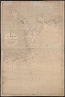
- Found in:
- Beinecke Rare Book and Manuscript Library > Conway Harbor ... Port Aylesbury ... Servey'd ... by J.F.W. Des Barres.
- Published / Created:
- 1865
- Call Number:
- 732cea H13 1853
- Container / Volume:
- BRBL_00378
- Image Count:
- 1
- Resource Type:
- Maps, Atlases & Globes
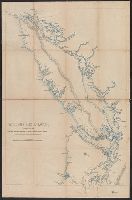
- Found in:
- Beinecke Rare Book and Manuscript Library > North America. Nova Scotia : South East Coast. Mars Head to Shut In Island / Surveyed by Captn. Bayfield R.N., Commr. J. Orlebar, Lieut. J. Hancock, , Mr. W. Forbes Master. and Mr. T Des Brisay Mastr. Assist. R.N. 1853.
- Creator:
- Bouchette, Joseph, 1774-1841
- Published / Created:
- Aug. 12 1815.
- Call Number:
- 734 G214 1815
- Container / Volume:
- BRBL_00380
- Image Count:
- 1
- Resource Type:
- Maps, Atlases & Globes
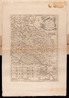
- Found in:
- Beinecke Rare Book and Manuscript Library > Plan of the district of Gaspé / by Joseph Bouchette, Surveyor General ; J. Walker, sculpt.
- Published / Created:
- [1843?]
- Call Number:
- 7391 1843
- Container / Volume:
- BRBL_00394
- Image Count:
- 1
- Resource Type:
- Maps, Atlases & Globes
- Found in:
- Beinecke Rare Book and Manuscript Library > Vancouver's Island.
- Creator:
- Pine, John, 1690-1756
Rocque, John, d. 1762
Tinney, John
- Published / Created:
- 1746
- Call Number:
- 2002 Folio 94
- Image Count:
- 1
- Resource Type:
- Maps, Atlases & Globes
- Found in:
- Beinecke Rare Book and Manuscript Library > A contracted scetch of the plan of London &c. : printed on 24 sheets of imperial paper, to shew the general appearance of the whole : for the use of those who bind it in a book, and for the better comprehension of the divisions mentioned in the index.
- Creator:
- Bowen, Emanuel, d. 1767
Jefferys, Thomas, d. 1771
- Published / Created:
- 1758
- Call Number:
- 1977 Folio 177
- Image Count:
- 3
- Resource Type:
- Maps, Atlases & Globes
- Found in:
- Beinecke Rare Book and Manuscript Library > The seat of war on the coast of France : being a new chart of the coasts of Holland, Flanders, France, Spain & Portugal, with the adjacent Islands, part of Barbary, England and Ireland / drawn from the latest surveys, and regulated by astronomical observa
- Creator:
- Jefferys, Thomas, d. 1771
- Published / Created:
- Oct. 28, 1756.
- Call Number:
- 1977 Folio 177
- Image Count:
- 3
- Resource Type:
- Maps, Atlases & Globes
- Found in:
- Beinecke Rare Book and Manuscript Library > The routs of the Prussian Armies into Bohemia [cartographic material] : with the post roads & distances from the original map publish'd at Berlin / by Thos. Jefferys ...