Skip to search
Skip to main content
Skip to first result
Search
You Searched For
"Latin"
Access
Public
Resource Type
Maps, Atlases & Globes
Language
English
Publication Place
[London :
New Search
Search Results
Creator:
Published / Created:
172-?]
Call Number:
400 172X
Container / Volume:
BRBL_00232
Image Count:
1
Resource Type:
Maps, Atlases & Globes
Description:
English, with Latin place names.
Publisher:
s.n.,
Subject (Geographic):
Italy--Historical geography--Maps--Early works to 1800, Italy--History--To 476--Maps--Early works to 1800, and Rome--Maps--Early works to 1800
Subject (Name):
Nicholls, Sutton and Wells, Edward, 1667-1727. New sett of maps both of antient and present geography
Found in:
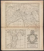
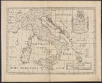
Beinecke Rare Book and Manuscript Library > A new map of Gallia Cisalpina & Graecia Magna, shewing their cheif [sic] divisions, people, cities, towns &c. / Sutton Nicholls sculp.
Creator:
Published / Created:
172-?]
Call Number:
400 172XA
Container / Volume:
BRBL_00232
Image Count:
1
Resource Type:
Maps, Atlases & Globes
Description:
English, with Latin place names.
Publisher:
s.n.,
Subject (Geographic):
Italy--Historical geography--Maps--Early works to 1800, Italy--History--To 476--Maps--Early works to 1800, and Rome--Maps--Early works to 1800
Subject (Name):
Nicholls, Sutton and Wells, Edward, 1667-1727. New sett of maps both of antient and present geography
Found in:
Beinecke Rare Book and Manuscript Library > A new map of Latium, Etruria, and as much of antient Italy as lay between Gallia Cisalpina and Graecia Magna, shewing their principal divisions, cities, towns, rivers, mountains, &c. / Sutton Nicholls sculp.
Creator:
Published / Created:
172-?]
Call Number:
400 172XB
Container / Volume:
BRBL_00232
Image Count:
1
Resource Type:
Maps, Atlases & Globes
Description:
English, with Latin place names.
Publisher:
s.n.,
Subject (Geographic):
Italy--Historical geography--Maps--Early works to 1800, Italy--History--To 476--Maps--Early works to 1800, and Rome--Maps--Early works to 1800
Subject (Name):
Nicholls, Sutton and Wells, Edward, 1667-1727. New sett of maps both of antient and present geography
Found in:
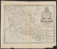
Beinecke Rare Book and Manuscript Library > A new map of antient Italy : together with the adjoyning islands of Sicily, Sardinia, and Corsica, shewing their principal divisions, cities, towns, rivers, mountains &c. / Sutton Nicholls sculp.
Creator:
Published / Created:
1720?]
Call Number:
49 1740
Container / Volume:
BRBL_00684
Image Count:
1
Resource Type:
Maps, Atlases & Globes
Description:
"Iohan. Senex scu, Imprint derived from other maps in the same atlas., London meridian., Ms. no. on verso: 34. Sheet measures 53 x 68 cm. Cross Collection no. 96., Relief shown pictorially., and Shows boundaries, forests, rivers, roads and settlements, with notes.
Publisher:
John Senex,
Subject (Geographic):
Mediterranean Region--Historical geography--Early works to 1800--Maps
Subject (Name):
Senex, John, d. 1740. New general atlas
Subject (Topic):
Ecclesiastical geography--Africa, North--Maps--Early works to 1800
Found in:
Beinecke Rare Book and Manuscript Library > In notitiam ecclesiasticam Africae tabula geographica / auctore G. De L'Isle ...
Branch:v1.61.6 ,Deployed:2024-06-12T09:55:37-04:00