Search
You Searched For
Search Results
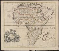
- Creator:
- Senex, John, d. 1740
- Published / Created:
- 1721]
- Call Number:
- 60 1721
- Container / Volume:
- BRBL_00322
- Image Count:
- 1
- Resource Type:
- Maps, Atlases & Globes
- Subject (Geographic):
- Africa--Maps--Early works to 1800
- Found in:
- Beinecke Rare Book and Manuscript Library > A new map of Africa, from the latest observations.
- Published / Created:
- 1794-1795]
- Call Number:
- BrSides Double Folio 2012 39
- Image Count:
- 1
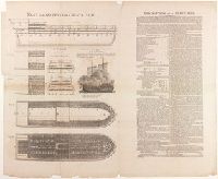
- Description:
- to the western coast of Africa (London
- Subject (Name):
- to the western coast of Africa.
- Subject (Topic):
- Slave trade--Africa.
- Found in:
- Beinecke Rare Book and Manuscript Library > Plan and sections of a slave ship [graphic].
- Creator:
- Seale, Richard William
- Published / Created:
- 1766]
- Call Number:
- 654 1766
- Container / Volume:
- BRBL_00344
- Image Count:
- 1
- Resource Type:
- Maps, Atlases & Globes
- Subject (Geographic):
- Africa, West--Maps--Early works to 1800
- Subject (Topic):
- Coasts--Africa, West--Maps--Early works
- Found in:
- Beinecke Rare Book and Manuscript Library > A new and correct map of the coast of Africa, from Cape Blanco (lat. 20⁰40Ń) to the coast of Angola (lat. 11⁰S) : with explanatory notes of all the forts and settlements belonging to the several European powers / R.W. Seale, sculp.
- Creator:
- L'Isle, Guillaume de, 1675-1726
- Published / Created:
- 1720?]
- Call Number:
- 49 1740
- Container / Volume:
- BRBL_00684
- Image Count:
- 1
- Resource Type:
- Maps, Atlases & Globes
- Subject (Topic):
- Ecclesiastical geography--Africa, North
- Found in:
- Beinecke Rare Book and Manuscript Library > In notitiam ecclesiasticam Africae tabula geographica / auctore G. De L'Isle ...
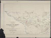
- Published / Created:
- 1909]
- Call Number:
- 652 M31 1909
- Container / Volume:
- BRBL_00343
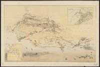
- Image Count:
- 2
- Resource Type:
- Maps, Atlases & Globes
- Alternative Title:
- , Africa
- Found in:
- Beinecke Rare Book and Manuscript Library > Topographic map of portion of Maniema-Kivu district, Belgian Congo, Africa / topography by R.B. Oliver ; assisted by traverses and sketches by S.H. Ball, M.K. Shaler, A.F. Smith, A.E.H. Reid, and C.A. Reid.
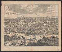
- Creator:
- Ogilby, John, 1600-1676
- Published / Created:
- 1670]
- Call Number:
- 653 L63 1670
- Container / Volume:
- BRBL_00343
- Image Count:
- 1
- Resource Type:
- Maps, Atlases & Globes
- Description:
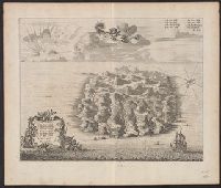
- From Ogilby's Africa, being an accurate
- Subject (Name):
- Ogilby, John, 1600-1676. Africa, being
- Found in:
- Beinecke Rare Book and Manuscript Library > De stadt van Louango = The citÿ of Lovango.
- Creator:
- Hemsley, William, acrive 1789-1817, engraver.
- Published / Created:
- 1808]
- Call Number:
- BrSides Folio 2012 21
- Image Count:
- 1
- Subject (Topic):
- Slave trade--Africa--Pictorial works.
- Found in:
- Beinecke Rare Book and Manuscript Library > [Engraving of the hold of the slave ship Brooks] [graphic] / Hemsley, sculp.
- Creator:
- Nieuhof, Johannes, 1618-1672
Ogilby, John, 1600-1676
Ogilby, John, 1600-1676. Africa, being an accurate description of the regions of Egypt, Barbary
- Published / Created:
- 1670]
- Call Number:
- 215 1670
- Container / Volume:
- BRBL_00015
- Image Count:
- 1
- Resource Type:
- Maps, Atlases & Globes
- Description:
- From Ogilby's Africa, being an accurate
- Found in:
- Beinecke Rare Book and Manuscript Library > St. Helena / door I.N.
- Published / Created:
- 1882
- Call Number:
- 61AM 1882
- Container / Volume:
- BRBL_00331
- Image Count:
- 1
- Resource Type:
- Maps, Atlases & Globes
- Description:
- and northern Africa].
- Found in:
- Beinecke Rare Book and Manuscript Library > Birdseye view of Egypt.
- Creator:
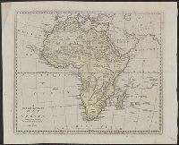
- Bowen, Thomas, d. 1790
- Published / Created:
- 1794?]
- Call Number:
- 60 1794B
- Container / Volume:
- BRBL_00324
- Image Count:
- 1
- Resource Type:
- Maps, Atlases & Globes
- Subject (Geographic):
- Africa--Maps--Early works to 1800
- Found in:
- Beinecke Rare Book and Manuscript Library > A new and accurate map of Africa, drawn from the best authorities / by Thos. Bowen.