Search
You Searched For
Search Results
- Published / Created:
- 1776]
- Call Number:
- 766 1776
- Container / Volume:
- BRBL_00690
- Image Count:
- 1
- Resource Type:
- Maps, Atlases & Globes
- Found in:
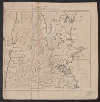
- Beinecke Rare Book and Manuscript Library > A map of Connecticut and Rhode Island with Long Island Sound, &c.
- Published / Created:
- 1776]
- Call Number:
- 766 1776
- Container / Volume:
- BRBL_00690
- Image Count:
- 1
- Resource Type:
- Maps, Atlases & Globes
- Found in:
- Beinecke Rare Book and Manuscript Library > A map of Connecticut and Rhode Island with Long Island Sound, &c.
- Creator:
- Bowen, Emanuel, d. 1767
- Published / Created:
- 1754
- Call Number:
- 75 1720
- Container / Volume:
- BRBL_00689
- Image Count:
- 1
- Resource Type:
- Maps, Atlases & Globes
- Found in:
- Beinecke Rare Book and Manuscript Library > A map of the British American plantations [cartographic material] : extending from Boston in New England to Georgia, including all the back settlements in the respective provinces, as far as the Mississippi / by Eman. Bowen Geogr. to His Majesty ; Tho. Bo
- Creator:
- Kitchin, Thomas, d. 1784
- Published / Created:
- 1766?]
- Call Number:
- 755 1763A
- Container / Volume:
- BRBL_00428
- Image Count:
- 1
- Resource Type:
- Maps, Atlases & Globes
- Found in:
- Beinecke Rare Book and Manuscript Library > A new and accurate map of the British dominions in America, according to the Treaty of 1763, divided into the several provinces and jurisdictions : projected upon the best authorities and astronomical observations / by Thos. Kitchin, geographer.
- Published / Created:
- 1755]
- Call Number:
- 755 1755A
- Container / Volume:
- BRBL_00690
- Image Count:
- 1
- Resource Type:
- Maps, Atlases & Globes
- Description:
- Shows New England, Maritime Provinces
- Subject (Geographic):
- New England--Maps--Early works to 1800
- Found in:
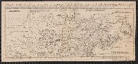
- Beinecke Rare Book and Manuscript Library > A map of the British & French Plantations in North America.
- Creator:
- Des Barres, Joseph F. W. (Joseph Frederick Wallet), 1722-1824
- Published / Created:
- 1775?-1781?]
- Call Number:
- 1983 Folio 25
- Image Count:
- 3
- Resource Type:
- Maps, Atlases & Globes
- Abstract:
- coast and harbors of New England, 1781 bound
- Found in:
- Beinecke Rare Book and Manuscript Library > [The Atlantic Neptune : published for the use of the Royal Navy Great Britain / by Joseph F.W. Des Barres, esq.].
- Published / Created:
- 1775]
- Call Number:
- 76 1740
- Container / Volume:
- BRBL_00690
- Image Count:
- 1
- Resource Type:
- Maps, Atlases & Globes
- Description:
- A variant of McCorkle, B.B. New England
- Found in:
- Beinecke Rare Book and Manuscript Library > A map of 100 miles round Boston [cartographic material].
- Creator:
- Bowen, Thomas, d. 1790
- Published / Created:
- 1755]
- Call Number:
- 71 1755E
- Container / Volume:
- BRBL_00687
- Image Count:
- 1
- Resource Type:
- Maps, Atlases & Globes
- Description:
- scotia, Newfoundland, New England, part of
- Found in:
- Beinecke Rare Book and Manuscript Library > A map of the British and French settlements in North America / T. Bowen, sculpt[or].