Search
You Searched For
Search Results
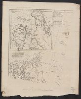
- Creator:
- Kitchin, Thomas, d. 1784
- Published / Created:
- 1766?]
- Call Number:
- 755 1763A
- Container / Volume:
- BRBL_00428
- Image Count:
- 1
- Resource Type:
- Maps, Atlases & Globes
- Subject (Geographic):
- North America--Maps--Early works to
- Subject (Topic):
- British--North America--Maps--Early
- Found in:
- Beinecke Rare Book and Manuscript Library > A new and accurate map of the British dominions in America, according to the Treaty of 1763, divided into the several provinces and jurisdictions : projected upon the best authorities and astronomical observations / by Thos. Kitchin, geographer.
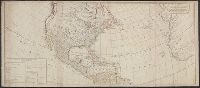
- Creator:
- Gibson, J. (John)
- Published / Created:
- 1763]
- Call Number:
- 75 1778
- Collection Title:
- Gentleman's magazine.
- Container / Volume:
- BRBL_00689
- Image Count:
- 1
- Resource Type:
- Maps, Atlases & Globes
- Subject (Geographic):
- North America--Maps--Early works to
- Subject (Topic):
- Indians of North America--Maps--Early
- Found in:
- Beinecke Rare Book and Manuscript Library > [Map of Louisiana and the western parts of Virginia and Carolina] / [cartographic material] / J. Gibson, sculp.
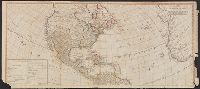
- Creator:
- Bolton, Solomon, d. ca. 1768
- Published / Created:
- 1766]
- Call Number:
- 71 1766B
- Container / Volume:
- BRBL_00364
- Image Count:
- 4
- Resource Type:
- Maps, Atlases & Globes
- Subject (Geographic):
- North America--Maps--Early works to
- Found in:
- Beinecke Rare Book and Manuscript Library > North America : performed under the patronage of Louis Duke of Orleans, First Prince of the Blood / by the Sieur d'Anville, greatly improved by Mr. Bolton ; engraved by R.W. Seale ; Gravelot, delin. ; Walker, sculp.
- Creator:
- Blair, John, d. 1782
- Published / Created:
- 176-?]
- Call Number:
- 71 1760B
- Container / Volume:
- BRBL_00364
- Image Count:
- 1
- Resource Type:
- Maps, Atlases & Globes
- Subject (Geographic):
- North America--Maps--Early works to
- Found in:
- Beinecke Rare Book and Manuscript Library > A map of North America, from the latest surveys and maps / by John Blair as a supplement to his Tables of chronology ; Thos. Kitchin, sculpsit.
- Creator:
- Des Barres, Joseph F. W. (Joseph Frederick Wallet), 1722-1824
- Published / Created:
- 1775?-1781?]
- Call Number:
- 1983 Folio 25
- Image Count:
- 3
- Resource Type:
- Maps, Atlases & Globes
- Subject (Geographic):
- North America--Maps
- Found in:
- Beinecke Rare Book and Manuscript Library > [The Atlantic Neptune : published for the use of the Royal Navy Great Britain / by Joseph F.W. Des Barres, esq.].
- Creator:
- Moll, Herman, d. 1732
- Call Number:
- 85 1745A
- Container / Volume:
- BRBL_00636
- Image Count:
- 1
- Resource Type:
- Maps, Atlases & Globes
- Subject (Topic):
- Coasts--North America--Maps--Early
- Found in:
- Beinecke Rare Book and Manuscript Library > A chart of ye West-Indies or the islands of America in the North Sea &c., being ye present seat of war / by Herman Moll, geographer.
- Published / Created:
- 1755]
- Call Number:
- 755 1755Q
- Container / Volume:
- BRBL_00690
- Image Count:
- 1
- Resource Type:
- Maps, Atlases & Globes
- Subject (Geographic):
- Great Lakes (North America)--Maps
- Found in:
- Beinecke Rare Book and Manuscript Library > A map of the five Great Lakes with part of Pensilvania, New York, Canada and Hudsons Bay territories &c [cartographic material].
- Creator:
- Sayer, Robert, 1725-1794
- Published / Created:
- between 1783 and 1794?]
- Call Number:
- 71 1800
- Container / Volume:
- BRBL_00367
- Image Count:
- 1
- Resource Type:
- Maps, Atlases & Globes
- Subject (Geographic):
- North America--Maps--Early works to
- Found in:
- Beinecke Rare Book and Manuscript Library > [A new map of the whole continent of America : divided into North and South and West Indies ...]
- Creator:
- Sayer, Robert, 1725-1794
- Published / Created:
- between 1783 and 1794?]
- Call Number:
- 71 1800B
- Container / Volume:
- BRBL_00367
- Image Count:
- 1
- Resource Type:
- Maps, Atlases & Globes
- Subject (Geographic):
- North America--Maps--Early works to
- Found in:
- Beinecke Rare Book and Manuscript Library > [A new map of the whole continent of America : divided into North and South and West Indies ...]
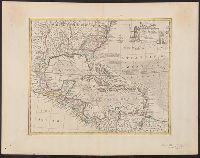
- Creator:
- Bowen, Emanuel, d. 1767
- Published / Created:
- 1747]
- Call Number:
- 85 1730A
- Container / Volume:
- BRBL_00692
- Image Count:
- 1
- Resource Type:
- Maps, Atlases & Globes
- Subject (Geographic):
- North America--Maps--Early works to
- Found in:
- Beinecke Rare Book and Manuscript Library > An accurate map of the West Indies [cartographic material] : drawn from the best authorities, assisted by the most approved modern maps and charts, and regulated by astronomical observations / by Eman: Bowen.