Skip to search
Skip to main content
Skip to first result
Search
You Searched For
"Latin"
Access
Public
Format
cartographic
Genre
Marginalia
Publication Place
[Nuremberg]
New Search
Search Results
Creator:
Published / Created:
1748
Call Number:
1973 Folio 30
Collection Title:
[Atlas factice of 32 maps and 1 distance table, produced by the Homann Erben firm]
Image Count:
2
Alternative Title:
Carte des XVII. provinces ou de l’Allemagne inferievre, dressee suivant la projection stereographique, et appueyee par les mesures faites de Mess. Cassini, Snellius et Mouschenbrok, par Mr. Tob. Majer de la Societe geographique, et publiee par les Heritiers de Homann, l’An 1748
Publisher:
Cura et Studio Homannianorum Heredum
Subject (Geographic):
Belgium --Maps --Early works to 1800, Benelux countries --Maps --Early works to 1800, Luxembourg --Maps --Early works to 1800, and Netherlands --Maps --Early works to 1800
Subject (Topic):
Atlases, German --Early works to 1800
Collection Created:
[Nuremberg : s.n.,
Found in:
Beinecke Rare Book and Manuscript Library > Belgii universi seu inferioris Germaniae quam XVII provinciae Austriaco Gallico et Batavo sceptro parentes constituunt nova tabula geographica / [cartographic material] / a Tobia Majero, Math. Cult. ad leges legitimae delineationis revocata
Creator:
Published / Created:
1731
Call Number:
1973 Folio 30
Collection Title:
[Atlas factice of 32 maps and 1 distance table, produced by the Homann Erben firm]
Image Count:
2
Alternative Title:
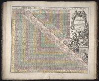
Tabula poliometrica Germaniae ac praecipuorum quorundam locorum Europae
Publisher:
In der Homannische Ufficin
Subject (Geographic):
Europe --Distances, etc --Early works to 1800
Subject (Topic):
Atlases, German --Early works to 1800
Collection Created:
[Nuremberg : s.n., 1701-1760]
Found in:
Beinecke Rare Book and Manuscript Library > Neu vermehrter curioser Meilen-Zeiger der vornehmsten Staedte in Europa, besonders in Teutschland ...
Creator:
Published / Created:
1741
Call Number:
1973 Folio 30
Collection Title:
[Atlas factice of 32 maps and 1 distance table, produced by the Homann Erben firm]
Image Count:
2
Alternative Title:
Carte de France dressee par Guillaume de L’Isle et accommodee par les Heritiers d’Homann
Publisher:
[Homann Erben]
Subject (Geographic):
France --Maps --Early works to 1800
Subject (Topic):
Atlases, German --Early works to 1800
Collection Created:
[Nuremberg : s.n.,
Found in:
Beinecke Rare Book and Manuscript Library > Regni Galliae seu Franciae et Navarrae [cartographic material] : tabula geographica in usum elementorum geographiae schazianorum accom[m]odata / per Homannianos Heredes
Branch:v1.61.6 ,Deployed:2024-06-12T09:55:31-04:00