Search
You Searched For
Search Results
- Creator:
- Marion, Israel
- Published / Created:
- 1888
- Call Number:
- 739 1888
- Container / Volume:
- BRBL_00388
- Image Count:
- 1
- Resource Type:
- Maps, Atlases & Globes
- Found in:
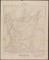
- Beinecke Rare Book and Manuscript Library > Map of a portion of the southern Interior of British Columbia : embodying the explorations made in 1877 by G.M. Dawson, and in 1882-4 by Amos Bowman / drawn by Israel Marion.
- Creator:
- Marion, Israel
- Published / Created:
- 1888
- Call Number:
- 739 1888
- Container / Volume:
- BRBL_00388
- Image Count:
- 1
- Resource Type:
- Maps, Atlases & Globes
- Found in:
- Beinecke Rare Book and Manuscript Library > Map of a portion of the southern Interior of British Columbia : embodying the explorations made in 1877 by G.M. Dawson, and in 1882-4 by Amos Bowman / drawn by Israel Marion.
- Creator:
- Geological Survey of Canada
- Published / Created:
- [1886?]
- Call Number:
- 739GBC C19 1886I
- Container / Volume:
- BRBL_00392
- Image Count:
- 1
- Resource Type:
- Maps, Atlases & Globes
- Found in:
- Beinecke Rare Book and Manuscript Library > Map of placer mines & quartz locations in the vicinity of Williams Creek, Cariboo District, B.C. / surveyed and drawn by Amos Bowman, mining engineer ; assisted by James McEvoy ; drawn for photolithography by L.N. Richard.