Search
You Searched For
Search Results
- Creator:
- Haanel, Eugene, 1841-1927
- Published / Created:
- [1905?]
- Call Number:
- 735gfc C125 1905
- Container / Volume:
- BRBL_00382
- Image Count:
- 1
- Resource Type:
- Maps, Atlases & Globes
- Publisher:
- Dept. of the Interior, Mines Branch,
- Found in:
- Beinecke Rare Book and Manuscript Library > Magnetic survey, Calabogie Mine, Bagot Township, Renfrew County : vertical intensity / Eugene Haanel, Superintendent of Mines ; surveyed by E. Nystrom.
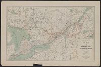
- Creator:
- Canada. Dept. of the Interior. Railway Lands Branch
- Published / Created:
- 1915
- Call Number:
- 73gr 1915B
- Container / Volume:
- BRBL_00376
- Image Count:
- 2
- Resource Type:
- Maps, Atlases & Globes
- Found in:
- Beinecke Rare Book and Manuscript Library > Map showing branches of chartered banks in Ontario and Quebec / prepared in the Railway Lands Branch under the direction of F.C.C. Lynch, superintendent.
- Creator:
- Canada. Dominion Water Power Branch
- Published / Created:
- [1912]
- Call Number:
- 737CBF 1912
- Container / Volume:
- BRBL_00386
- Image Count:
- 1
- Resource Type:
- Maps, Atlases & Globes
- Publisher:
- Dept. of the Interior Water Power
- Found in:
- Beinecke Rare Book and Manuscript Library > Contour map of Bow River Basin above Calgary [Alberta] : to accompany report on power and storage investigation / by M.C. Hendry.
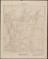
- Creator:
- Marion, Israel
- Published / Created:
- 1888
- Call Number:
- 739 1888
- Container / Volume:
- BRBL_00388
- Image Count:
- 1
- Resource Type:
- Maps, Atlases & Globes
- Found in:
- Beinecke Rare Book and Manuscript Library > Map of a portion of the southern Interior of British Columbia : embodying the explorations made in 1877 by G.M. Dawson, and in 1882-4 by Amos Bowman / drawn by Israel Marion.