Skip to search
Skip to main content
Skip to first result
Search
You Searched For
Extent of Digitization
Completely digitized
Format
cartographic
Language
English
Publication Place
[S.l. :
New Search
Search Results
Published / Created:
1919]
Call Number:
11hcf 1919B-5
Container / Volume:
BRBL_00010S
Image Count:
1
Resource Type:
Maps, Atlases & Globes
Description:
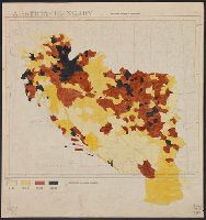
Legend indicates "Inhabitants per square kilometer."
Publisher:
s.n.,
Subject (Geographic):
Europe, Eastern--Maps
Subject (Topic):
Population density--Europe, Eastern--Maps
Found in:
Beinecke Rare Book and Manuscript Library > Austria-Hungary : Population density of Jugo-slavia.
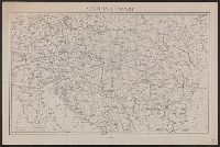
Published / Created:
1910?]
Call Number:
41 1910A
Container / Volume:
BRBL_00241
Image Count:
1
Resource Type:
Maps, Atlases & Globes
Publisher:
s.n.,
Subject (Geographic):
Austria--Maps, Balkan Peninsula--Maps, and Hungary--Maps
Found in:
Beinecke Rare Book and Manuscript Library > Austria-Hungary.
Published / Created:
1910?]
Call Number:
11hcf 1919C-14
Image Count:
1
Resource Type:
Maps, Atlases & Globes
Publisher:
s.n.,
Subject (Geographic):
Austria--Maps., Balkan Peninsula--Maps., and Hungary--Maps.
Found in:
Beinecke Rare Book and Manuscript Library > Austria-Hungary.
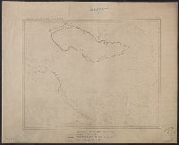
Published / Created:
1919?].
Call Number:
11hcf 1919C-3-14
Container / Volume:
BRBL_00010U
Image Count:
1
Resource Type:
Maps, Atlases & Globes
Description:
"610" in upper right and bottom left.
Publisher:
s.n.,
Subject (Geographic):
Austria--Maps and Hungary--Maps
Found in:
Beinecke Rare Book and Manuscript Library > Austria-Hungary.
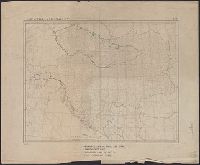
Published / Created:
1919?]
Call Number:
11hcf 1919C-3-17
Container / Volume:
BRBL_00010U
Image Count:
1
Resource Type:
Maps, Atlases & Globes
Description:
In upper right and bottom left: 610.
Publisher:
s.n.,
Subject (Geographic):
Balkan Peninsula--Maps and Europe, Eastern--Maps
Found in:
Beinecke Rare Book and Manuscript Library > Austria-Hungary.
Published / Created:
1919?]
Call Number:
11hcf 1919C-3-16
Container / Volume:
BRBL_00010U
Image Count:
1
Resource Type:
Maps, Atlases & Globes
Description:
Ms. notes: Divided into land area, giving populations of various ethnic groups.
Publisher:
s.n.,
Subject (Geographic):
Balkan Peninsula--Maps and Europe, Eastern--Maps
Subject (Topic):
Ethnology--Balkan Peninsula--Maps and Ethnology--Europe, Eastern--Maps
Found in:
Beinecke Rare Book and Manuscript Library > Austria-Hungary.
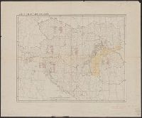
Published / Created:
1919?]
Call Number:
11hcf 1919C-3-8
Container / Volume:
BRBL_00010U
Image Count:
1
Resource Type:
Maps, Atlases & Globes
Description:
Hand colored regions and borders.
Publisher:
s.n.,
Subject (Geographic):
Balkan Peninsula--Maps and Europe, Eastern--Maps
Found in:
Beinecke Rare Book and Manuscript Library > Austria-Hungary.
Published / Created:
1919]
Call Number:
11hcf 1919B-33
Container / Volume:
BRBL_00010Q
Image Count:
1
Resource Type:
Maps, Atlases & Globes
Publisher:
s.n.,
Subject (Geographic):
Baltic States--Maps.
Found in:
Beinecke Rare Book and Manuscript Library > Baltic provinces.
Creator:
Published / Created:
1864
Call Number:
801hc N17 1864
Container / Volume:
BRBL_00541
Image Count:
1
Resource Type:
Maps, Atlases & Globes
Alternative Title:
[Sherman map collection ; no. 170]
Description:
For another copy see entry no. 433., From "39th Cong., 1st Sess. [1866]-Report of the Chief Engineer, U.S.A.", and Legend in the upper left corner contains a brief resume of each day's action while the map shows troop positions, roads, railroads, hachures, drainage, vegetation, and rural houses. Streets and houses of Nashville are not indicated.
Publisher:
s.n.],
Subject (Geographic):
Nashville (Tenn.)--History--Civil War, 1861-1865--Maps
Found in:
Beinecke Rare Book and Manuscript Library > Battlefields in front of Nashville where the United States forces commanded by Major General Geo. H. Thomas defeated and routed the Rebel army under General Hood, December 15th & 16th 1864 / surveyed and drawn under the direction of Gen: Tower by M. Peseu
Creator:
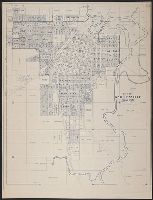
Published / Created:
c1939.
Call Number:
827 B284 1939
Container / Volume:
BRBL_00577
Image Count:
1
Resource Type:
Maps, Atlases & Globes
Description:
Copyright: M.K. Jensen. and Shows "original town" and additions.
Publisher:
s.n.],
Subject (Geographic):
Bartlesville (Okla.)--Maps
Found in:
Beinecke Rare Book and Manuscript Library > City of Bartlesville, Oklahoma / compiled and drawn by M.K. Jensen.
Branch:v1.61.8 ,Deployed:2024-06-20T11:14:46-04:00