Skip to search
Skip to main content
Skip to first result
Search
You Searched For
Extent of Digitization
Completely digitized
Access
Public
Repository
Beinecke Rare Book and Manuscript Library
Resource Type
Maps, Atlases & Globes
Publication Place
[S.l. :
New Search
Search Results
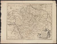
Published / Created:
1770]
Call Number:
36 1770A
Container / Volume:
BRBL_00118
Image Count:
1
Resource Type:
Maps, Atlases & Globes
Description:
By Eman. Bowen.
Publisher:
s. n. ,
Subject (Geographic):
Germany--Maps--Early works to 1800
Found in:
Beinecke Rare Book and Manuscript Library > A correct map of the north west part of Germany...
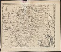
Published / Created:
1770]
Call Number:
36 1770B
Container / Volume:
BRBL_00118
Image Count:
1
Resource Type:
Maps, Atlases & Globes
Description:
By Eman. Bowen.
Publisher:
s. n. ,
Subject (Geographic):
Germany--Maps--Early works to 1800
Found in:
Beinecke Rare Book and Manuscript Library > A correct map of the north west part of Germany...
Published / Created:
1770]
Call Number:
36 1770F
Container / Volume:
BRBL_00118
Image Count:
1
Resource Type:
Maps, Atlases & Globes
Description:
By Eman. Bowen.
Publisher:
s. n. ,
Subject (Geographic):
Germany--Maps--Early works to 1800
Found in:
Beinecke Rare Book and Manuscript Library > A correct map of the south east part of Germany...
Published / Created:
1770]
Call Number:
36 1770E
Container / Volume:
BRBL_00118
Image Count:
1
Resource Type:
Maps, Atlases & Globes
Description:
By Eman. Bowen.
Publisher:
s. n. ,
Subject (Geographic):
Germany--Maps--Early works to 1800
Found in:
Beinecke Rare Book and Manuscript Library > A correct map of the south east part of Germany...
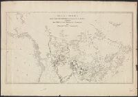
Published / Created:
1860?]
Call Number:
796gme 1860
Container / Volume:
BRBL_00531
Image Count:
1
Resource Type:
Maps, Atlases & Globes
Alternative Title:
Red River, Sabine & Western Railway and Red River, Sabine and Western Railway
Description:
"I.[?] C. Terry, Chf. Eng.", Covers Texas and Louisiana, and parts of New Mexico, Indian Territory, Arkansas, Mississippi, and northern Mexico., From the Streeter collection., and Library's copy imperfect: Holes in center.
Publisher:
s.n.,
Subject (Name):
Red River, Sabine and Western Railway--Maps and Streeter, Thomas W.--(Thomas Winthrop),--1883-1965--Ownership
Subject (Topic):
Coal--Texas--Maps, Forests and forestry--Louisiana--Maps, Forests and forestry--Texas--Maps, Iron--Texas--Maps, Petroleum--Texas--Maps, Railroads--Louisiana--Maps, and Railroads--Texas--Maps
Found in:
Beinecke Rare Book and Manuscript Library > A geographically correct map of the Red River, Sabine & Western Railway (under construction) and connections : showing distribution of pine forests (compiled from maps of U.S. government), also location of coal, iron, and oil deposits.
Published / Created:
178-?]
Call Number:
71 1780C
Container / Volume:
BRBL_00366
Image Count:
1
Resource Type:
Maps, Atlases & Globes
Description:
Part of imprint is faintly visible in bottom margin: [?]acKen[?] No. 38 No[?]folk Street Strand., Relief shown by hachures., and Rivers and lakes in the Pacific Northwest and British Columbia are in manuscript, pen-and-ink.
Publisher:
s.n.,
Subject (Geographic):
Canada--Maps--Early works to 1800
Subject (Name):
North West Company--Maps--Early works to 1800
Subject (Topic):
Fur trade--Canada--Maps--Early works to 1800
Found in:
Beinecke Rare Book and Manuscript Library > A map of America between latitudes 40 and 70 north, and longitudes 45 and 180 west : exhibiting the principal trading stations of the North West Company.
Creator:
Published / Created:
17--?]
Call Number:
71 1769A
Container / Volume:
BRBL_00364
Image Count:
1
Resource Type:
Maps, Atlases & Globes
Description:
Includes text and inset of Hudson and Baffin bays. and Relief shown pictorially.
Publisher:
s.n.,
Subject (Geographic):
North America--Maps--Early works to 1800
Found in:
Beinecke Rare Book and Manuscript Library > A map of North America : from D'Anville, 1769.
Published / Created:
ca 1810]
Call Number:
773 J487 1810
Container / Volume:
BRBL_00496
Image Count:
1
Resource Type:
Maps, Atlases & Globes
Publisher:
s.n. ,
Subject (Geographic):
New Jersey--Maps
Found in:
Beinecke Rare Book and Manuscript Library > A map of that part of the town of Jersey, commonly called Aharsimus.
Published / Created:
1770]
Call Number:
36 1770D
Container / Volume:
BRBL_00118
Image Count:
1
Resource Type:
Maps, Atlases & Globes
Description:
By Eman. Bowen.
Publisher:
s. n. ,
Subject (Geographic):
Germany--Maps--Early works to 1800
Found in:
Beinecke Rare Book and Manuscript Library > A new and correct map of the south west part of Germany...
Published / Created:
1770]
Call Number:
36 1770C
Container / Volume:
BRBL_00118
Image Count:
1
Resource Type:
Maps, Atlases & Globes
Description:
By Eman. Bowen.
Publisher:
s. n. ,
Subject (Geographic):
Germany--Maps--Early works to 1800
Found in:
Beinecke Rare Book and Manuscript Library > A new and correct map of the south west part of Germany...
Branch:v1.61.8 ,Deployed:2024-06-20T11:14:48-04:00