Search
You Searched For
Search Results
- Published / Created:
- 1916?]
- Call Number:
- 38am V58 1916
- Container / Volume:
- BRBL_00168
- Image Count:
- 1
- Resource Type:
- Maps, Atlases & Globes
- Found in:
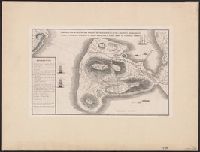
- Beinecke Rare Book and Manuscript Library > [Verdun and Environs].
- Published / Created:
- 1916?].
- Call Number:
- 38 V58 1916
- Container / Volume:
- BRBL_00166
- Image Count:
- 1
- Resource Type:
- Maps, Atlases & Globes
- Found in:
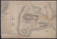
- Beinecke Rare Book and Manuscript Library > [Verdun and Environs].
- Published / Created:
- c1949.
- Call Number:
- 846 P837 1949A
- Container / Volume:
- BRBL_00622
- Image Count:
- 4
- Resource Type:
- Maps, Atlases & Globes
- Found in:
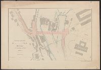
- Beinecke Rare Book and Manuscript Library > [Street map of Portland, Or.].
- Published / Created:
- 1883
- Call Number:
- 39 1883
- Container / Volume:
- BRBL_00188
- Image Count:
- 1
- Resource Type:
- Maps, Atlases & Globes
- Found in:
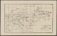
- Beinecke Rare Book and Manuscript Library > [Spain and Portugal].
- Published / Created:
- 1919?]
- Call Number:
- 11hcf 1919C-4-3
- Container / Volume:
- BRBL_00010V
- Image Count:
- 1
- Resource Type:
- Maps, Atlases & Globes
- Found in:
- Beinecke Rare Book and Manuscript Library > [Southwestern portion of Map of Europe].
- Published / Created:
- 1880?]
- Call Number:
- 408 1880
- Container / Volume:
- BRBL_00238
- Image Count:
- 1
- Resource Type:
- Maps, Atlases & Globes
- Found in:
- Beinecke Rare Book and Manuscript Library > [South East section of Sicily].
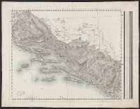
- Published / Created:
- 185-?]
- Call Number:
- 846hc 1850
- Container / Volume:
- BRBL_00624
- Image Count:
- 1
- Resource Type:
- Maps, Atlases & Globes
- Found in:
- Beinecke Rare Book and Manuscript Library > [Six route operations of a United States military company in Oregon Territory].
- Published / Created:
- 1870?]
- Call Number:
- 501 1870
- Container / Volume:
- BRBL_00276
- Image Count:
- 1
- Resource Type:
- Maps, Atlases & Globes
- Found in:
- Beinecke Rare Book and Manuscript Library > [Section East and South East of Smyrna].
- Published / Created:
- 1910]
- Call Number:
- 40 R66 1910
- Container / Volume:
- BRBL_00219
- Image Count:
- 1
- Resource Type:
- Maps, Atlases & Globes
- Found in:
- Beinecke Rare Book and Manuscript Library > [Rome].
- Published / Created:
- [1885?].
- Call Number:
- 40 R66 1885A
- Container / Volume:
- BRBL_00219
- Image Count:
- 1
- Resource Type:
- Maps, Atlases & Globes
- Found in:
- Beinecke Rare Book and Manuscript Library > [Rome and Environs].
- Published / Created:
- 1919?]
- Call Number:
- 11hcf 1919B-11
- Image Count:
- 2
- Resource Type:
- Maps, Atlases & Globes
- Found in:
- Beinecke Rare Book and Manuscript Library > [Portion of map of France and Germany].
- Published / Created:
- 1892?]
- Call Number:
- 40 1892
- Container / Volume:
- BRBL_00202
- Image Count:
- 2
- Resource Type:
- Maps, Atlases & Globes
- Found in:
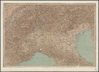
- Beinecke Rare Book and Manuscript Library > [Northern Italy].
- Published / Created:
- 1942?]
- Call Number:
- 352cbf 1942
- Container / Volume:
- BRBL_00109
- Image Count:
- 1
- Resource Type:
- Maps, Atlases & Globes
- Found in:
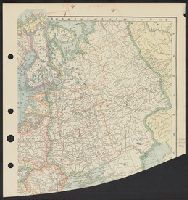
- Beinecke Rare Book and Manuscript Library > [Map of the Soviet Union].
- Published / Created:
- 1922?]
- Call Number:
- 825ad An23 1922
- Container / Volume:
- BRBL_00575
- Image Count:
- 1
- Resource Type:
- Maps, Atlases & Globes
- Found in:
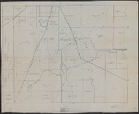
- Beinecke Rare Book and Manuscript Library > [Map of sections in townships 20 S and 21 S, and ranges 19 E and 20 E, Anderson County, Kansas] / F.S.T. 3/25/'22, Garnett, Kas.
- Published / Created:
- 1915?]
- Call Number:
- 884 1915A
- Container / Volume:
- BRBL_00654
- Image Count:
- 1
- Resource Type:
- Maps, Atlases & Globes
- Found in:
- Beinecke Rare Book and Manuscript Library > [Map of region around Tamiahua Lagoon].
- Published / Created:
- 1893?]
- Call Number:
- 88 M57 1893
- Container / Volume:
- BRBL_00647
- Image Count:
- 1
- Resource Type:
- Maps, Atlases & Globes
- Found in:
- Beinecke Rare Book and Manuscript Library > [Map of railroads in Mexico City Region].
- Published / Created:
- 1919?]
- Call Number:
- 11hcf 1919B-18
- Container / Volume:
- BRBL_00010O
- Image Count:
- 1
- Resource Type:
- Maps, Atlases & Globes
- Found in:
- Beinecke Rare Book and Manuscript Library > [Map of central Europe].
- Published / Created:
- 1919?]
- Call Number:
- 11hcf 1919B-18
- Container / Volume:
- BRBL_00010O
- Image Count:
- 1
- Resource Type:
- Maps, Atlases & Globes
- Found in:
- Beinecke Rare Book and Manuscript Library > [Map of central Europe].
- Published / Created:
- 1919?]
- Call Number:
- 11hcf 1919B-18
- Container / Volume:
- BRBL_00010O
- Image Count:
- 1
- Resource Type:
- Maps, Atlases & Globes
- Found in:
- Beinecke Rare Book and Manuscript Library > [Map of central Europe].
- Published / Created:
- 191-]
- Call Number:
- 11hcf 1919-2
- Container / Volume:
- BRBL_00010J
- Image Count:
- 1
- Resource Type:
- Maps, Atlases & Globes
- Found in:
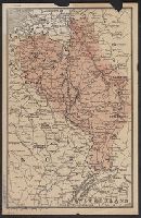
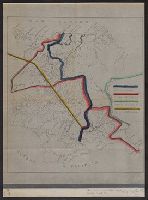
- Beinecke Rare Book and Manuscript Library > [Map of area in dispute between Belgium and Germany.]
- Published / Created:
- 19--?]
- Call Number:
- 71ED 1850
- Container / Volume:
- BRBL_00371
- Image Count:
- 1
- Resource Type:
- Maps, Atlases & Globes
- Found in:
- Beinecke Rare Book and Manuscript Library > [Map of Indian tribes of North America].
- Published / Created:
- 1919?]
- Call Number:
- 11hcf 1919B-31
- Container / Volume:
- BRBL_00010Q
- Image Count:
- 1
- Resource Type:
- Maps, Atlases & Globes
- Found in:
- Beinecke Rare Book and Manuscript Library > [Map of Eastern Europe].
- Published / Created:
- 1919?]
- Call Number:
- 11hcf 1919C-3-9
- Container / Volume:
- BRBL_00010U
- Image Count:
- 1
- Resource Type:
- Maps, Atlases & Globes
- Found in:
- Beinecke Rare Book and Manuscript Library > [Map of Eastern Europe and the Balkan Peninsula].
- Published / Created:
- 1920?].
- Call Number:
- 902 1920A
- Container / Volume:
- BRBL_00665
- Image Count:
- 1
- Resource Type:
- Maps, Atlases & Globes
- Found in:
- Beinecke Rare Book and Manuscript Library > [Map of Colombia].
- Published / Created:
- 1919?]
- Call Number:
- 11hcf 1919B-12
- Container / Volume:
- BRBL_00010O
- Image Count:
- 1
- Resource Type:
- Maps, Atlases & Globes
- Found in:
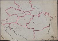
- Beinecke Rare Book and Manuscript Library > [Map of Central Europe].
- Published / Created:
- 1919?]
- Call Number:
- 11hcf 1919C-3-7
- Container / Volume:
- BRBL_00010U
- Image Count:
- 1
- Resource Type:
- Maps, Atlases & Globes
- Found in:
- Beinecke Rare Book and Manuscript Library > [Map of Balkan Peninsula and Eastern Europe].
- Published / Created:
- 1919?]
- Call Number:
- 11hcf 1919C-3-6
- Container / Volume:
- BRBL_00010U
- Image Count:
- 1
- Resource Type:
- Maps, Atlases & Globes
- Found in:
- Beinecke Rare Book and Manuscript Library > [Map of Balkan Peninsula and Eastern Europe].
- Published / Created:
- 1919?]
- Call Number:
- 11hcf 1919C-3-5
- Container / Volume:
- BRBL_00010U
- Image Count:
- 1
- Resource Type:
- Maps, Atlases & Globes
- Found in:
- Beinecke Rare Book and Manuscript Library > [Map of Balkan Peninsula and Eastern Europe].
- Published / Created:
- 1919?]
- Call Number:
- 11hcf 1919C-3-4
- Container / Volume:
- BRBL_00010U
- Image Count:
- 1
- Resource Type:
- Maps, Atlases & Globes
- Found in:
- Beinecke Rare Book and Manuscript Library > [Map of Balkan Peninsula and Eastern Europe].
- Published / Created:
- 1919?]
- Call Number:
- 11hcf 1919C-3-3
- Container / Volume:
- BRBL_00010U
- Image Count:
- 1
- Resource Type:
- Maps, Atlases & Globes
- Found in:
- Beinecke Rare Book and Manuscript Library > [Map of Balkan Peninsula and Eastern Europe].
- Published / Created:
- 1919?]
- Call Number:
- 11hcf 1919C-3-2
- Container / Volume:
- BRBL_00010U
- Image Count:
- 1
- Resource Type:
- Maps, Atlases & Globes
- Found in:
- Beinecke Rare Book and Manuscript Library > [Map of Balkan Peninsula and Eastern Europe].
- Published / Created:
- 1919?]
- Call Number:
- 11hcf 1919C-3-12
- Container / Volume:
- BRBL_00010U
- Image Count:
- 1
- Resource Type:
- Maps, Atlases & Globes
- Found in:
- Beinecke Rare Book and Manuscript Library > [Map of Balkan Peninsula and Eastern Europe].
- Published / Created:
- 1919?]
- Call Number:
- 11hcf 1919C-3-11
- Container / Volume:
- BRBL_00010U
- Image Count:
- 1
- Resource Type:
- Maps, Atlases & Globes
- Found in:
- Beinecke Rare Book and Manuscript Library > [Map of Balkan Peninsula and Eastern Europe].
- Published / Created:
- 1919?]
- Call Number:
- 11hcf 1919C-3-10
- Container / Volume:
- BRBL_00010U
- Image Count:
- 1
- Resource Type:
- Maps, Atlases & Globes
- Found in:
- Beinecke Rare Book and Manuscript Library > [Map of Balkan Peninsula and Eastern Europe].
- Published / Created:
- 1913].
- Call Number:
- 897fda 1913
- Container / Volume:
- BRBL_00659
- Image Count:
- 1
- Resource Type:
- Maps, Atlases & Globes
- Found in:
- Beinecke Rare Book and Manuscript Library > [Map illustrating Costa Rica-Panama boundary dispute].
- Published / Created:
- 1919?]
- Call Number:
- 11hcf 1919C-1-3
- Container / Volume:
- BRBL_00010S
- Image Count:
- 1
- Resource Type:
- Maps, Atlases & Globes
- Found in:
- Beinecke Rare Book and Manuscript Library > [Manuscript map of the Balkan Peninsula].
- Published / Created:
- 1919?]
- Call Number:
- 11hcf 1919C-4-1
- Container / Volume:
- BRBL_00010V
- Image Count:
- 1
- Resource Type:
- Maps, Atlases & Globes
- Found in:
- Beinecke Rare Book and Manuscript Library > [Manuscript map of Hungary].
- Published / Created:
- 1919?]
- Call Number:
- 11hcf 1919C-3-15
- Container / Volume:
- BRBL_00010U
- Image Count:
- 1
- Resource Type:
- Maps, Atlases & Globes
- Found in:
- Beinecke Rare Book and Manuscript Library > [Manuscript map of Balkan Peninsula and Eastern Europe].
- Published / Created:
- 1919?]
- Call Number:
- 11hcf 1919C-3-13
- Container / Volume:
- BRBL_00010U
- Image Count:
- 1
- Resource Type:
- Maps, Atlases & Globes
- Found in:
- Beinecke Rare Book and Manuscript Library > [Manuscript map of Balkan Peninsula and Eastern Europe].
- Published / Created:
- 1878?]
- Call Number:
- 11hcf 1919C-1-1
- Container / Volume:
- BRBL_00010S
- Image Count:
- 1
- Resource Type:
- Maps, Atlases & Globes
- Found in:
- Beinecke Rare Book and Manuscript Library > [Manuscript Map showing boundaries according to the Treaty of Berlin and the Treaty of San Stefano].
- Published / Created:
- 1919?]
- Call Number:
- 11hcf 1919C-1-2
- Container / Volume:
- BRBL_00010S
- Image Count:
- 1
- Resource Type:
- Maps, Atlases & Globes
- Found in:
- Beinecke Rare Book and Manuscript Library > [Manuscript Map of the Balkan Peninsula].
- Published / Created:
- 1918?]
- Call Number:
- 11hc 1918Z-2
- Container / Volume:
- BRBL_00010G
- Image Count:
- 1
- Resource Type:
- Maps, Atlases & Globes
- Found in:
- Beinecke Rare Book and Manuscript Library > [Linea d'Armistizio : Villa Giusti, 3 Novembre 1918].
- Published / Created:
- [1890?]
- Call Number:
- 423 K88 1890
- Container / Volume:
- BRBL_00245
- Image Count:
- 1
- Resource Type:
- Maps, Atlases & Globes
- Found in:
- Beinecke Rare Book and Manuscript Library > [Krems and Environs].
- Published / Created:
- 1945?]
- Call Number:
- 11hd 1945G-3
- Container / Volume:
- BRBL_00010ZF
- Image Count:
- 1
- Resource Type:
- Maps, Atlases & Globes
- Found in:
- Beinecke Rare Book and Manuscript Library > [Karte des Deutschen Reiches 1:100,000, Ulm and vicinity]
- Published / Created:
- 1875?]
- Call Number:
- 428 IN7 1875
- Container / Volume:
- BRBL_00248
- Image Count:
- 1
- Resource Type:
- Maps, Atlases & Globes
- Found in:
- Beinecke Rare Book and Manuscript Library > [Innsbruck and Environs].
- Published / Created:
- ca. 1942]
- Call Number:
- 36 Sa12 1942
- Container / Volume:
- BRBL_00126
- Image Count:
- 2
- Resource Type:
- Maps, Atlases & Globes
- Found in:
- Beinecke Rare Book and Manuscript Library > [Facsimile map of Saarbrücken, Germany].
- Creator:
- Löwe, Cornelius
Pharus-Verlag
United States. Office of Strategic Services. Geography Division. Map Information Section
- Published / Created:
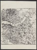
- ca. 1942]
- Call Number:
- 36 L65 1942
- Container / Volume:
- BRBL_00125
- Image Count:
- 2
- Resource Type:
- Maps, Atlases & Globes
- Found in:
- Beinecke Rare Book and Manuscript Library > [Facsimile map of Linz, Austria].
- Published / Created:
- 1919?]
- Call Number:
- 11hcf 1919B-34
- Container / Volume:
- BRBL_00010Q
- Image Count:
- 1
- Resource Type:
- Maps, Atlases & Globes
- Found in:
- Beinecke Rare Book and Manuscript Library > [Europe].
- Published / Created:
- 1860
- Call Number:
- 464 1860
- Container / Volume:
- BRBL_00261
- Image Count:
- 1
- Resource Type:
- Maps, Atlases & Globes
- Found in:
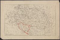
- Beinecke Rare Book and Manuscript Library > [Dalmatia].
- Published / Created:
- 1919?]
- Call Number:
- 11hcf 1919B-30
- Container / Volume:
- BRBL_00010Q
- Image Count:
- 1
- Resource Type:
- Maps, Atlases & Globes
- Found in:
- Beinecke Rare Book and Manuscript Library > [Coast of the Adriatic Sea].
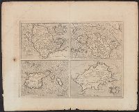
- Published / Created:
- 1633?]
- Call Number:
- 322 1633
- Container / Volume:
- BRBL_00059
- Image Count:
- 2
- Resource Type:
- Maps, Atlases & Globes
- Found in:
- Beinecke Rare Book and Manuscript Library > [Channel Islands]
- Published / Created:
- 1910?]
- Call Number:
- 41 1910
- Container / Volume:
- BRBL_00241
- Image Count:
- 1
- Resource Type:
- Maps, Atlases & Globes
- Found in:
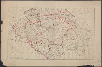
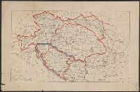
- Beinecke Rare Book and Manuscript Library > [Austrian Empire].
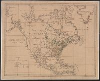
- Published / Created:
- ca. 1790?]
- Call Number:
- 71 1790C
- Container / Volume:
- BRBL_00367
- Image Count:
- 1
- Resource Type:
- Maps, Atlases & Globes
- Found in:
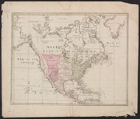
- Beinecke Rare Book and Manuscript Library > [Amérique Septentrionale].
- Published / Created:
- ca. 1790?]
- Call Number:
- 71 1790
- Container / Volume:
- BRBL_00367
- Image Count:
- 1
- Resource Type:
- Maps, Atlases & Globes
- Found in:
- Beinecke Rare Book and Manuscript Library > [Amérique Septentrionale].
- Published / Created:
- 1919
- Call Number:
- 11hcf 1919B-50
- Container / Volume:
- BRBL_00010S
- Image Count:
- 4
- Resource Type:
- Maps, Atlases & Globes
- Found in:
- Beinecke Rare Book and Manuscript Library > [4 Ethnographic Maps of Central Europe] / Dess. par A.D. Alanasiu.
- Published / Created:
- 1919]
- Call Number:
- 11hcf 1919B-48
- Image Count:
- 3
- Resource Type:
- Maps, Atlases & Globes
- Found in:
- Beinecke Rare Book and Manuscript Library > [3 maps of France showing location of German troops].
- Published / Created:
- 1880?]
- Call Number:
- 404 M76 1880
- Container / Volume:
- BRBL_00235
- Image Count:
- 1
- Resource Type:
- Maps, Atlases & Globes
- Found in:
- Beinecke Rare Book and Manuscript Library > Zocca. Fo. 87 della Carta d'Italia.
- Published / Created:
- 1919]
- Call Number:
- 11hcf 1919B-20-4
- Container / Volume:
- BRBL_00010P
- Image Count:
- 1
- Resource Type:
- Maps, Atlases & Globes
- Found in:
- Beinecke Rare Book and Manuscript Library > Yougo-Slavie.
- Published / Created:
- 1909
- Call Number:
- 56 W55 1909
- Container / Volume:
- BRBL_00297
- Image Count:
- 2
- Resource Type:
- Maps, Atlases & Globes
- Found in:
- Beinecke Rare Book and Manuscript Library > Whangpoo River Conservancy : Whangpoo River up to above Lung-Hua (Pagoda) Creek, showing the normal lines of the regulated stream and works made and designed / Surveyed and compiled by Mr. H. Chr. Müller, Surveyor.
- Published / Created:
- 188-?]
- Call Number:
- 832 W155 1888
- Container / Volume:
- BRBL_00582
- Image Count:
- 1
- Resource Type:
- Maps, Atlases & Globes
- Found in:
- Beinecke Rare Book and Manuscript Library > Wallace.
- Published / Created:
- 1925?]
- Call Number:
- 37 V645 1925
- Container / Volume:
- BRBL_00150
- Image Count:
- 2
- Resource Type:
- Maps, Atlases & Globes
- Found in:
- Beinecke Rare Book and Manuscript Library > Vevey.
- Published / Created:
- 1918
- Call Number:
- 38hc 1918 Sep. folder
- Container / Volume:
- BRBL_00172
- Image Count:
- 1
- Resource Type:
- Maps, Atlases & Globes
- Found in:
- Beinecke Rare Book and Manuscript Library > Verdun-Point-à-Mousson.
- Published / Created:
- 1880
- Call Number:
- 356 K85 1880
- Container / Volume:
- BRBL_00114
- Image Count:
- 1
- Resource Type:
- Maps, Atlases & Globes
- Found in:
- Beinecke Rare Book and Manuscript Library > Umgebungs-karte von Krakau.
- Published / Created:
- 1860?]
- Call Number:
- 428 B63 1860
- Container / Volume:
- BRBL_00248
- Image Count:
- 2
- Resource Type:
- Maps, Atlases & Globes
- Found in:
- Beinecke Rare Book and Manuscript Library > Umgebungs-Karte von Bozen.
- Published / Created:
- 1919?]
- Call Number:
- 11hcf 1919B-39
- Image Count:
- 1
- Resource Type:
- Maps, Atlases & Globes
- Found in:
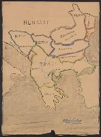
- Beinecke Rare Book and Manuscript Library > Turkey.
- Published / Created:
- 1910?]
- Call Number:
- 11hcf 1919B-38
- Container / Volume:
- BRBL_00010R
- Image Count:
- 1
- Resource Type:
- Maps, Atlases & Globes
- Found in:
- Beinecke Rare Book and Manuscript Library > Turkey.
- Published / Created:
- 1850?]
- Call Number:
- 796 St24 1850
- Container / Volume:
- BRBL_00528
- Image Count:
- 1
- Resource Type:
- Maps, Atlases & Globes
- Found in:
- Beinecke Rare Book and Manuscript Library > Town of St. Mary's, Refugio Co., Texas.
- Creator:
- Johnson, Douglas Wilson, 1878-1944
- Published / Created:
- 1916?]
- Call Number:
- 335cbf 1916
- Container / Volume:
- BRBL_00087
- Image Count:
- 1
- Resource Type:
- Maps, Atlases & Globes
- Found in:
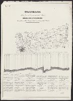
- Beinecke Rare Book and Manuscript Library > Topography of western war zone... / D.W.J.
- Creator:
- Hardee, T. S
- Published / Created:
- 1878
- Call Number:
- 795 N47 1878A
- Container / Volume:
- BRBL_00522
- Image Count:
- 1
- Resource Type:
- Maps, Atlases & Globes
- Found in:
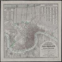
- Beinecke Rare Book and Manuscript Library > Topographical and drainage map of New Orleans and surroundings / from recent surveys and investigations by T.S. Hardee, Civil Engineer, 1878.
- Creator:
- Hardee, T. S
- Published / Created:
- 188-?].
- Call Number:
- 795 N47 1889
- Container / Volume:
- BRBL_00522
- Image Count:
- 1
- Resource Type:
- Maps, Atlases & Globes
- Found in:
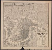
- Beinecke Rare Book and Manuscript Library > Topographical and drainage map of New Orleans / prepared for Joseph Jones, M.D., by T.S. Hardee, civil engineer.
- Published / Created:
- [ca. 1850]
- Call Number:
- 40gme 1850
- Container / Volume:
- BRBL_00230
- Image Count:
- 8
- Resource Type:
- Maps, Atlases & Globes
- Found in:
- Beinecke Rare Book and Manuscript Library > Topografia della zona di terrano corsa della strada : Profilo di livellazione delle pendenze della Strada, e della linea battuta della Strada.
- Creator:
- Rennell, James, 1742-1830
- Published / Created:
- 1800?]
- Call Number:
- 60 1792
- Container / Volume:
- BRBL_00324
- Image Count:
- 1
- Resource Type:
- Maps, Atlases & Globes
- Found in:
- Beinecke Rare Book and Manuscript Library > The route of Mr. Mungo Park : from Pisania to the River Gambia, to Silla, on the River Joliba or Niger, with his return by the southern route to Pisania / compiled from Mr. Park's observations, notes, & sketches by J. Rennell ; Scoles sculp.
- Published / Created:
- 1915?]
- Call Number:
- 331 W14 1915
- Container / Volume:
- BRBL_00080
- Image Count:
- 1
- Resource Type:
- Maps, Atlases & Globes
- Found in:
- Beinecke Rare Book and Manuscript Library > The ancient tidal channels of Walcheren.
- Published / Created:
- 1915?]
- Call Number:
- 38315gfc 1915
- Container / Volume:
- BRBL_00177
- Image Count:
- 1
- Resource Type:
- Maps, Atlases & Globes
- Found in:
- Beinecke Rare Book and Manuscript Library > The Lorraine-Saar Minefield.
- Published / Created:
- 1919?]
- Call Number:
- 11hcf 1919B-26
- Container / Volume:
- BRBL_00010Q
- Image Count:
- 1
- Resource Type:
- Maps, Atlases & Globes
- Found in:
- Beinecke Rare Book and Manuscript Library > The Caucasus.
- Published / Created:
- 191-?]
- Call Number:
- 11hcf 1919D-12
- Container / Volume:
- BRBL_00010W
- Image Count:
- 1
- Resource Type:
- Maps, Atlases & Globes
- Found in:
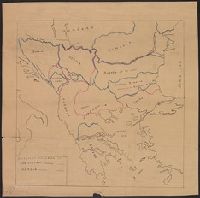
- Beinecke Rare Book and Manuscript Library > The Balkans.
- Published / Created:
- 1919?]
- Call Number:
- 11hcf 1919B-10
- Image Count:
- 1
- Resource Type:
- Maps, Atlases & Globes
- Found in:
- Beinecke Rare Book and Manuscript Library > Territoire de Moresnet. Carte No. 3.
- Published / Created:
- 1680?]
- Call Number:
- 51 1680A
- Container / Volume:
- BRBL_00278
- Image Count:
- 1
- Resource Type:
- Maps, Atlases & Globes
- Found in:
- Beinecke Rare Book and Manuscript Library > Terra sancta : sive Palestina in qua Christus peregrin atus est.
- Published / Created:
- 1946?]
- Call Number:
- 825cbf F778 1943
- Container / Volume:
- BRBL_00575
- Image Count:
- 1
- Resource Type:
- Maps, Atlases & Globes
- Found in:
- Beinecke Rare Book and Manuscript Library > Tactical map, Fort Riley & vicinity / horizontal and vertical control by U.S.G.S. & U.S.C. & G.S. ; aerial photography by Flight C 1st Photographic Squadron, A.C. Dec. 1940 ; multiplex mapping & drafting by the District Engineer, U.S.E.D. Little Rock, Ark
- Published / Created:
- 1919?]
- Call Number:
- 11hcf 1919B-49
- Image Count:
- 1
- Resource Type:
- Maps, Atlases & Globes
- Found in:
- Beinecke Rare Book and Manuscript Library > Syria.
- Published / Created:
- 1896?].
- Call Number:
- 37 1896
- Container / Volume:
- BRBL_00149
- Image Count:
- 1
- Resource Type:
- Maps, Atlases & Globes
- Found in:
- Beinecke Rare Book and Manuscript Library > Swiss Maneuvers in 1896.
- Published / Created:
- 1837?]
- Call Number:
- 796 H37 1837
- Container / Volume:
- BRBL_00527A
- Image Count:
- 1
- Resource Type:
- Maps, Atlases & Globes
- Found in:
- Beinecke Rare Book and Manuscript Library > Survey of 5 leagues of land belonging to Wm P. Harris & others / lith. of P. Snell.
- Published / Created:
- 1908
- Call Number:
- 766 Ea762 1908
- Container / Volume:
- BRBL_00468
- Image Count:
- 1
- Resource Type:
- Maps, Atlases & Globes
- Found in:
- Beinecke Rare Book and Manuscript Library > State rifle range, East Haven, Conn.
- Published / Created:
- [ca. 1940?]
- Call Number:
- 331 D72 1940
- Container / Volume:
- BRBL_00079
- Image Count:
- 2
- Resource Type:
- Maps, Atlases & Globes
- Found in:
- Beinecke Rare Book and Manuscript Library > Stadtplan von Dordrecht.
- Published / Created:
- 1953?]
- Call Number:
- 11hcf 1919A-4
- Container / Volume:
- BRBL_00010N
- Image Count:
- 1
- Resource Type:
- Maps, Atlases & Globes
- Found in:
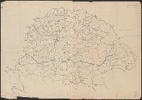
- Beinecke Rare Book and Manuscript Library > Small sketch map of Poland probably drawn by R.J. Kerner to illustrate hastily proposed Czech-Jugoslav Corridor.
- Published / Created:
- 1847?]
- Call Number:
- 815fcm 1847
- Container / Volume:
- BRBL_00561
- Image Count:
- 1
- Resource Type:
- Maps, Atlases & Globes
- Found in:
- Beinecke Rare Book and Manuscript Library > Sketch of the public surveys in Iowa.
- Published / Created:
- 1775?]
- Call Number:
- 764 B65 1775B
- Container / Volume:
- BRBL_00454
- Image Count:
- 1
- Resource Type:
- Maps, Atlases & Globes
- Found in:
- Beinecke Rare Book and Manuscript Library > Sketch of the action on the heights of Charlestown 17 June 1775 between his majestys troops under the command of M. Gnl. Howe and a large body of American rebels.
- Published / Created:
- 1875?]
- Call Number:
- 37 Z88 1875
- Container / Volume:
- BRBL_00150A
- Image Count:
- 1
- Resource Type:
- Maps, Atlases & Globes
- Found in:
- Beinecke Rare Book and Manuscript Library > Situationsplan zu dem Projecte für eine steinerne Brücke über die Limmat von der Limmatburg zum Bahnhofe in Zürich / Lith. Anstalt. v. J. Wurster u. Comp. in Winterthur.
- Published / Created:
- 1919?]
- Call Number:
- 11hcf 1919B-36
- Container / Volume:
- BRBL_00010Q
- Image Count:
- 1
- Resource Type:
- Maps, Atlases & Globes
- Found in:
- Beinecke Rare Book and Manuscript Library > Siberia.
- Published / Created:
- 1865?]
- Call Number:
- 5616 1865
- Container / Volume:
- BRBL_00299
- Image Count:
- 1
- Resource Type:
- Maps, Atlases & Globes
- Found in:
- Beinecke Rare Book and Manuscript Library > Shantung, China / compiled by Alex Armstrong, F.E.I.S.
- Published / Created:
- 1918?]
- Call Number:
- 461 1918
- Container / Volume:
- BRBL_00260
- Image Count:
- 1
- Resource Type:
- Maps, Atlases & Globes
- Found in:
- Beinecke Rare Book and Manuscript Library > Serbia's Part in the World War.
- Published / Created:
- 1874?]
- Call Number:
- 825 1874
- Container / Volume:
- BRBL_00573
- Image Count:
- 1
- Resource Type:
- Maps, Atlases & Globes
- Found in:
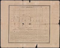
- Beinecke Rare Book and Manuscript Library > Sectional map of the Pottawattomie Reserve lands : remaining unsold July 1st 1874.
- Published / Created:
- 1919]
- Call Number:
- 45fdb 1919
- Container / Volume:
- BRBL_00258
- Image Count:
- 1
- Resource Type:
- Maps, Atlases & Globes
- Found in:
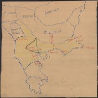
- Beinecke Rare Book and Manuscript Library > Roumanie.
- Published / Created:
- 1919]
- Call Number:
- 45fdb 1918
- Container / Volume:
- BRBL_00258
- Image Count:
- 2
- Resource Type:
- Maps, Atlases & Globes
- Found in:
- Beinecke Rare Book and Manuscript Library > Roumanie.
- Published / Created:
- 1919]
- Call Number:
- 11hcf 1919B-20-2
- Container / Volume:
- BRBL_00010P
- Image Count:
- 1
- Resource Type:
- Maps, Atlases & Globes
- Found in:
- Beinecke Rare Book and Manuscript Library > Roumanie.
- Published / Created:
- 1919]
- Call Number:
- 11hcf 1919B-20-1
- Container / Volume:
- BRBL_00010P
- Image Count:
- 1
- Resource Type:
- Maps, Atlases & Globes
- Found in:
- Beinecke Rare Book and Manuscript Library > Roumanie.
- Published / Created:
- 1919]
- Call Number:
- 11hcf 1919B-20-3
- Container / Volume:
- BRBL_00010P
- Image Count:
- 1
- Resource Type:
- Maps, Atlases & Globes
- Found in:
- Beinecke Rare Book and Manuscript Library > Roumanie = Rumania.
- Published / Created:
- 1879?]
- Call Number:
- 825 K134 1879
- Container / Volume:
- BRBL_00574
- Image Count:
- 1
- Resource Type:
- Maps, Atlases & Globes
- Found in:
- Beinecke Rare Book and Manuscript Library > Riverview, Wyandott County, Kansas / surveyed April 2nd 1879 by Dan'l OFlaherty, civil eng'r. Kansas City and surroundings / compiled and drawn by D.M. Smith, Wyandott, Kansas ; Ramsey, Millett & Hudson, map engravers, Kns. City Mo.
- Published / Created:
- 1860?]
- Call Number:
- 40 V867 1860A
- Container / Volume:
- BRBL_00227
- Image Count:
- 1
- Resource Type:
- Maps, Atlases & Globes
- Found in:
- Beinecke Rare Book and Manuscript Library > Provincia di Pavia, Comune di Voghera : Quadro d'unione.