Search
You Searched For
Search Results
- Published / Created:
- [1880?].
- Call Number:
- 762 W588 1880
- Container / Volume:
- BRBL_00451
- Image Count:
- 1
- Resource Type:
- Maps, Atlases & Globes
- Found in:
- Beinecke Rare Book and Manuscript Library > A topographical map of the White Mountains of New Hampshire / by C.H. Hancock.
- Creator:
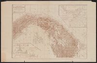
- Wyse, Lucien N. B. (Lucien Napoléon Bonaparte), 1845-1909
- Published / Created:
- 1886
- Call Number:
- 899 1885
- Container / Volume:
- BRBL_00660
- Image Count:
- 1
- Resource Type:
- Maps, Atlases & Globes
- Found in:
- Beinecke Rare Book and Manuscript Library > Carte général de l'Isthme Colombien / dressée par Lucien N.B. Wyse, Chef des Commissions internationales d'exploration de 1876-77-78 ; d'après les travaux exécutés sous sa direction et les documents les plus récents.
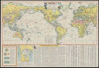
- Creator:
- Esso Marketers
Esso Standard Oil Company
General Drafting Company
- Published / Created:
- [1942?]
- Call Number:
- 11hd 1942
- Image Count:
- 2
- Resource Type:
- Maps, Atlases & Globes
- Found in:
- Beinecke Rare Book and Manuscript Library > Esso war map, featuring transportation, the key to every successful campaign : edited and published by the makers of the well known Esso Road Maps / Esso Marketers.
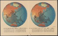
- Creator:
- Harrison, Richard Edes
- Published / Created:
- 1942
- Call Number:
- 11hd 1942B
- Container / Volume:
- BRBL_00010ZB
- Image Count:
- 2
- Resource Type:
- Maps, Atlases & Globes
- Found in:
- Beinecke Rare Book and Manuscript Library > Japan's empire was won at bargain prices... / drawn by Richard Edes Harrison.
- Published / Created:
- [1846?]
- Call Number:
- 796hc 1846
- Image Count:
- 1
- Resource Type:
- Maps, Atlases & Globes
- Found in:
- Beinecke Rare Book and Manuscript Library > Map of Texas.
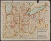
- Published / Created:
- 1915
- Call Number:
- 754gme 1915
- Container / Volume:
- BRBL_00420
- Image Count:
- 2
- Resource Type:
- Maps, Atlases & Globes
- Found in:
- Beinecke Rare Book and Manuscript Library > Official Interurban map issued by the Terre Haute, Indianapolis & Eastern Traction Company : 425 miles in Indiana and Illinois, connecting with interurban railways in Indiana, Ohio, and Michigan.
- Creator:
- Saunders, Charles Francis, 1859-1941
- Published / Created:
- 1901
- Call Number:
- 834 L46 1901
- Container / Volume:
- BRBL_00589
- Image Count:
- 1
- Resource Type:
- Maps, Atlases & Globes
- Found in:
- Beinecke Rare Book and Manuscript Library > The Leadville mining district / compiled from official records and other reliable sources, by Chas. F. Saunders.
- Creator:
- Harrison, Richard Edes
- Published / Created:
- 1943
- Call Number:
- 11hd 1943A
- Container / Volume:
- BRBL_00010ZE
- Image Count:
- 2
- Resource Type:
- Maps, Atlases & Globes
- Found in:
- Beinecke Rare Book and Manuscript Library > The Not-so-soft underside/ drawn by Richard Edes Harrison.
- Published / Created:
- [1944?]
- Call Number:
- BrSides Folio 2017 106
- Image Count:
- 1
- Resource Type:
- Maps, Atlases & Globes
- Found in:
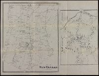
- Beinecke Rare Book and Manuscript Library > Town of New Canaan, Fairfield Co., Conn.
- Creator:
- Taylor, George Rogers, 1895-1983
- Published / Created:
- c1956.
- Call Number:
- 753gme 1861
- Container / Volume:
- BRBL_00415
- Image Count:
- 3
- Resource Type:
- Maps, Atlases & Globes
- Found in:
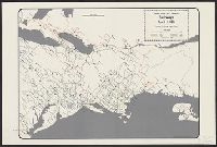
- Beinecke Rare Book and Manuscript Library > United States and Canadian railways, April 1, 1861 / compiled by George Rogers Taylor ; Robert L. Williams, map maker.