Search
You Searched For
Search Results
- Creator:
- Brodie, Paul
- Published / Created:
- 1884
- Call Number:
- 75EA 1884
- Container / Volume:
- BRBL_00409
- Image Count:
- 1
- Resource Type:
- Maps, Atlases & Globes
- Subject (Topic):
- Indian reservations--United States
- Found in:
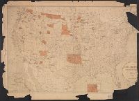
- Beinecke Rare Book and Manuscript Library > Map showing the location of the Indian reservations within the limits of the United States and territories / compiled from official and other authentic sources under the direction of Hiram Price, Commissioner of Indian Affairs ; Paul Brodie, draughtsman.
- Published / Created:
- 1880?]
- Call Number:
- 75 1880I
- Container / Volume:
- BRBL_00407
- Image Count:
- 1
- Resource Type:
- Maps, Atlases & Globes
- Subject (Geographic):
- United States--Maps
- Found in:
- Beinecke Rare Book and Manuscript Library > Map showing Indian reservations in the United States west of the 84th meridian and number of Indians belonging thereto, 1880.
- Creator:
- Glümer, J. v
- Published / Created:
- 1883?]
- Call Number:
- 847 1883
- Container / Volume:
- BRBL_00625
- Image Count:
- 1
- Resource Type:
- Maps, Atlases & Globes
- Subject (Geographic):
- Canada--Boundaries--United States--Maps
- Found in:
- Beinecke Rare Book and Manuscript Library > Map of the n.w. boundaries of the United States / compiled in 1883 under the direction of Bvt. Brig. Gen'l. O.M. Poe, U.S. Army Lt. Col. of Engineers, Col. & A.D.C. ; compiled & drawn by J. von Glümer.
- Creator:
- Geological Survey (U.S.)
- Published / Created:
- 193-?]
- Call Number:
- 71 1755Q
- Container / Volume:
- BRBL_00364
- Image Count:
- 4
- Resource Type:
- Maps, Atlases & Globes
- Subject (Geographic):
- United States--Boundaries--Maps--Early
- Found in:
- Beinecke Rare Book and Manuscript Library > The Mitchell map of the British and French dominions in North America, 1755.