Search
You Searched For
Search Results
- Creator:
- United States Coast Survey
- Published / Created:
- 1869
- Call Number:
- 848 1869
- Container / Volume:
- BRBL_00630
- Image Count:
- 1
- Resource Type:
- Maps, Atlases & Globes
- Found in:
- Beinecke Rare Book and Manuscript Library > Alaska and adjoining territory / drawn by H. Lindenkohl.
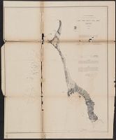
- Creator:
- Peirce, Benjamin, 1809-1880
United States Coast Survey
- Published / Created:
- 1869
- Call Number:
- 846cea Or4 1869
- Container / Volume:
- BRBL_00623
- Image Count:
- 1
- Resource Type:
- Maps, Atlases & Globes
- Found in:
- Beinecke Rare Book and Manuscript Library > Cape Orford and reef, Oregon / U.S. Coast Survey, Benjamin Peirce, superintendant ; triangulation by A.W. Chase, sub-assistant in 1869 ; topography by A.M. Harrison, assist. and A.W. Chase, sub-assistant in 1851 & '69 ; hydrography by Commander J. Alden U
- Creator:
- United States Coast Survey
- Published / Created:
- 1883
- Call Number:
- 761CEB 1883
- Container / Volume:
- BRBL_00449
- Image Count:
- 1
- Resource Type:
- Maps, Atlases & Globes
- Found in:
- Beinecke Rare Book and Manuscript Library > Gulf of Maine, current stations / United States Coast Survey.
- Creator:
- United States Coast Survey
- Published / Created:
- [ca. 1864]
- Call Number:
- 783hc 1864A
- Container / Volume:
- BRBL_00512
- Image Count:
- 1
- Resource Type:
- Maps, Atlases & Globes
- Found in:
- Beinecke Rare Book and Manuscript Library > Middle Virginia and North Carolina / compiled at the U.S. Coast Survey Office, drawn by H. Lindenkohl ; Chas. G. Krebs, lith.
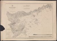
- Creator:
- United States Coast Survey
- Published / Created:
- 1863
- Call Number:
- 787 1863
- Container / Volume:
- BRBL_00516
- Image Count:
- 1
- Resource Type:
- Maps, Atlases & Globes
- Found in:
- Beinecke Rare Book and Manuscript Library > Northern Georgia with portions of adjacent states / U.S. Coast Survey, A.D. Bache, supt.
- Creator:
- United States Coast Survey
- Published / Created:
- [1875]
- Call Number:
- 764cea SA32 1875
- Container / Volume:
- BRBL_00461
- Image Count:
- 1
- Resource Type:
- Maps, Atlases & Globes
- Found in:
- Beinecke Rare Book and Manuscript Library > Salem harbor, Massachusetts / United States Coast Survey ; topography by F. Dankworth ; sand by H.M. Knight ; lettering by J. Knight & S.E. Stull ; views by G. McCoy.
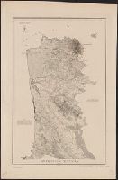
- Creator:
- United States Coast Survey
- Published / Created:
- 1869
- Call Number:
- 844 Sa52 1869A
- Container / Volume:
- BRBL_00608
- Image Count:
- 1
- Resource Type:
- Maps, Atlases & Globes
- Found in:
- Beinecke Rare Book and Manuscript Library > San Francisco Peninsula / U.S. Coast Survey.
- Creator:
- United States Coast Survey
- Published / Created:
- 1869
- Call Number:
- 844 Sa52 1869
- Container / Volume:
- BRBL_00608
- Image Count:
- 1
- Resource Type:
- Maps, Atlases & Globes
- Found in:
- Beinecke Rare Book and Manuscript Library > San Francisco Peninsula / U.S. Coast Survey.
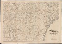
- Creator:
- United States Coast Survey
- Published / Created:
- 1865
- Call Number:
- 754 1865A
- Container / Volume:
- BRBL_00417
- Image Count:
- 1
- Resource Type:
- Maps, Atlases & Globes
- Found in:
- Beinecke Rare Book and Manuscript Library > Southern Georgia and part of South Carolina / U.S. Coast Survey, A.D. Bache, supdt. ; drawn by A. Lindenkohl.
- Creator:
- United States Coast Survey
- Published / Created:
- 1865
- Call Number:
- 754 1865C
- Container / Volume:
- BRBL_00417
- Image Count:
- 1
- Resource Type:
- Maps, Atlases & Globes
- Found in:
- Beinecke Rare Book and Manuscript Library > Southern Georgia and part of South Carolina / U.S. Coast Survey, A.D. Bache, supdt. ; drawn by A. Lindenkohl; Chas. G. Krebs, lith.