Skip to search
Skip to main content
Skip to first result
Search
You Searched For
Extent of Digitization
Completely digitized
Genre
Maps
Publication Place
[Washington, D.C.] :
New Search
Search Results
Creator:
Published / Created:
1945
Call Number:
36gf 1941C
Container / Volume:
BRBL_00129
Image Count:
1
Resource Type:
Maps, Atlases & Globes
Description:
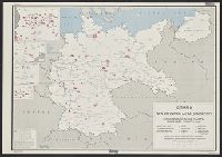
"No. 6434-R. & A., OSS, 1 May 1945.", "This map supplements no. 6307-R.& A., OSS, Germany: Principal industries.", and Includes 4 insets.
Publisher:
R. & A., OSS,
Subject (Geographic):
Germany--Maps
Subject (Topic):
Chemical industry--Germany--Military aspects--Maps
Found in:
Beinecke Rare Book and Manuscript Library > Germany, distribution of the war chemicals industry (explosives, poison gas) (1941).
Creator:
Published / Created:
1945
Call Number:
36gme 1945A
Container / Volume:
BRBL_00132
Image Count:
1
Resource Type:
Maps, Atlases & Globes
Description:
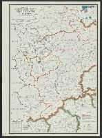
"No. 6368." and Includes insets: Location. Upper Silesian industrial area.
Publisher:
Research and Analysis Branch, Office of Strategic Services,
Subject (Topic):
Railroads--Germany--Maps and Railroads--Poland--Maps
Found in:
Beinecke Rare Book and Manuscript Library > Germany, eastern border regions : rail traffic volume.
Creator:
Published / Created:
1943
Call Number:
36fab 1943A
Container / Volume:
BRBL_00128
Image Count:
1
Resource Type:
Maps, Atlases & Globes
Description:
"Map no., 2904, 21 December 1943." and Names of individual countries overprinted on map.
Publisher:
R & A, OSS,
Subject (Geographic):
Europe, Central--Administrative and political divisions--Maps and Germany--Administrative and political divisions--Maps
Found in:
Beinecke Rare Book and Manuscript Library > Germany, major political boundaries / compiled and drawn in the Branch of Research and Analysis, OSS.
Creator:
Published / Created:
1945
Call Number:
36gf 1941F
Container / Volume:
BRBL_00129
Image Count:
1
Resource Type:
Maps, Atlases & Globes
Description:
"Map no. 6430 - R & A, OSS, 1 May 1945.", "This map supplements no. 6337 - R & A, OSS, Germany: principal industries.", and Includes 4 insets.
Publisher:
R & A, OSS,
Subject (Topic):
Metal trade--Germany--Maps
Found in:
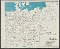
Beinecke Rare Book and Manuscript Library > Germany, non-ferrous metals industry (excluding light metals, including semi-finished products) (1941).
Creator:
Published / Created:
1945
Call Number:
36fb 1945C
Container / Volume:
BRBL_00128
Image Count:
1
Resource Type:
Maps, Atlases & Globes
Description:
"No. 6245." and Location map inset.
Publisher:
R & A, OSS,
Subject (Geographic):
Germany (West)--Administrative and political divisions--Maps
Found in:
Beinecke Rare Book and Manuscript Library > Germany, western border regions, administrative divisions.
Creator:
Published / Created:
1945
Call Number:
36gfa 1945
Container / Volume:
BRBL_00130
Image Count:
1
Resource Type:
Maps, Atlases & Globes
Description:
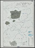
"No. 6249.", Index to valley dams., and Location map inset.
Publisher:
R & A, OSS,
Subject (Geographic):
Germany (West)--Maps
Subject (Topic):
Water-supply--Germany (West)--Maps
Found in:
Beinecke Rare Book and Manuscript Library > Germany, western border regions, stream control and industrial water supply.
Creator:
Published / Created:
1946
Call Number:
36fd 1946
Container / Volume:
BRBL_00129
Image Count:
1
Resource Type:
Maps, Atlases & Globes
Description:
"10139 March 1946." and Inset map: Greater Berlin.
Publisher:
Dept. of State, Division of Map Intelligence and Cartography,
Subject (Geographic):
Germany--Administrative and political divisions--Maps
Found in:
Beinecke Rare Book and Manuscript Library > Germany, zones of occupation.
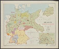
Creator:
Published / Created:
1940
Call Number:
80gcg 1940
Container / Volume:
BRBL_00537
Image Count:
1
Resource Type:
Maps, Atlases & Globes
Description:
"Albuquerque drafting office C.C.C., December 1940, Troy Robinson, enrollee draftsman." and Includes national forests, military and Indian reservations, grazing districts, and national parks and monuments.
Publisher:
The Service,
Subject (Topic):
Grazing districts--West (U.S.)--Maps
Found in:
Beinecke Rare Book and Manuscript Library > Grazing districts under Taylor Grazing Act / United States Department of the Interior, Grazing Service.
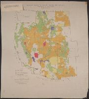
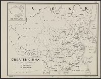
Creator:
Published / Created:
1944
Call Number:
56fb 1944
Container / Volume:
BRBL_00298
Image Count:
1
Resource Type:
Maps, Atlases & Globes
Description:
"3 August 1944.", "Free.", "No. 3448.", DLC, Includes inset "Areal [sic] comparison of greater China with the United States.", LC copy mounted on cloth and laminated., and LC copy stamped on: 44B.
Publisher:
Lithographed in the Reproduction Branch, OSS,
Subject (Geographic):
China--Maps
Found in:
Beinecke Rare Book and Manuscript Library > Greater China [cartographic material] / R & A, OSS.
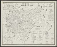
Creator:
Published / Created:
1945
Call Number:
36fb 1945A
Container / Volume:
BRBL_00128
Image Count:
1
Resource Type:
Maps, Atlases & Globes
Description:
"No. 6289 - R & A, OSS, 17 March 1945.", Designed to be colored., and Includes 2 insets.
Publisher:
R & A, OSS,
Subject (Geographic):
Europe, Central--Administrative and political divisions--Maps and Germany--Administrative and political divisions--Maps
Found in:
Beinecke Rare Book and Manuscript Library > Greater Germany, Kreis boundaries, July 1, 1944.
Branch:v1.61.6 ,Deployed:2024-06-12T09:55:36-04:00