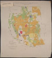
"Albuquerque drafting office C.C.C., December 1940, Troy Robinson, enrollee draftsman." and Includes national forests, military and Indian reservations, grazing districts, and national parks and monuments.
United States. Office of Strategic Services. Research and Analysis Branch
Published / Created:
1944
Call Number:
56fb 1944
Container / Volume:
BRBL_00298
Image Count:
1
Resource Type:
Maps, Atlases & Globes
Description:
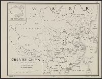
"3 August 1944.", "Free.", "No. 3448.", DLC, Includes inset "Areal [sic] comparison of greater China with the United States.", LC copy mounted on cloth and laminated., and LC copy stamped on: 44B.
United States. Office of Strategic Services. Research and Analysis Branch
Published / Created:
1945
Call Number:
36fb 1945
Container / Volume:
BRBL_00128
Image Count:
1
Resource Type:
Maps, Atlases & Globes
Description:
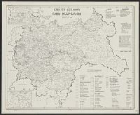
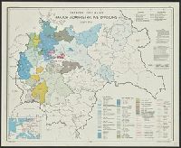
"FREE"--Upper right border and center lower border., "No. 5408 -- R & A, OSS, rev. 1 May, 1945.", Includes location map, "Reliability of data" table, and notes., and Indexed for administrative units.
Publisher:
R & A, OSS,
Subject (Geographic):
Europe, Central--Administrative and political divisions--Maps and Germany--Administrative and political divisions--Maps
Subject (Name):
United States. Office of Strategic Services. Reproduction Branch
"Plate No. 1446.", Also shows tide rips, direction and strength of currents, and shoals on George's Bank and Cashe's Ledge., and Depths shown by soundings, isolines, form lines, and shading.
Publisher:
The Survey,
Subject (Geographic):
Maine, Gulf of--Maps and North Atlantic Ocean--Maps
Subject (Topic):
Nautical charts--Maine, Gulf of and Nautical charts--North Atlantic Ocean
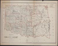
Includes dates of treaties with Indian nations., Library's copy annotated in black ink., Prime meridians: Washington and Greenwich., Relief shown by hachures., and Shows wagon roads, trails, railroads and natural features.