Skip to search
Skip to main content
Skip to first result
Search
You Searched For
"Interiors"
Language
English
Publication Place
[Washington, D.C.] :
New Search
Search Results
Creator:
Published / Created:
1940
Call Number:
80gcg 1940
Container / Volume:
BRBL_00537
Image Count:
1
Resource Type:
Maps, Atlases & Globes
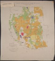
Description:
"Albuquerque drafting office C.C.C., December 1940, Troy Robinson, enrollee draftsman." and Includes national forests, military and Indian reservations, grazing districts, and national parks and monuments.
Publisher:
The Service,
Subject (Topic):
Grazing districts--West (U.S.)--Maps
Found in:
Beinecke Rare Book and Manuscript Library > Grazing districts under Taylor Grazing Act / United States Department of the Interior, Grazing Service.
Creator:
Published / Created:
1918
Call Number:
848 M41 1918
Container / Volume:
BRBL_00634
Image Count:
1
Resource Type:
Maps, Atlases & Globes
Alternative Title:
Alaska ; 602 A and Lower Matanuska Valley, Alaska
Description:
"Surveyed in 1909 and 1913 ; topography by Alaskan Branch, R.H. Sargent, topographic engineer.", Includes regional location map., and Relief shown by contours and spot heights.
Publisher:
The Survey,
Subject (Geographic):
Matanuska River Valley (Alaska)--Maps
Found in:
Beinecke Rare Book and Manuscript Library > Topographic map of Lower Matanuska Valley, Alaska / Department of the Interior, U.S. Geological Survey.
Creator:
Published / Created:
1869
Call Number:
848 1869
Container / Volume:
BRBL_00630
Image Count:
1
Resource Type:
Maps, Atlases & Globes
Description:
the interior from a reconnaissance by W.H
Publisher:
U.S. Coast Survey,
Subject (Geographic):
Alaska--Maps and Yukon Territory--Maps
Subject (Name):
Dall, William Healey, 1845-1927 and Lindenkohl, H. (Henry)
Found in:
Beinecke Rare Book and Manuscript Library > Alaska and adjoining territory / drawn by H. Lindenkohl.
Creator:
Published / Created:
[1918]
Call Number:
844fcm Y83 1918
Container / Volume:
BRBL_00615
Image Count:
1
Resource Type:
Maps, Atlases & Globes
Alternative Title:
Yosemite Valley, Yosemite National Park, California
Description:
Interior .
Publisher:
U.S. Geological Survey,
Subject (Geographic):
Yosemite Valley (Calif.)--Maps
Subject (Name):
Douglas, Edward Morehouse, 1855-1932, Marshall, R. B. (Robert Bradford), 1867-1949, Matthes, François, 1874-1948, and Urquhart, C. F
Found in:
Beinecke Rare Book and Manuscript Library > Map of Yosemite Valley, Yosemite National Park, California, Mariposa County / U.S. Geological Survey ; State of California ; E.M. Douglas, geographer ; R.B. Marshall, in charge of section ; topography by F.E. Matthes ; triangulation by C.F. Urquhart.
Creator:
Published / Created:
1869
Call Number:
844 Sa52 1869A
Container / Volume:
BRBL_00608
Image Count:
1
Resource Type:
Maps, Atlases & Globes
Alternative Title:
[Chart] ; no. 628
Description:
supplementary surveys of the interior made ... in
Publisher:
The Survey,
Subject (Geographic):
San Francisco (Calif.)--Maps and San Francisco Peninsula (Calif.)--Maps
Subject (Name):
Davidson, George, 1825-1911 and U.S. Coast and Geodetic Survey
Found in:
Beinecke Rare Book and Manuscript Library > San Francisco Peninsula / U.S. Coast Survey.
Creator:
Published / Created:
[1941]
Call Number:
80ex 1941
Container / Volume:
BRBL_00537
Image Count:
2
Resource Type:
Maps, Atlases & Globes
Description:
"U.S. G.P.O. 1941--O-325724.", Ill. surround map., Ill., text, and 4 local route maps on verso., and Text "information revised as of June 1, 1941."
Publisher:
National Park Service,
Subject (Name):
Black, John J
Subject (Topic):
National parks and reserves--Southwest, New--Maps
Found in:
Beinecke Rare Book and Manuscript Library > Southwestern national monuments / United States Department of the Interior, National Park Service ; J.J. Black, 1939.
Creator:
Published / Created:
1911
Call Number:
75cbf 1911S
Container / Volume:
BRBL_00408
Image Count:
1
Resource Type:
Maps, Atlases & Globes
Description:
Relief shown by hypsometric tints and contours.
Publisher:
The Survey,
Subject (Geographic):
United States--Maps
Subject (Name):
Gannett, Henry, 1846-1914
Found in:
Beinecke Rare Book and Manuscript Library > United States relief map / U.S. Geological Survey, Department of the Interior ; compiled by Henry Gannett.
Creator:
Published / Created:
1869
Call Number:
844 Sa52 1869
Container / Volume:
BRBL_00608
Image Count:
1
Resource Type:
Maps, Atlases & Globes
Description:
supplementary surveys of the interior made ... in
Publisher:
The Survey,
Subject (Geographic):
San Francisco (Calif.)--Maps and San Francisco Peninsula (Calif.)--Maps
Subject (Name):
Davidson, George, 1825-1911
Found in:
Beinecke Rare Book and Manuscript Library > San Francisco Peninsula / U.S. Coast Survey.
Creator:
Published / Created:
[1872]
Call Number:
833 Y38 1871B
Container / Volume:
BRBL_00584
Image Count:
1
Resource Type:
Maps, Atlases & Globes
Description:
Interior , U.S. Geological Survey of the
Publisher:
Geological Survey of the Territories,
Subject (Geographic):
Yellowstone Lake (Wyo.)--Maps and Yellowstone National Park--Maps
Subject (Name):
Elliott, Henry Wood, 1846-1930, Geological Survey of the Territories (U.S.), Hayden, F. V. (Ferdinand Vandeveer), 1829-1887, and Schönborn, A
Found in:
Beinecke Rare Book and Manuscript Library > Yellowstone Lake, Wyoming Territory / surveyed by the party in charge of F.V. Hayden ; compiled and drawn by E. Hergesheimer from field notes and sketches of A. Schönborn & H.W. Elliott.
Creator:
Published / Created:
1898
Call Number:
848 1898J
Container / Volume:
BRBL_00630
Image Count:
1
Resource Type:
Maps, Atlases & Globes
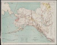
Description:
Interior , General Land Office, Hon. Binger
Publisher:
General Land Office,
Subject (Geographic):
Alaska--Maps
Subject (Name):
Norris Peters Co and United States. General Land Office
Found in:
Beinecke Rare Book and Manuscript Library > Map of Alaska / compiled from the official records of the General Land Office, U.S. Coast & Geodetic Survey, U.S. Geological Survey, Canadian and other sources, under the direction of Harry King ; compiled and drawn by M. Hendges.
Branch:v1.61.6 ,Deployed:2024-06-12T09:55:36-04:00