Search
You Searched For
Search Results
- Creator:
- United States. Office of Farm Management
- Published / Created:
- 1915
- Call Number:
- 75gce 1915
- Container / Volume:
- BRBL_00410
- Image Count:
- 1
- Resource Type:
- Maps, Atlases & Globes
- Found in:
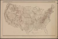
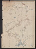
- Beinecke Rare Book and Manuscript Library > Irrigation map of the United States / engraved and printed by the U.S. Geological Survey ; outline of irrigated areas based upon data collected by the Bureau of the Census, 1910 ; revised by Irrigation Division, Office of Experimental Stations, and by the
- Creator:
- Selden, Henry S
- Published / Created:
- 1899
- Call Number:
- 80 1899
- Container / Volume:
- BRBL_00536
- Image Count:
- 1
- Resource Type:
- Maps, Atlases & Globes
- Found in:
- Beinecke Rare Book and Manuscript Library > Map of Texas and parts of adjoining territories / compiled by and under the direction of Robert T. Hill ; drawn by Henry S. Selden and Willard D. Johnson.
- Creator:
- Richardson, G. B
- Published / Created:
- 1921
- Call Number:
- 774gbc 1921
- Container / Volume:
- BRBL_00501A
- Image Count:
- 1
- Resource Type:
- Maps, Atlases & Globes
- Found in:
- Beinecke Rare Book and Manuscript Library > Oil and gas fields of Pennsylvania / compiled under the direction of G.B. Richardson.
- Creator:
- United States. Department of Agriculture. Division of Publications
- Published / Created:
- 1910
- Call Number:
- 75fb 1910
- Container / Volume:
- BRBL_00410
- Image Count:
- 1
- Resource Type:
- Maps, Atlases & Globes
- Found in:
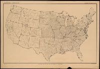
- Beinecke Rare Book and Manuscript Library > Outline map of the United States by counties / engraved and printed by the U.S. Geological Survey.
- Creator:
- United States. Department of Agriculture. Division of Publications
- Published / Created:
- 1915
- Call Number:
- 75eb 1910B
- Container / Volume:
- BRBL_00410
- Image Count:
- 1
- Resource Type:
- Maps, Atlases & Globes
- Found in:
- Beinecke Rare Book and Manuscript Library > Outline map of the United States by counties / engraved and printed by the U.S. Geological Survey.
- Creator:
- Renshawe, J. H. (John Henry), 1852-
- Published / Created:
- [1914?]
- Call Number:
- 846am C855 1914
- Container / Volume:
- BRBL_00623
- Image Count:
- 1
- Resource Type:
- Maps, Atlases & Globes
- Found in:
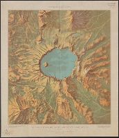
- Beinecke Rare Book and Manuscript Library > Panoramic View of the Crater Lake National Park, Oregon / prepared by John H. Renshawe from topographic sheet of the United States Geological Survey.
- Creator:
- Renshawe, John H
- Published / Created:
- [1930?]
- Call Number:
- 844am Y83 1930
- Container / Volume:
- BRBL_00612
- Image Count:
- 1
- Resource Type:
- Maps, Atlases & Globes
- Found in:
- Beinecke Rare Book and Manuscript Library > Panoramic view of the Yosemite National Park, California.
- Creator:
- Brooks, Alfred H. (Alfred Hulse), 1871-1924
- Published / Created:
- 1904
- Call Number:
- 848 M215 1904
- Container / Volume:
- BRBL_00634
- Image Count:
- 1
- Resource Type:
- Maps, Atlases & Globes
- Found in:
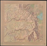
- Beinecke Rare Book and Manuscript Library > Reconnaissance map of Mt. McKinley region, Alaska / Alfred H. Brooks, geologist in charge. Topography by D.L. Reaburn. Surveyed in 1902. Additional information compiled from surveys by U.S. Geo. Surveys and U.S. Army.
- Creator:
- Dinsmore, A. F
- Published / Created:
- 1919
- Call Number:
- 841fcm 1919
- Container / Volume:
- BRBL_00597
- Image Count:
- 1
- Resource Type:
- Maps, Atlases & Globes
- Found in:
- Beinecke Rare Book and Manuscript Library > State of New Mexico / compiled by A.F. Dinsmore ; traced and lettered by Wm. Bauman ; engraved and printed by the U.S. Geological Survey.
- Creator:
- Gannett, Henry, 1846-1914
- Published / Created:
- [1904]
- Call Number:
- 754cbf 1904
- Container / Volume:
- BRBL_00417
- Image Count:
- 1
- Resource Type:
- Maps, Atlases & Globes
- Found in:
- Beinecke Rare Book and Manuscript Library > United States contour map / U.S. Geological Survey ; compiled by Henry Gannett.