Search
You Searched For
Search Results
- Published / Created:
- .
- Call Number:
- 75H 1895
- Container / Volume:
- BRBL_00414A
- Image Count:
- 1
- Resource Type:
- Maps, Atlases & Globes
- Subject (Geographic):
- United States--Maps
- Found in:
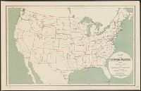
- Beinecke Rare Book and Manuscript Library > Map of the United States showing Military Posts and Principal Lines of Communication / Prepared by direction of the Secretary of War in the Office of the Chief of Engineers U.S.A.
- Creator:
- Steiger, W. T
- Published / Created:
- 1854
- Call Number:
- 75gme 1854
- Container / Volume:
- BRBL_00411
- Image Count:
- 2
- Resource Type:
- Maps, Atlases & Globes
- Subject (Topic):
- Railroads--United States--Maps
- Found in:
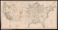
- Beinecke Rare Book and Manuscript Library > Diagram of the United States of America, Mexico, the West India Islands and Isthmus of Darien : showing proposed routes of the Pacific Rail Road ... / by W. T. Steiger, General Land Office ; Lith. by A. Hoen & Co. Baltimore.
- Creator:
- United States. General Land Office
- Published / Created:
- 1866
- Call Number:
- 75 1866
- Container / Volume:
- BRBL_00403
- Image Count:
- 1
- Resource Type:
- Maps, Atlases & Globes
- Subject (Geographic):
- United States--Surveys--Maps
- Subject (Topic):
- States--Maps
- Found in:
- Beinecke Rare Book and Manuscript Library > Map of the United States and territories : shewing the extent of public surveys and other details / constructed from the plats and official sources of the General Land Office, under the direction of Hon. Jos. S. Wilson, Commissioner, by Theodore Franks, d
- Creator:
- United States. General Land Office
- Published / Created:
- [1868]
- Call Number:
- 75 1868C
- Container / Volume:
- BRBL_00404
- Image Count:
- 2
- Resource Type:
- Maps, Atlases & Globes
- Subject (Geographic):
- United States--Surveys--Maps
- Subject (Topic):
- States--Maps
- Found in:
- Beinecke Rare Book and Manuscript Library > Map of the United States and territories, showing the extent of public surveys and other details / constructed from the plats and official sources of the General Land Office, under the direction of the Hon. Jos. S. Wilson, commissioner, by Joseph Gorlinsk
- Creator:
- Freyhold, Edward
- Published / Created:
- 1870
- Call Number:
- 75 1870A
- Container / Volume:
- BRBL_00404
- Image Count:
- 4
- Resource Type:
- Maps, Atlases & Globes
- Subject (Geographic):
- United States--Maps
- Subject (Topic):
- Military bases--United States--Maps
- Found in:
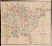
- Beinecke Rare Book and Manuscript Library > Military map of the United States / compiled and drawn by E. Freyhold.
- Published / Created:
- 1878
- Call Number:
- 75gme 1878
- Container / Volume:
- BRBL_00412
- Image Count:
- 1
- Resource Type:
- Maps, Atlases & Globes
- Subject (Geographic):
- United States--Maps
- Subject (Topic):
- Land grants--United States--Maps
- Found in:
- Beinecke Rare Book and Manuscript Library > Map of the United States : exhibiting the grants of lands made by the General government to aid the construction of railroads and wagon roads / Dept. of the Interior. U.S. Geographical and Geological Survey of the Rocky Mountain Region J.W. Powell, in Cha
- Published / Created:
- 1878
- Call Number:
- 75GM 1878
- Container / Volume:
- BRBL_00410
- Image Count:
- 1
- Resource Type:
- Maps, Atlases & Globes
- Subject (Geographic):
- United States--Maps
- Subject (Topic):
- Land grants--United States--Maps
- Found in:
- Beinecke Rare Book and Manuscript Library > Map of the United States : exhibiting the grants of lands made by the General government to aid the construction of railroads and wagon roads / Dept. of the Interior. U.S. Geographical and Geological Survey of the Rocky Mountain Region J.W. Powell, in Cha
- Creator:
- U.S. Coast and Geodetic Survey
- Published / Created:
- 1880
- Call Number:
- 75AK 1880
- Container / Volume:
- BRBL_00407A
- Image Count:
- 1
- Resource Type:
- Maps, Atlases & Globes
- Subject (Geographic):
- United States--Maps
- Found in:
- Beinecke Rare Book and Manuscript Library > Base-map of the United States / Drawn and engraved by A. and H. Lindenkohl.
- Creator:
- Winship, W. W
- Published / Created:
- 1889
- Call Number:
- 75 1889
- Container / Volume:
- BRBL_00407
- Image Count:
- 4
- Resource Type:
- Maps, Atlases & Globes
- Subject (Geographic):
- United States--Maps
- Subject (Topic):
- Military bases--United States--Maps
- Found in:
- Beinecke Rare Book and Manuscript Library > Map of the United States / prepared in the Office of the Chief of Engineers, U.S.A., by W.W. Winship, under the direction of Brig. Gen. John Newton, Chief of Eng., Bvt. Major General, U.S.A.