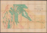
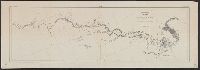
Chart including Smith Strait, Peabody Bay, and Kennedy Channel along Grinnellland [i.e. Grinnell Peninsula], Arctic Canada.
Description:
"Ackerman Lith.", Senate Ex. Doc., 1st session, 34th Congress ; no.1., and With detailed tracks and location of caches, as well as Esquimaux village sites.
Below scale: U.S. Geological Survey., Relief shown by contours and spot heights., and Shows trails in lands around San Bernardino National Forest and Agua Caliente Indian Reservation in Riverside County, Calif.
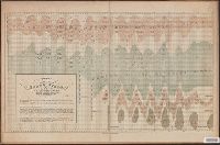
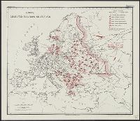
Geological and Geographical Survey of the Territories (U.S.)
Published / Created:
[1879]
Call Number:
833g 1879
Container / Volume:
BRBL_00586
Image Count:
1
Resource Type:
Maps, Atlases & Globes
Description:
"April 1879.", Includes notes., Relief shown by spot heights., Shows forests, vegetation, rock and coal, and arable lands., and To accompany the Survey's 13th (?) annual report.
Publisher:
Julius Bien, Lith., and The Survey ;
Subject (Name):
Hayden, F. V. (Ferdinand Vandeveer), 1829-1887
Subject (Topic):
Land capability for agriculture--Idaho--Maps, Land capability for agriculture--Utah--Maps, Land capability for agriculture--Wyoming--Maps, Natural resources--Idaho--Maps, and Natural resources--Utah--Maps
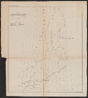
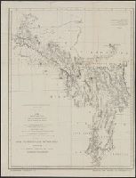
Explorations in Nevada and Arizona. and Preliminary topographical map embracing in skeleton a portion only of the notes from surveys made in accordance with Par.II Special Orders No. 109 War Dept., March 18th, 1871 and letter of instructions of Brig. General
Description:
"Note: This map is a hasty and partial compilation from the topographical data already received, many still remaining en route.", In upper margin: Explorations, and Preliminary report of explorations in Nevada and Arizona. 1872.
Publisher:
G.P.O.?,
Subject (Geographic):
Southwest, New--Discovery and exploration--Maps and Southwest, New--Maps
Subject (Name):
Lockwood, Daniel W, Lyle, D. A, Nell, Louis, United States. Army. Corps of Engineers. Preliminary report of explorations in Nevada and Arizona, and Wheeler, George M. (George Montague), 1842-1905
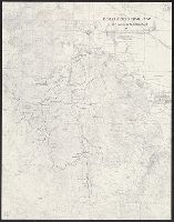
"W.J. Peters, Topographer in Charge. Topography by W.J. Peters and Alfred H. Brooks, Assistant Geologist.", At head of map "Map 9.", In upper left-hand corner "U.S. Geological Survey Charles D. Walcott Director.", and In upper right-hand corner "Report, Public Resolution No. 25, 55th Congress, 3D Session."
Publisher:
U.S. Congress],
Subject (Geographic):
Tanana River (Alaska)--Maps and White River (Alaska)--Maps
Subject (Name):
Brooks, Alfred H, Geological Survey (U.S.), Peters, W. J, and United States. Congress. (55th, 3rd : 1898)