Skip to search
Skip to main content
Skip to first result
Search
You Searched For
Repository
Beinecke Rare Book and Manuscript Library
Format
cartographic
Resource Type
Maps, Atlases & Globes
Creator
Geological Survey (U.S.)
Publication Place
[Washington] :
New Search
Search Results
Creator:
Published / Created:
1913
Call Number:
848 1913A
Container / Volume:
BRBL_00631
Image Count:
2
Resource Type:
Maps, Atlases & Globes
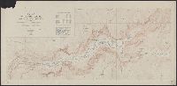
Description:
"Index map showing areas covered by topographic maps, August 1913"., "Recent survey publications" text on verso., Includes inset of the Aleutian Islands and chart of "Maps of Alaska for sale by U.S. Geological Survey.", and Relief shown by hachures and spot heights.
Publisher:
U.S. Geological Survey,
Subject (Geographic):
Alaska--Maps
Found in:
Beinecke Rare Book and Manuscript Library > Map of Alaska : compiled chiefly from maps of the U.S. Geological Survey / engraved and printed by the U.S. Geological Survey ; Alfred H. Brooks, Geologist in charge, Division of Alaskan Mineral Resources.
Creator:
Published / Created:
1909
Call Number:
844fcm Y83 1909
Container / Volume:
BRBL_00615
Image Count:
1
Resource Type:
Maps, Atlases & Globes
Description:
Includes "Index map" and table of "Elevations of principal points." and Relief shown by contours and spot heights.
Publisher:
The Survey,
Subject (Geographic):
Yosemite Valley (Calif.)--Maps
Subject (Name):
Douglas, Edward Morehouse, 1855-1932, Marshall, R. B. (Robert Bradford), 1867-1949, and Matthes, François, 1874-1948
Found in:
Beinecke Rare Book and Manuscript Library > Map of Yosemite Valley, Mariposa County, California / U.S. Geological Survey, George Otis Smith, Director ; E.M. Douglas, geographer ; State of California, George C. Pardee, Govenor.
Creator:
Published / Created:
1909
Call Number:
848 R14 1909
Container / Volume:
BRBL_00634
Image Count:
1
Resource Type:
Maps, Atlases & Globes
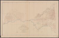
Alternative Title:
Alaska ; sheet no. 643
Description:
"Surveyed in 1906"., "Topography and triangulation by D.C. Witherspoon and R.B. Oliver"., and Relief shown by contours and spot heights.
Publisher:
The Survey,
Subject (Geographic):
Tanana River (Alaska)--Maps and Yukon River (Yukon and Alaska)--Maps
Subject (Name):
Brooks, Alfred H. (Alfred Hulse), 1871-1924
Found in:
Beinecke Rare Book and Manuscript Library > Reconnaissance map of Rampart quadrangle, Yukon-Tanana region, Alaska / U.S. Geological Survey ; Alfred H. Brooks, geologist in charge.
Creator:
Published / Created:
1915
Call Number:
834 M56 1915A
Container / Volume:
BRBL_00589
Image Count:
1
Resource Type:
Maps, Atlases & Globes
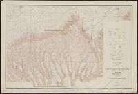
Description:
"Contour interval 25 feet." and Includes inset "Railroad lines leading to Mesa Verde National Park."
Publisher:
The Survey,
Subject (Geographic):
Mesa Verde National Park (Colo.)--Maps
Subject (Name):
Berry, R. W and Gleissner, Max J
Found in:
Beinecke Rare Book and Manuscript Library > Topographic map of Mesa Verde National Park, Montezuma County, Colorado / Topography by R.W. Berry and C.A. Eckland, control by U. S. Geological Survey, surveyed in 1910-1911, partial revision in 1926 by Max Gleissner.
Creator:
Published / Created:
1915
Call Number:
834 M56 1915
Container / Volume:
BRBL_00589
Image Count:
1
Resource Type:
Maps, Atlases & Globes
Description:
"R.B. Marshall, chief geographer. Sledge Tatum, geographer in charge. Topography by R.W. Berry and C.A. Ecklund. Control by C.F. Urquhart, M.R. McDanal, and R.M. Copeland.", "Surveyed in 1910-11.", and Includes inset showing "Railroad lines leading to Mesa Verde National Park."
Publisher:
U.S. Geological Survey,
Subject (Geographic):
Mesa Verde National Park (Colo.)--Maps
Subject (Name):
Berry, R. W, Copeland, R. M, Ecklund, C. A, Marshall, R. B. (Robert Bradford), 1867-1949, McDanal, M. R, Tatum, Sledge, and Urquhart, C. F
Found in:
Beinecke Rare Book and Manuscript Library > Topographic map of Mesa Verde National Park, Montezuma County, Colorado.
Creator:
Published / Created:
1910
Call Number:
75cbf 1910
Container / Volume:
BRBL_00408
Image Count:
1
Resource Type:
Maps, Atlases & Globes
Description:
Relief shown by contours and gradient tints.
Publisher:
USGS,
Subject (Geographic):
United States--Maps
Subject (Name):
Gannett, Henry, 1846-1914
Found in:
Beinecke Rare Book and Manuscript Library > United States relief map / compiled by Henry Gannett.
Branch:v1.61.6 ,Deployed:2024-06-12T09:55:36-04:00