Search
You Searched For
Search Results
- Creator:
- U.S. Coast and Geodetic Survey
- Published / Created:
- [1881]
- Call Number:
- 851 1881
- Container / Volume:
- BRBL_00639
- Image Count:
- 1
- Resource Type:
- Maps, Atlases & Globes
- Found in:
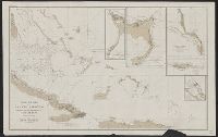
- Beinecke Rare Book and Manuscript Library > Chart of part of the Bahama Islands showing the tracks ascribed to Columbus on his discovery of the New World / compiled and drawn, under the direction of W.T. Bright, in charge of Drawing Division, U.S. Coast and Geodetic Survey Office ; by T.J. O'Sulliv
- Creator:
- U.S. Coast and Geodetic Survey
- Published / Created:
- 1875
- Call Number:
- 761 M86 1875
- Container / Volume:
- BRBL_00448
- Image Count:
- 1
- Resource Type:
- Maps, Atlases & Globes
- Found in:
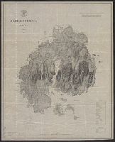
- Beinecke Rare Book and Manuscript Library > Mt. Desert Island Maine / C.P Patterson, Superintendent ; verified, J.E. Hilgard, Assistant in Charge of Office ; topography surveyed by J.W. Donn.
- Creator:
- U.S. Coast and Geodetic Survey
- Published / Created:
- 1898
- Call Number:
- 848 J953 1897
- Container / Volume:
- BRBL_00633
- Image Count:
- 1
- Resource Type:
- Maps, Atlases & Globes
- Found in:
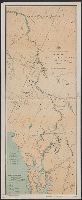
- Beinecke Rare Book and Manuscript Library > Route map, Juneau to Porcupine River, Alaska.
- Creator:
- U.S. Coast and Geodetic Survey
- Published / Created:
- 1881
- Call Number:
- 847cea W279 1880
- Container / Volume:
- BRBL_00628
- Image Count:
- 1
- Resource Type:
- Maps, Atlases & Globes
- Found in:
- Beinecke Rare Book and Manuscript Library > Washington Sound and approaches, Washington Territory : 1866.
- Creator:
- U.S. Coast and Geodetic Survey
- Published / Created:
- 1898
- Call Number:
- 848 Y91 1898
- Container / Volume:
- BRBL_00634
- Image Count:
- 1
- Resource Type:
- Maps, Atlases & Globes
- Found in:
- Beinecke Rare Book and Manuscript Library > Yukon River, Alaska.